Hillcoat Topo Map Florida
To zoom in, hover over the map of Hillcoat
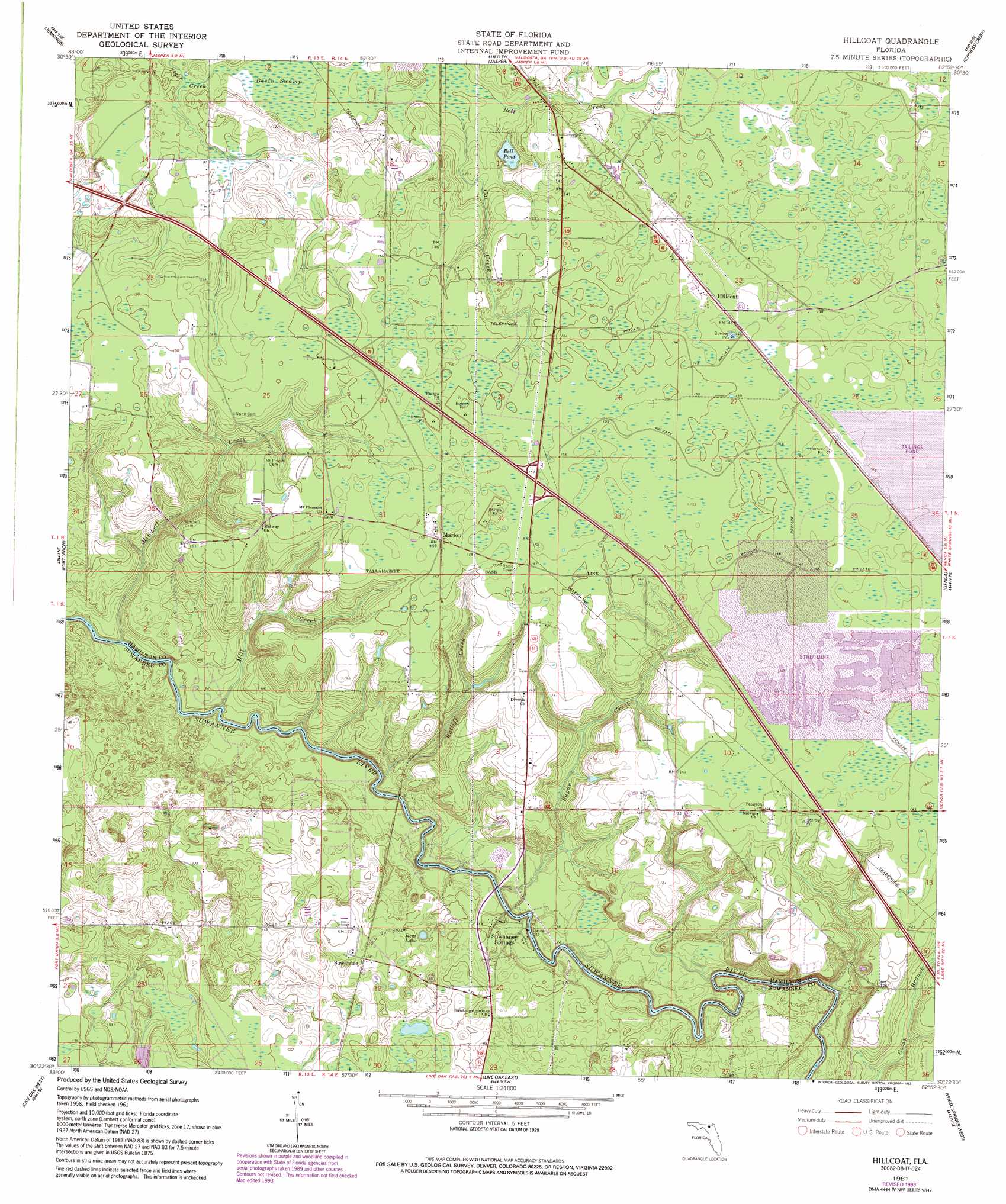
USGS Topo Quad 30082d8 - 1:24,000 scale
| Topo Map Name: | Hillcoat |
| USGS Topo Quad ID: | 30082d8 |
| Print Size: | ca. 21 1/4" wide x 27" high |
| Southeast Coordinates: | 30.375° N latitude / 82.875° W longitude |
| Map Center Coordinates: | 30.4375° N latitude / 82.9375° W longitude |
| U.S. State: | FL |
| Filename: | O30082D8.jpg |
| Download Map JPG Image: | Hillcoat topo map 1:24,000 scale |
| Map Type: | Topographic |
| Topo Series: | 7.5´ |
| Map Scale: | 1:24,000 |
| Source of Map Images: | United States Geological Survey (USGS) |
| Alternate Map Versions: |
Hillcoat FL 1961, updated 1963 Download PDF Buy paper map Hillcoat FL 1961, updated 1993 Download PDF Buy paper map Hillcoat FL 2012 Download PDF Buy paper map Hillcoat FL 2015 Download PDF Buy paper map |
1:24,000 Topo Quads surrounding Hillcoat
Lake Park |
Statenville |
Tarver |
Pineland |
Needmore |
Octahatchee |
Jennings |
Jasper |
Cypress Creek |
Fargo Sw |
Ellaville |
Fort Union |
Hillcoat |
Genoa |
Benton |
Falmouth |
Live Oak West |
Live Oak East |
White Springs West |
White Springs East |
Dowling Park |
Mayo Ne |
Mcalpin |
Wellborn |
Lake City West |
> Back to 30082a1 at 1:100,000 scale
> Back to 30082a1 at 1:250,000 scale
> Back to U.S. Topo Maps home
Hillcoat topo map: Gazetteer
Hillcoat: Lakes
Bell Pond elevation 29m 95′Borrow Pit Pond elevation 44m 144′
Rees Lake elevation 26m 85′
Hillcoat: Populated Places
Hillcoat elevation 44m 144′Marion elevation 49m 160′
Suwannee elevation 37m 121′
Suwannee Springs elevation 24m 78′
Hillcoat: Streams
Bell Creek elevation 30m 98′Cat Creek elevation 30m 98′
Mill Creek elevation 11m 36′
Mitchell Creek elevation 11m 36′
Ratliff Creek elevation 11m 36′
Sugar Creek elevation 13m 42′
Hillcoat: Swamps
Basin Swamp elevation 27m 88′Hillcoat digital topo map on disk
Buy this Hillcoat topo map showing relief, roads, GPS coordinates and other geographical features, as a high-resolution digital map file on DVD: