Saint George Topo Map Georgia
To zoom in, hover over the map of Saint George
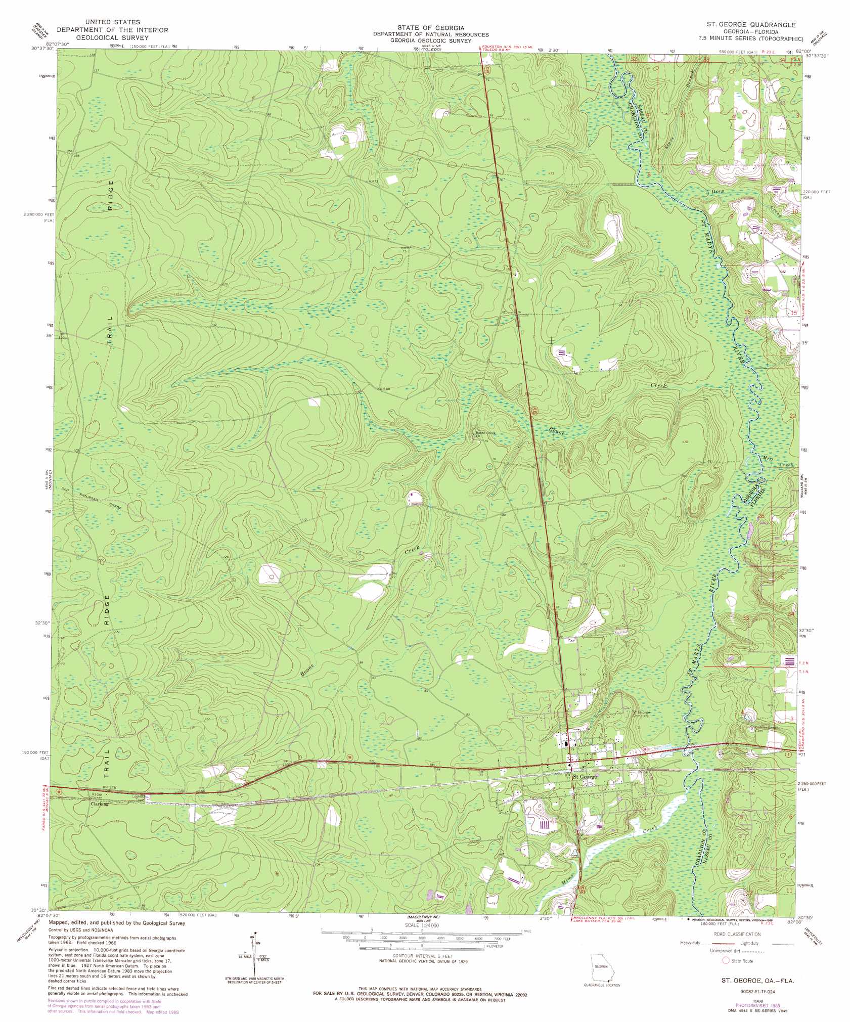
USGS Topo Quad 30082e1 - 1:24,000 scale
| Topo Map Name: | Saint George |
| USGS Topo Quad ID: | 30082e1 |
| Print Size: | ca. 21 1/4" wide x 27" high |
| Southeast Coordinates: | 30.5° N latitude / 82° W longitude |
| Map Center Coordinates: | 30.5625° N latitude / 82.0625° W longitude |
| U.S. States: | GA, FL |
| Filename: | o30082e1.jpg |
| Download Map JPG Image: | Saint George topo map 1:24,000 scale |
| Map Type: | Topographic |
| Topo Series: | 7.5´ |
| Map Scale: | 1:24,000 |
| Source of Map Images: | United States Geological Survey (USGS) |
| Alternate Map Versions: |
St George GA 1966, updated 1967 Download PDF Buy paper map St George GA 1966, updated 1981 Download PDF Buy paper map St George GA 1966, updated 1988 Download PDF Buy paper map Saint George GA 1994, updated 1998 Download PDF Buy paper map Saint George GA 2011 Download PDF Buy paper map Saint George GA 2014 Download PDF Buy paper map |
1:24,000 Topo Quads surrounding Saint George
Billys Island |
Chase Prairie |
Folkston |
Boulogne |
Kings Ferry |
Blackjack Island |
Chesser Island |
Toledo |
Hilliard |
Hilliard Ne |
Eddy |
Moniac |
Saint George |
Hilliard Sw |
Callahan |
Taylor |
Macclenny Nw |
Macclenny Ne |
Bryceville |
Dinsmore |
Sanderson North |
Macclenny West |
Macclenny East |
Baldwin |
Marietta |
> Back to 30082e1 at 1:100,000 scale
> Back to 30082a1 at 1:250,000 scale
> Back to U.S. Topo Maps home
Saint George topo map: Gazetteer
Saint George: Bridges
Bell Bridge elevation 9m 29′Earnest A Bell Bridge elevation 9m 29′
Saint George: Populated Places
Clarking elevation 53m 173′Saint George elevation 24m 78′
Saint George: Streams
Boone Creek elevation 7m 22′Deep Creek elevation 7m 22′
Mill Creek elevation 7m 22′
Mims Creek elevation 10m 32′
Stave Branch elevation 7m 22′
Saint George digital topo map on disk
Buy this Saint George topo map showing relief, roads, GPS coordinates and other geographical features, as a high-resolution digital map file on DVD: