Toledo Topo Map Georgia
To zoom in, hover over the map of Toledo
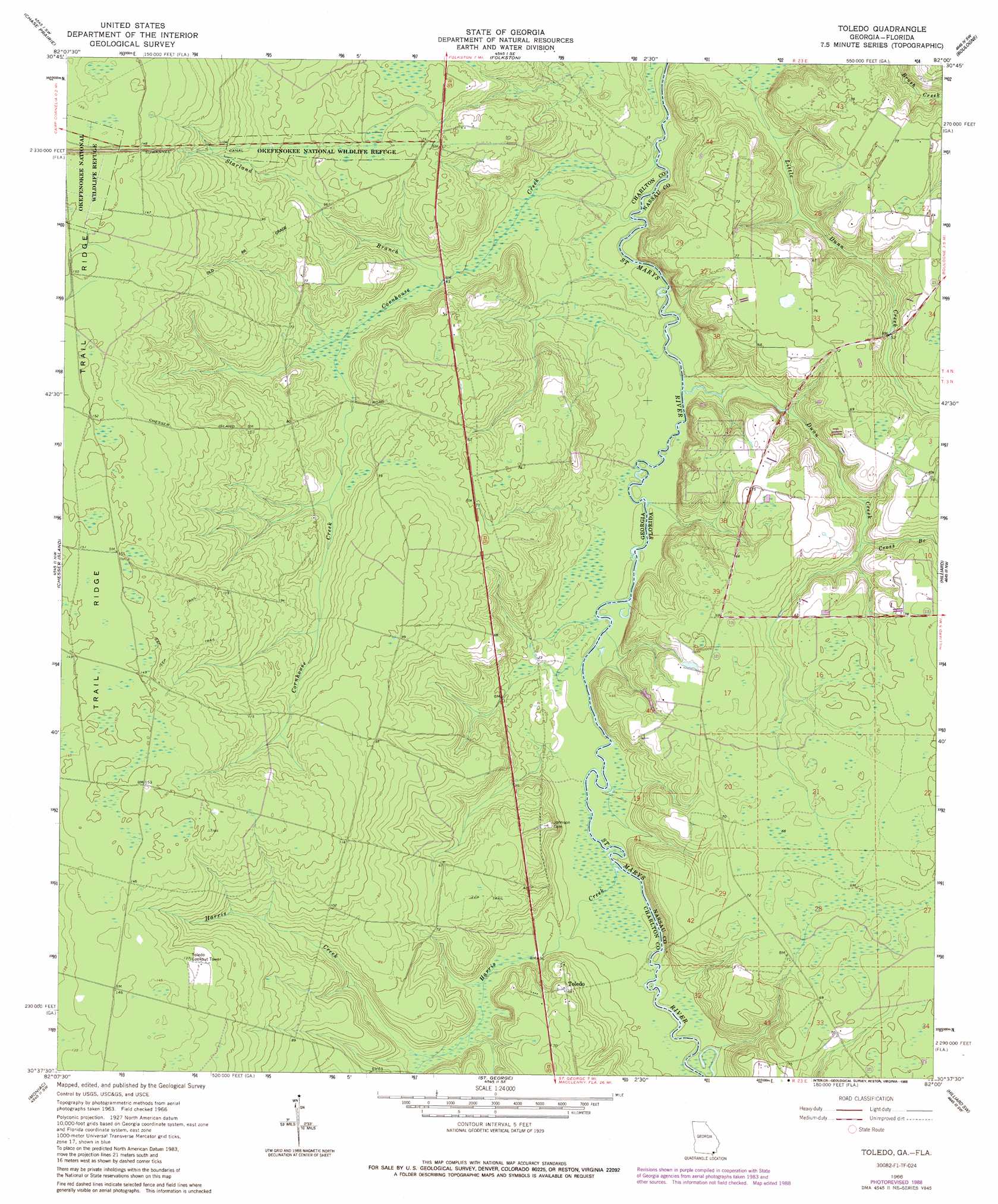
USGS Topo Quad 30082f1 - 1:24,000 scale
| Topo Map Name: | Toledo |
| USGS Topo Quad ID: | 30082f1 |
| Print Size: | ca. 21 1/4" wide x 27" high |
| Southeast Coordinates: | 30.625° N latitude / 82° W longitude |
| Map Center Coordinates: | 30.6875° N latitude / 82.0625° W longitude |
| U.S. States: | GA, FL |
| Filename: | o30082f1.jpg |
| Download Map JPG Image: | Toledo topo map 1:24,000 scale |
| Map Type: | Topographic |
| Topo Series: | 7.5´ |
| Map Scale: | 1:24,000 |
| Source of Map Images: | United States Geological Survey (USGS) |
| Alternate Map Versions: |
Toledo GA 1966, updated 1967 Download PDF Buy paper map Toledo GA 1966, updated 1988 Download PDF Buy paper map Toledo GA 1994, updated 1998 Download PDF Buy paper map Toledo GA 2011 Download PDF Buy paper map Toledo GA 2014 Download PDF Buy paper map |
1:24,000 Topo Quads surrounding Toledo
Dinner Pond |
Double Lakes |
Newell |
Burnt Fort |
Jerusalem |
Billys Island |
Chase Prairie |
Folkston |
Boulogne |
Kings Ferry |
Blackjack Island |
Chesser Island |
Toledo |
Hilliard |
Hilliard Ne |
Eddy |
Moniac |
Saint George |
Hilliard Sw |
Callahan |
Taylor |
Macclenny Nw |
Macclenny Ne |
Bryceville |
Dinsmore |
> Back to 30082e1 at 1:100,000 scale
> Back to 30082a1 at 1:250,000 scale
> Back to U.S. Topo Maps home
Toledo topo map: Gazetteer
Toledo: Parks
Okefenokee National Wildlife Refuge elevation 46m 150′Toledo: Populated Places
Toledo elevation 17m 55′Toledo: Streams
Cornhouse Creek elevation 3m 9′Cross Branch elevation 10m 32′
Dunn Creek elevation 3m 9′
Harris Creek elevation 5m 16′
Starland Branch elevation 10m 32′
Toledo digital topo map on disk
Buy this Toledo topo map showing relief, roads, GPS coordinates and other geographical features, as a high-resolution digital map file on DVD: