Monticello Topo Map Florida
To zoom in, hover over the map of Monticello
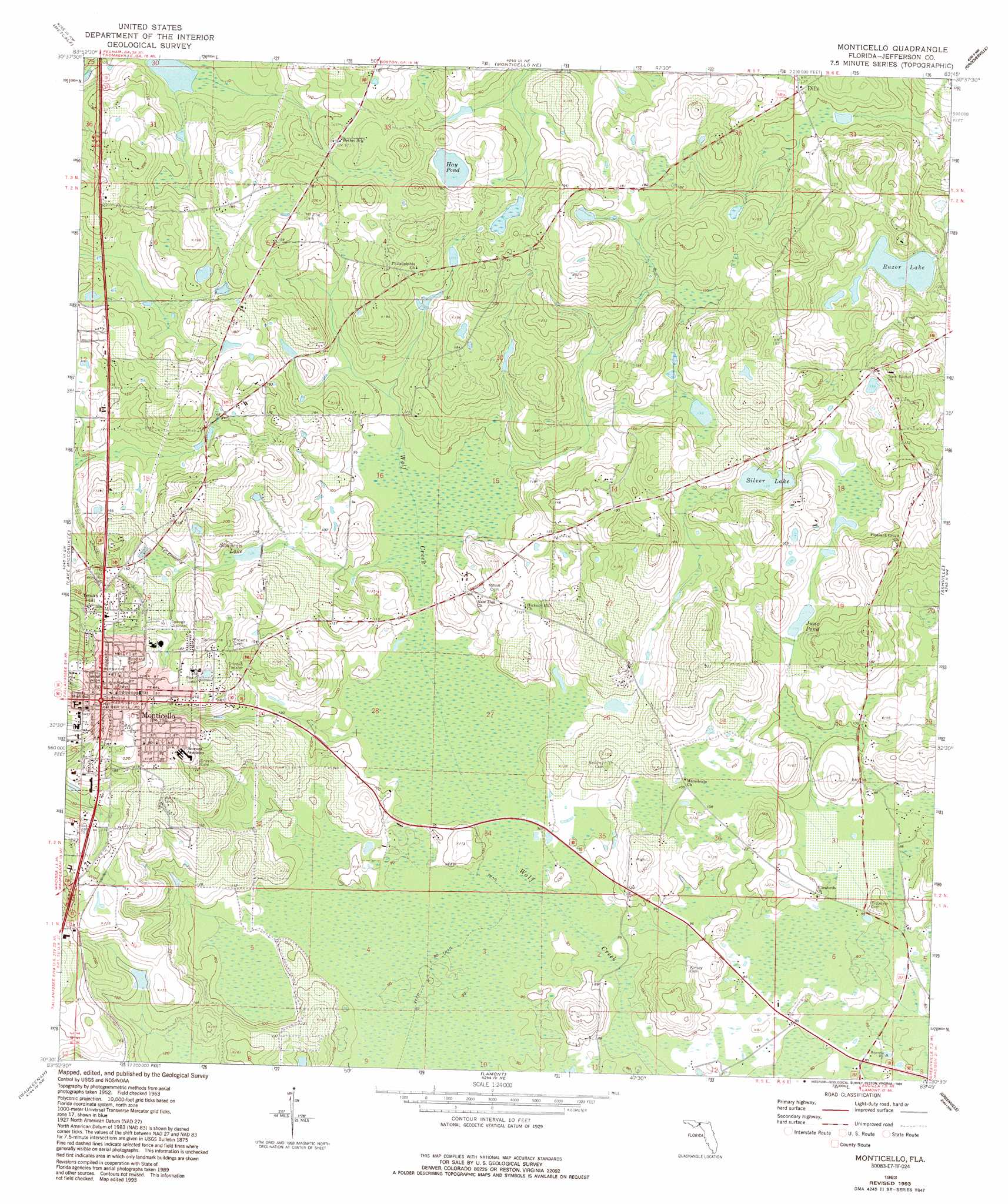
USGS Topo Quad 30083e7 - 1:24,000 scale
| Topo Map Name: | Monticello |
| USGS Topo Quad ID: | 30083e7 |
| Print Size: | ca. 21 1/4" wide x 27" high |
| Southeast Coordinates: | 30.5° N latitude / 83.75° W longitude |
| Map Center Coordinates: | 30.5625° N latitude / 83.8125° W longitude |
| U.S. State: | FL |
| Filename: | O30083E7.jpg |
| Download Map JPG Image: | Monticello topo map 1:24,000 scale |
| Map Type: | Topographic |
| Topo Series: | 7.5´ |
| Map Scale: | 1:24,000 |
| Source of Map Images: | United States Geological Survey (USGS) |
| Alternate Map Versions: |
Monticello FL 1963, updated 1964 Download PDF Buy paper map Monticello FL 1963, updated 1993 Download PDF Buy paper map Monticello FL 2012 Download PDF Buy paper map Monticello FL 2015 Download PDF Buy paper map |
1:24,000 Topo Quads surrounding Monticello
Pine Park |
Thomasville |
Boston |
Dixie |
Quitman |
Miccosukee Ne |
Metcalf |
Monticello Ne |
Grooverville |
Baden |
Miccosukee |
Lake Miccosukee |
Monticello |
Ashville |
Hamburg |
Lloyd |
Waukeenah |
Lamont |
Greenville |
Greenville Ne |
Cody |
Wacissa |
Lamont Se |
Shady Grove |
Greenville Se |
> Back to 30083e1 at 1:100,000 scale
> Back to 30082a1 at 1:250,000 scale
> Back to U.S. Topo Maps home
Monticello topo map: Gazetteer
Monticello: Lakes
Hay Pond elevation 45m 147′June Pond elevation 35m 114′
Razor Lake elevation 32m 104′
Silver Lake elevation 42m 137′
Simpson Nursery Pond elevation 34m 111′
Monticello: Populated Places
Dills elevation 38m 124′Fourth Street Trailer Park elevation 70m 229′
Monticello elevation 71m 232′
Monticello: Post Offices
Monticello Post Office elevation 71m 232′Monticello: Reservoirs
Simpson Lake elevation 38m 124′Monticello: Summits
Texas Hill elevation 70m 229′Monticello digital topo map on disk
Buy this Monticello topo map showing relief, roads, GPS coordinates and other geographical features, as a high-resolution digital map file on DVD: