Statenville Topo Map Georgia
To zoom in, hover over the map of Statenville
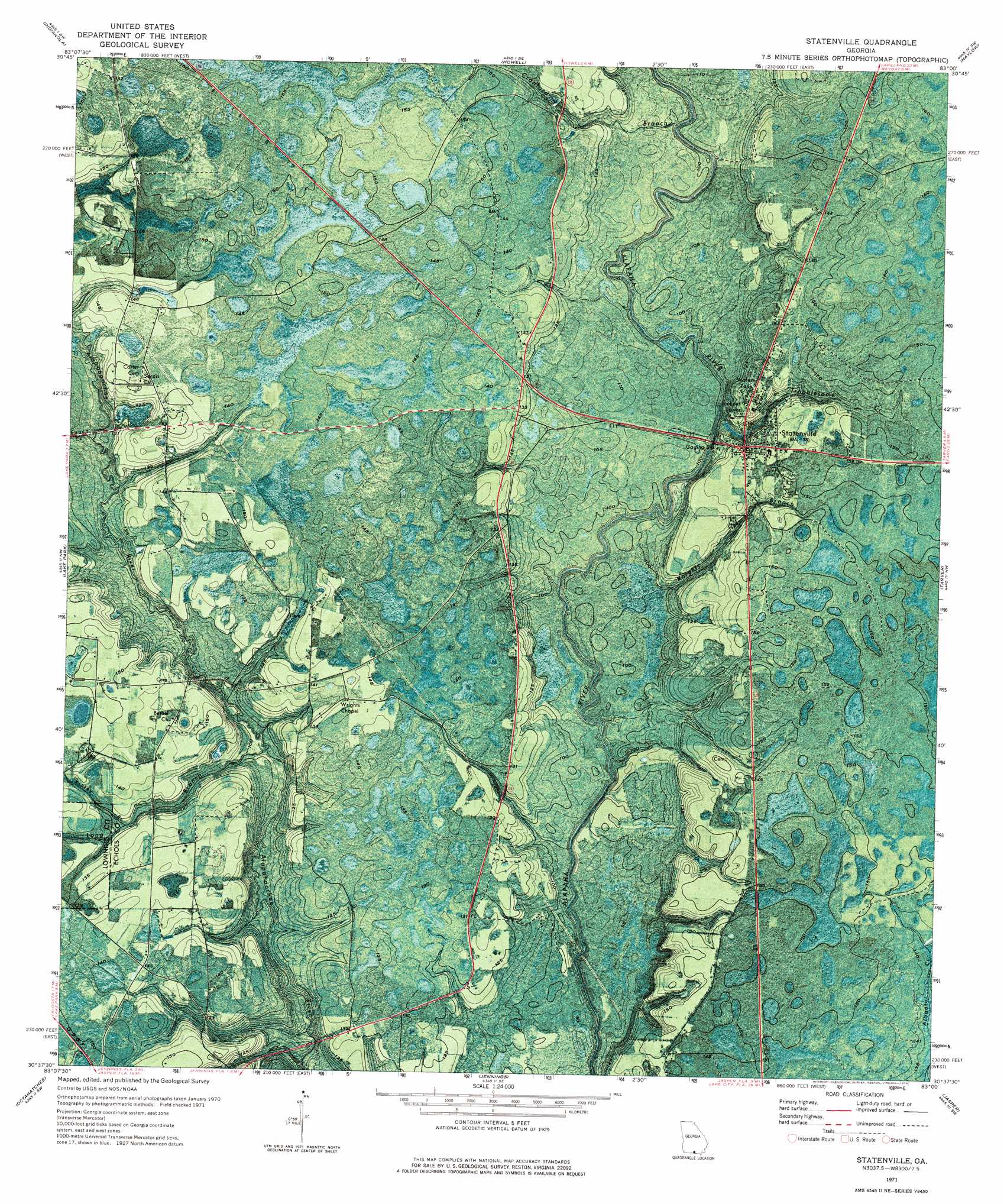
USGS Topo Quad 30083f1 - 1:24,000 scale
| Topo Map Name: | Statenville |
| USGS Topo Quad ID: | 30083f1 |
| Print Size: | ca. 21 1/4" wide x 27" high |
| Southeast Coordinates: | 30.625° N latitude / 83° W longitude |
| Map Center Coordinates: | 30.6875° N latitude / 83.0625° W longitude |
| U.S. State: | GA |
| Filename: | p30083f1.jpg |
| Download Map JPG Image: | Statenville topo map 1:24,000 scale |
| Map Type: | Orthophoto |
| Topo Series: | 7.5´ |
| Map Scale: | 1:24,000 |
| Source of Map Images: | United States Geological Survey (USGS) |
| Alternate Map Versions: |
Statenville GA 1971, updated 1976 Download PDF Buy paper map Statenville GA 2011 Download PDF Buy paper map Statenville GA 2014 Download PDF Buy paper map |
1:24,000 Topo Quads surrounding Statenville
Hahira East |
Bemiss |
Naylor |
Stockton |
Du Pont |
Valdosta |
Indianola |
Howell |
Haylow |
Thelma |
Clyattville |
Lake Park |
Statenville |
Tarver |
Pineland |
Pinetta |
Octahatchee |
Jennings |
Jasper |
Cypress Creek |
Lee |
Ellaville |
Fort Union |
Hillcoat |
Genoa |
> Back to 30083e1 at 1:100,000 scale
> Back to 30082a1 at 1:250,000 scale
> Back to U.S. Topo Maps home
Statenville topo map: Gazetteer
Statenville: Populated Places
Statenville elevation 42m 137′Statenville: Streams
Cranford Branch elevation 27m 88′Enoch Creek elevation 32m 104′
Kinsey Branch elevation 36m 118′
Knights Branch elevation 29m 95′
Long Branch elevation 28m 91′
Troublesome Creek elevation 34m 111′
Statenville digital topo map on disk
Buy this Statenville topo map showing relief, roads, GPS coordinates and other geographical features, as a high-resolution digital map file on DVD: