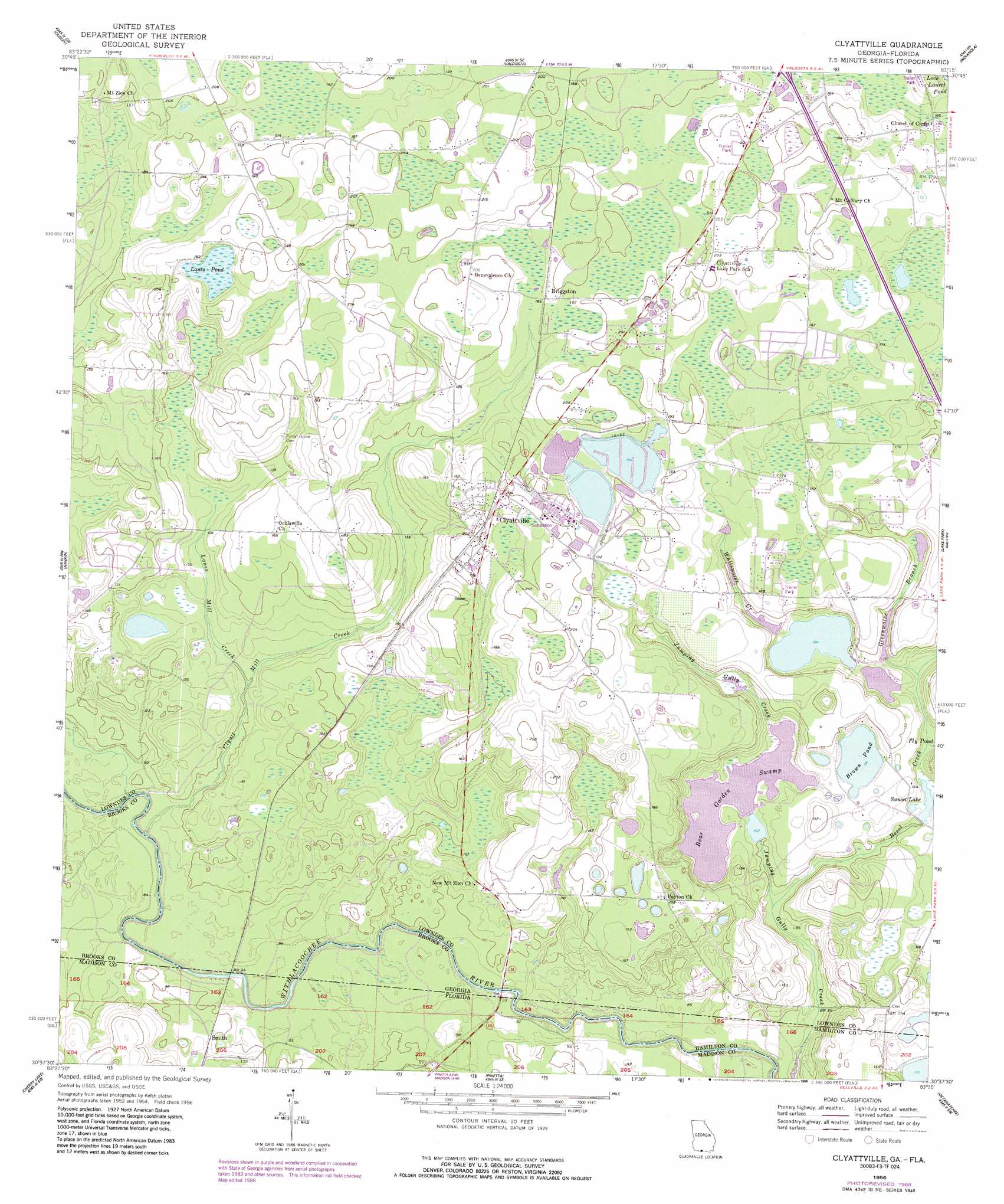
Clyattville Topo Map Georgia
To zoom in, hover over the map of Clyattville
USGS Topo Quad 30083f3 - 1:24,000 scale
| Topo Map Name: | Clyattville |
| USGS Topo Quad ID: | 30083f3 |
| Print Size: | ca. 21 1/4" wide x 27" high |
| Southeast Coordinates: | 30.625° N latitude / 83.25° W longitude |
| Map Center Coordinates: | 30.6875° N latitude / 83.3125° W longitude |
| U.S. States: | GA, FL |
| Filename: | o30083f3.jpg |
| Download Map JPG Image: | Clyattville topo map 1:24,000 scale |
| Map Type: | Topographic |
| Topo Series: | 7.5´ |
| Map Scale: | 1:24,000 |
| Source of Map Images: | United States Geological Survey (USGS) |
| Alternate Map Versions: |
Clyattville GA 1956, updated 1957 Download PDF Buy paper map Clyattville GA 1956, updated 1978 Download PDF Buy paper map Clyattville GA 1956, updated 1988 Download PDF Buy paper map Clyattville GA 1994, updated 1998 Download PDF Buy paper map Clyattville GA 1994, updated 2001 Download PDF Buy paper map Clyattville GA 2011 Download PDF Buy paper map Clyattville GA 2014 Download PDF Buy paper map |
1:24,000 Topo Quads surrounding Clyattville
Pebble Hill |
Hahira West |
Hahira East |
Bemiss |
Naylor |
Quitman |
Ousley |
Valdosta |
Indianola |
Howell |
Baden |
Nankin |
Clyattville |
Lake Park |
Statenville |
Hamburg |
Cherry Lake |
Pinetta |
Octahatchee |
Jennings |
Greenville Ne |
Madison |
Lee |
Ellaville |
Fort Union |
> Back to 30083e1 at 1:100,000 scale
> Back to 30082a1 at 1:250,000 scale
> Back to U.S. Topo Maps home
Clyattville topo map: Gazetteer
Clyattville: Bridges
Horn Bridge elevation 17m 55′Clyattville: Dams
Bear Garden Swamp Dam elevation 32m 104′Carrolls Pond Dam elevation 31m 101′
Owens Illinois Lake Dam elevation 58m 190′
Owens-Illinois Corporation Lake Dam elevation 56m 183′
Whitewater Club Lake Dam elevation 38m 124′
Clyattville: Lakes
Brown Pond elevation 35m 114′Lanes Pond elevation 53m 173′
Clyattville: Populated Places
Briggston elevation 58m 190′Clyattville elevation 60m 196′
McIntyre Spring (historical) elevation 25m 82′
Old Clyattville elevation 59m 193′
Olympia (historical) elevation 33m 108′
Clyattville: Post Offices
Clyattville Post Office elevation 59m 193′Clyattville: Reservoirs
Bear Garden Swamp elevation 32m 104′Carrolls Pond elevation 31m 101′
Owens Illinois Lake elevation 58m 190′
Owens-Illinois Corporation Lake elevation 56m 183′
Sunset Lake elevation 32m 104′
Whitewater Club Lake elevation 38m 124′
Clyattville: Streams
Bevel Creek elevation 25m 82′Clyatt Mill Creek elevation 20m 65′
Greenwater Branch elevation 33m 108′
Lanes Mill Creek elevation 30m 98′
Whitewater Creek elevation 39m 127′
Clyattville: Swamps
Bear Garden Swamp elevation 32m 104′Zeigler Lake elevation 32m 104′
Clyattville digital topo map on disk
Buy this Clyattville topo map showing relief, roads, GPS coordinates and other geographical features, as a high-resolution digital map file on DVD: