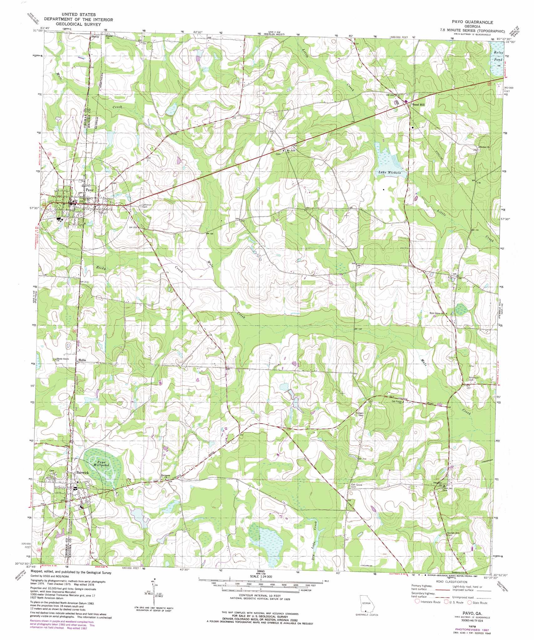
Pavo Topo Map Georgia
To zoom in, hover over the map of Pavo
USGS Topo Quad 30083h6 - 1:24,000 scale
| Topo Map Name: | Pavo |
| USGS Topo Quad ID: | 30083h6 |
| Print Size: | ca. 21 1/4" wide x 27" high |
| Southeast Coordinates: | 30.875° N latitude / 83.625° W longitude |
| Map Center Coordinates: | 30.9375° N latitude / 83.6875° W longitude |
| U.S. State: | GA |
| Filename: | o30083h6.jpg |
| Download Map JPG Image: | Pavo topo map 1:24,000 scale |
| Map Type: | Topographic |
| Topo Series: | 7.5´ |
| Map Scale: | 1:24,000 |
| Source of Map Images: | United States Geological Survey (USGS) |
| Alternate Map Versions: |
Pavo GA 1978, updated 1978 Download PDF Buy paper map Pavo GA 1978, updated 1987 Download PDF Buy paper map Pavo GA 2011 Download PDF Buy paper map Pavo GA 2014 Download PDF Buy paper map |
1:24,000 Topo Quads surrounding Pavo
Hartsfield |
Moultrie |
Pineboro |
Ellenton |
Adel |
Chastain |
Coolidge |
Berlin West |
Berlin East |
Cecil |
Merrillville |
Patten |
Pavo |
Pebble Hill |
Hahira West |
Thomasville |
Boston |
Dixie |
Quitman |
Ousley |
Metcalf |
Monticello Ne |
Grooverville |
Baden |
Nankin |
> Back to 30083e1 at 1:100,000 scale
> Back to 30082a1 at 1:250,000 scale
> Back to U.S. Topo Maps home
Pavo topo map: Gazetteer
Pavo: Dams
Bryan Lake Dam elevation 61m 200′Lake Nichols Dam Number I elevation 48m 157′
Lake Nichols Dam Number One elevation 48m 157′
Lake Pope Dam elevation 65m 213′
Riverbend Plantation Lake Dam elevation 64m 209′
Pavo: Lakes
Lake Nichols elevation 48m 157′Pope Millpond elevation 71m 232′
Pavo: Populated Places
Barwick elevation 81m 265′Hollis elevation 79m 259′
Pavo elevation 78m 255′
Sand Hill elevation 70m 229′
Shelly elevation 77m 252′
Pavo: Post Offices
Barwick Post Office elevation 84m 275′Pavo: Reservoirs
Bryan Lake elevation 61m 200′Lake Nicholls elevation 48m 157′
Lake Nichols elevation 49m 160′
Lake Pope elevation 65m 213′
Riverbend Plantation Lake elevation 64m 209′
Pavo: Streams
Reedy Creek elevation 47m 154′Pavo digital topo map on disk
Buy this Pavo topo map showing relief, roads, GPS coordinates and other geographical features, as a high-resolution digital map file on DVD: