Patten Topo Map Georgia
To zoom in, hover over the map of Patten
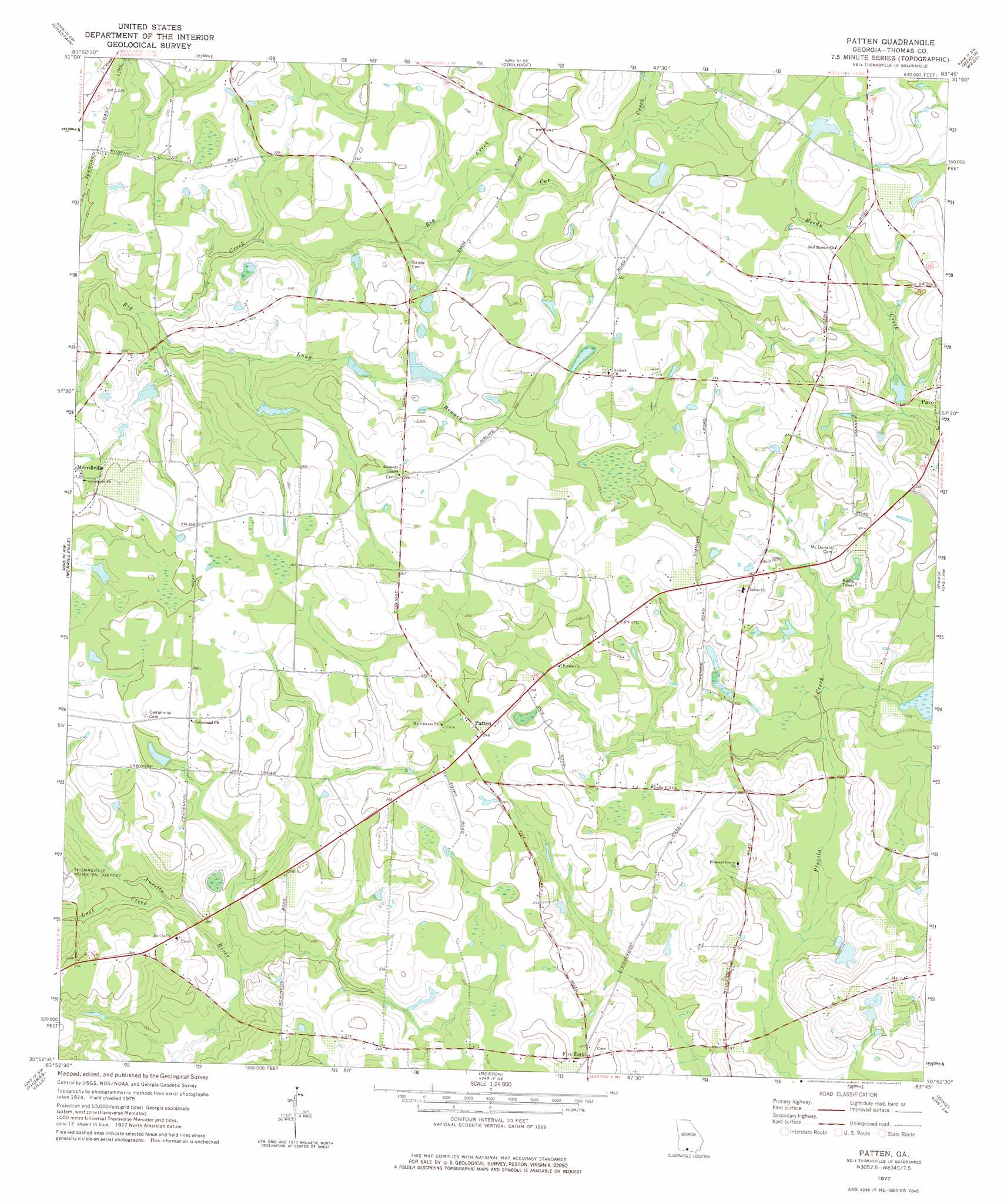
USGS Topo Quad 30083h7 - 1:24,000 scale
| Topo Map Name: | Patten |
| USGS Topo Quad ID: | 30083h7 |
| Print Size: | ca. 21 1/4" wide x 27" high |
| Southeast Coordinates: | 30.875° N latitude / 83.75° W longitude |
| Map Center Coordinates: | 30.9375° N latitude / 83.8125° W longitude |
| U.S. State: | GA |
| Filename: | o30083h7.jpg |
| Download Map JPG Image: | Patten topo map 1:24,000 scale |
| Map Type: | Topographic |
| Topo Series: | 7.5´ |
| Map Scale: | 1:24,000 |
| Source of Map Images: | United States Geological Survey (USGS) |
| Alternate Map Versions: |
Patten GA 1977, updated 1977 Download PDF Buy paper map Patten GA 2011 Download PDF Buy paper map Patten GA 2014 Download PDF Buy paper map |
1:24,000 Topo Quads surrounding Patten
Cotton |
Hartsfield |
Moultrie |
Pineboro |
Ellenton |
Meigs |
Chastain |
Coolidge |
Berlin West |
Berlin East |
Ochlocknee |
Merrillville |
Patten |
Pavo |
Pebble Hill |
Pine Park |
Thomasville |
Boston |
Dixie |
Quitman |
Miccosukee Ne |
Metcalf |
Monticello Ne |
Grooverville |
Baden |
> Back to 30083e1 at 1:100,000 scale
> Back to 30082a1 at 1:250,000 scale
> Back to U.S. Topo Maps home
Patten topo map: Gazetteer
Patten: Dams
Tyler Lake Dam elevation 58m 190′Patten: Populated Places
Five Forks elevation 73m 239′Patten elevation 82m 269′
Patten: Reservoirs
Tyler Lake elevation 58m 190′Patten: Streams
Cat Creek elevation 66m 216′Long Branch elevation 59m 193′
Lost Creek elevation 57m 187′
Patten: Swamps
Lancaster Pond elevation 78m 255′Murphys Pond elevation 70m 229′
Patten digital topo map on disk
Buy this Patten topo map showing relief, roads, GPS coordinates and other geographical features, as a high-resolution digital map file on DVD: