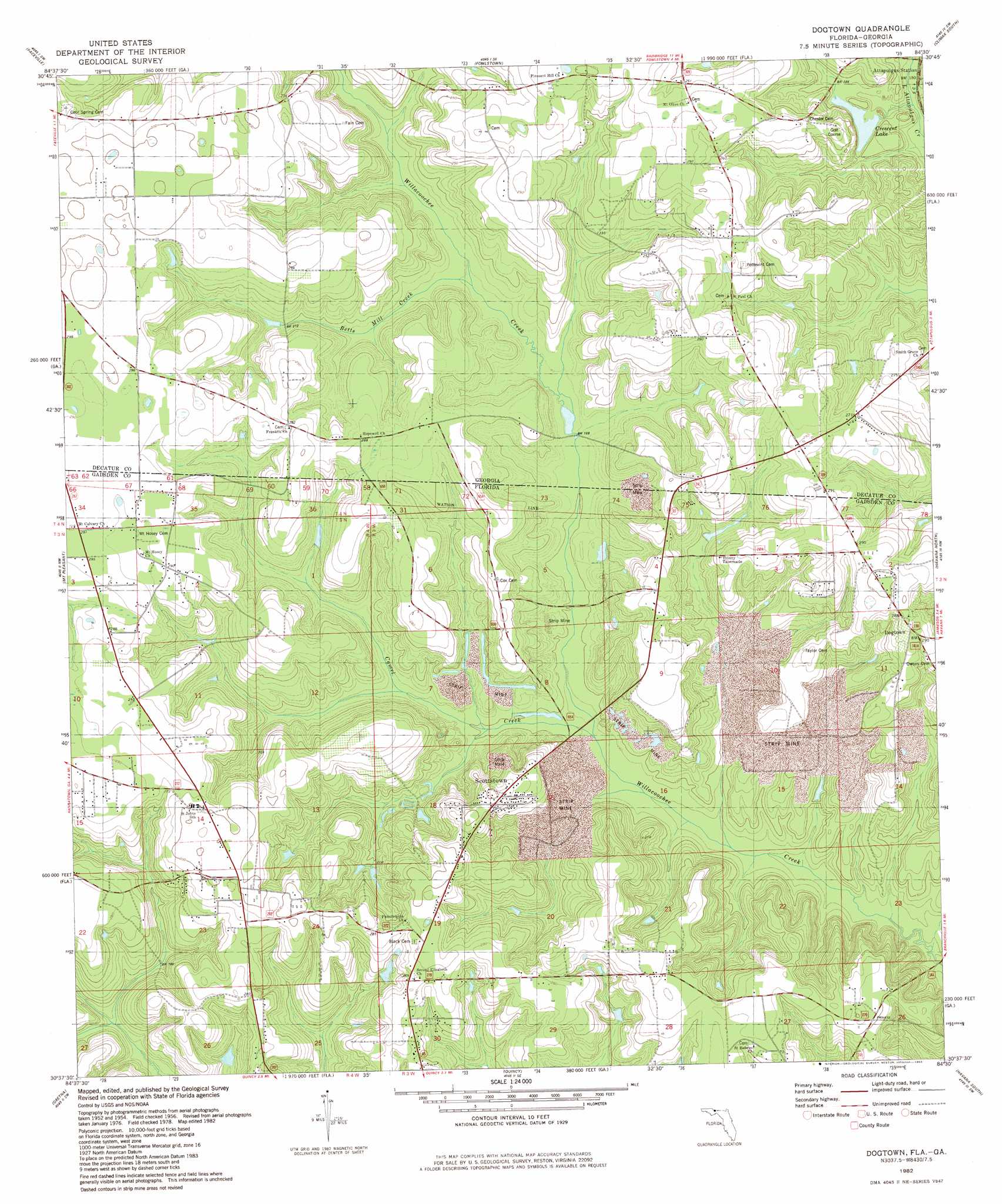
Dogtown Topo Map Florida
To zoom in, hover over the map of Dogtown
USGS Topo Quad 30084f5 - 1:24,000 scale
| Topo Map Name: | Dogtown |
| USGS Topo Quad ID: | 30084f5 |
| Print Size: | ca. 21 1/4" wide x 27" high |
| Southeast Coordinates: | 30.625° N latitude / 84.5° W longitude |
| Map Center Coordinates: | 30.6875° N latitude / 84.5625° W longitude |
| U.S. States: | FL, GA |
| Filename: | O30084F5.jpg |
| Download Map JPG Image: | Dogtown topo map 1:24,000 scale |
| Map Type: | Topographic |
| Topo Series: | 7.5´ |
| Map Scale: | 1:24,000 |
| Source of Map Images: | United States Geological Survey (USGS) |
| Alternate Map Versions: |
Dogtown FL 1956, updated 1957 Download PDF Buy paper map Dogtown FL 1956, updated 1957 Download PDF Buy paper map Dogtown FL 1982, updated 1983 Download PDF Buy paper map Dogtown FL 2011 Download PDF Buy paper map Dogtown FL 2012 Download PDF Buy paper map Dogtown FL 2015 Download PDF Buy paper map |
1:24,000 Topo Quads surrounding Dogtown
Desser |
Brinson |
Bainbridge |
Climax North |
Whigham |
Reynoldsville |
Faceville |
Fowlstown |
Climax South |
Reno |
Chattahoochee |
Mount Pleasant |
Dogtown |
Havana North |
Calvary |
Sycamore |
Gretna |
Quincy |
Havana South |
Lake Jackson |
Hosford |
Bloxham |
Lake Talquin |
Midway |
Tallahassee |
> Back to 30084e1 at 1:100,000 scale
> Back to 30084a1 at 1:250,000 scale
> Back to U.S. Topo Maps home
Dogtown topo map: Gazetteer
Dogtown: Lakes
Crescent Lake elevation 56m 183′Dogtown: Populated Places
Dogtown elevation 88m 288′Dogtown: Streams
Betts Mill Creek elevation 52m 170′Dogtown digital topo map on disk
Buy this Dogtown topo map showing relief, roads, GPS coordinates and other geographical features, as a high-resolution digital map file on DVD:
Gulf Coast (LA, MS, AL, FL) & Southwestern Georgia
Buy digital topo maps: Gulf Coast (LA, MS, AL, FL) & Southwestern Georgia
 & Southwestern Georgia map DVD")