Climax South Topo Map Georgia
To zoom in, hover over the map of Climax South
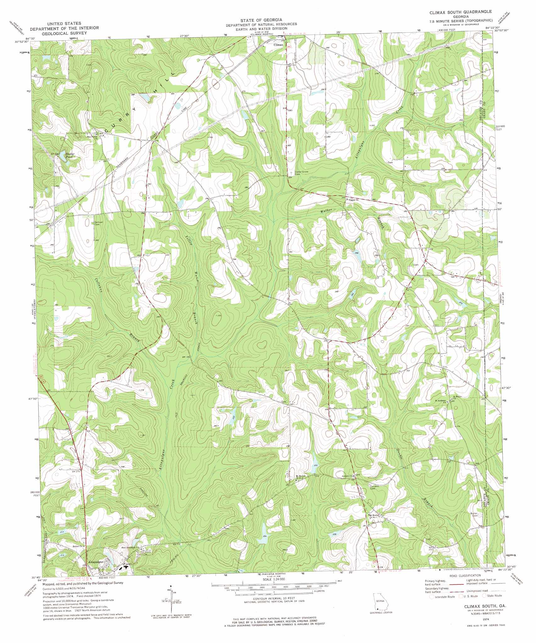
USGS Topo Quad 30084g4 - 1:24,000 scale
| Topo Map Name: | Climax South |
| USGS Topo Quad ID: | 30084g4 |
| Print Size: | ca. 21 1/4" wide x 27" high |
| Southeast Coordinates: | 30.75° N latitude / 84.375° W longitude |
| Map Center Coordinates: | 30.8125° N latitude / 84.4375° W longitude |
| U.S. State: | GA |
| Filename: | o30084g4.jpg |
| Download Map JPG Image: | Climax South topo map 1:24,000 scale |
| Map Type: | Topographic |
| Topo Series: | 7.5´ |
| Map Scale: | 1:24,000 |
| Source of Map Images: | United States Geological Survey (USGS) |
| Alternate Map Versions: |
Climax South GA 1974, updated 1976 Download PDF Buy paper map Climax South GA 2011 Download PDF Buy paper map Climax South GA 2014 Download PDF Buy paper map |
1:24,000 Topo Quads surrounding Climax South
Boykin |
Steadhams Store |
Vada |
Gee Pond |
Pelham |
Brinson |
Bainbridge |
Climax North |
Whigham |
Cairo North |
Faceville |
Fowlstown |
Climax South |
Reno |
Cairo South |
Mount Pleasant |
Dogtown |
Havana North |
Calvary |
Beachton |
Gretna |
Quincy |
Havana South |
Lake Jackson |
Bradfordville |
> Back to 30084e1 at 1:100,000 scale
> Back to 30084a1 at 1:250,000 scale
> Back to U.S. Topo Maps home
Climax South topo map: Gazetteer
Climax South: Dams
Coastal Loan Company Lake Dam elevation 61m 200′Dubarco Incorporated Lake Dam elevation 71m 232′
Climax South: Populated Places
Otisco elevation 89m 291′Climax South: Reservoirs
Coastal Loan Company Lake elevation 61m 200′Dubarco Incorporated Lake elevation 71m 232′
Sholar Pond elevation 72m 236′
Climax South: Streams
Callahan Branch elevation 53m 173′Walker Branch elevation 63m 206′
Yellow Water Branch elevation 54m 177′
Climax South digital topo map on disk
Buy this Climax South topo map showing relief, roads, GPS coordinates and other geographical features, as a high-resolution digital map file on DVD:
Gulf Coast (LA, MS, AL, FL) & Southwestern Georgia
Buy digital topo maps: Gulf Coast (LA, MS, AL, FL) & Southwestern Georgia
 & Southwestern Georgia map DVD")