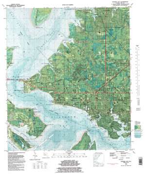
Panama City Topo Map Florida
To zoom in, hover over the map of Panama City
USGS Topo Quad 30085b6 - 1:24,000 scale
| Topo Map Name: | Panama City |
| USGS Topo Quad ID: | 30085b6 |
| Print Size: | ca. 21 1/4" wide x 27" high |
| Southeast Coordinates: | 30.125° N latitude / 85.625° W longitude |
| Map Center Coordinates: | 30.1875° N latitude / 85.6875° W longitude |
| U.S. State: | FL |
| Filename: | P30085b6.jpg |
| Download Map JPG Image: | Panama City topo map 1:24,000 scale |
| Map Type: | Orthophoto |
| Topo Series: | 7.5´ |
| Map Scale: | 1:24,000 |
| Source of Map Images: | United States Geological Survey (USGS) |
| Alternate Map Versions: |
Panama City FL 1956, updated 1957 Download PDF Buy paper map Panama City FL 1956, updated 1957 Download PDF Buy paper map Panama City FL 1982, updated 1984 Download PDF Buy paper map Panama City FL 1982, updated 1984 Download PDF Buy paper map Panama City FL 2012 Download PDF Buy paper map Panama City FL 2015 Download PDF Buy paper map |
1:24,000 Topo Quads surrounding Panama City
> Back to 30085a1 at 1:100,000 scale
> Back to 30084a1 at 1:250,000 scale
> Back to U.S. Topo Maps home
Panama City topo map: Gazetteer
Panama City: Airports
Bay Helicopters Heliport elevation 10m 32′Grand Lagoon Seaplane Base elevation 3m 9′
Heli-Tech Incorporated Heliport elevation 2m 6′
Panama City-Bay County International Airport elevation 4m 13′
Seaways South Incorporated Seaplane Base elevation 0m 0′
Panama City: Bays
Anderson Bayou elevation 0m 0′Bunkers Cove elevation 0m 0′
Goose Bayou elevation 0m 0′
Grand Lagoon elevation 0m 0′
Johnson Bayou elevation 0m 0′
Lake Van Vac elevation 0m 0′
Lynn Haven Bayou elevation 0m 0′
Massalina Bayou elevation 0m 0′
Mud Bayou elevation 0m 0′
Posten Bayou elevation 0m 0′
Pretty Bayou elevation 0m 0′
Robinson Bayou elevation 0m 0′
Saint Andrew Bay elevation 0m 0′
Smack Bayou elevation 0m 0′
Upper Goose Bayou elevation 0m 0′
Watson Bayou elevation 0m 0′
Panama City: Bridges
Hathaway Bridge elevation 0m 0′Panama City: Capes
Alligator Point elevation 0m 0′Bear Point elevation 0m 0′
Buena Vista Point elevation 1m 3′
Bunkers Point elevation 0m 0′
Courtney Point elevation 4m 13′
Dyers Point elevation 1m 3′
Little Oyster Bar Point elevation 1m 3′
Point Anchorage elevation 0m 0′
Redfish Point elevation 0m 0′
Shell Point elevation 0m 0′
Sulphur Point elevation 4m 13′
Town Point elevation 1m 3′
West Bay Point elevation 0m 0′
Panama City: Channels
Grand Lagoon Channel elevation 4m 13′Panama City: Islands
Audubon Island elevation 0m 0′Goose Island elevation 0m 0′
Panama City: Lakes
Lake Caroline elevation 2m 6′Lake Claire elevation 0m 0′
Lake Huntington elevation 0m 0′
Lake Ware elevation 0m 0′
Panama City: Parks
Cove Park elevation 5m 16′George Park elevation 5m 16′
Gray Park elevation 1m 3′
Linos Park elevation 10m 32′
Oakland Terrace Park elevation 10m 32′
Oliver Stadium elevation 10m 32′
Saint Andrews State Park elevation 1m 3′
Truesdell Park elevation 4m 13′
Panama City: Populated Places
Baker elevation 5m 16′Bayview elevation 3m 9′
Cedar Grove elevation 10m 32′
Cove elevation 10m 32′
Delwood Beach elevation 4m 13′
Dirego Park elevation 12m 39′
Glenwood elevation 8m 26′
Hiland Park elevation 11m 36′
Lynn Haven elevation 4m 13′
Magnolia Beach elevation 4m 13′
Millville elevation 7m 22′
Panama City elevation 8m 26′
Pretty Bayou elevation 4m 13′
Saint Andrew elevation 4m 13′
Upper Grand Lagoon elevation 0m 0′
Panama City digital topo map on disk
Buy this Panama City topo map showing relief, roads, GPS coordinates and other geographical features, as a high-resolution digital map file on DVD:
Gulf Coast (LA, MS, AL, FL) & Southwestern Georgia
Buy digital topo maps: Gulf Coast (LA, MS, AL, FL) & Southwestern Georgia


