Youngstown Topo Map Florida
To zoom in, hover over the map of Youngstown
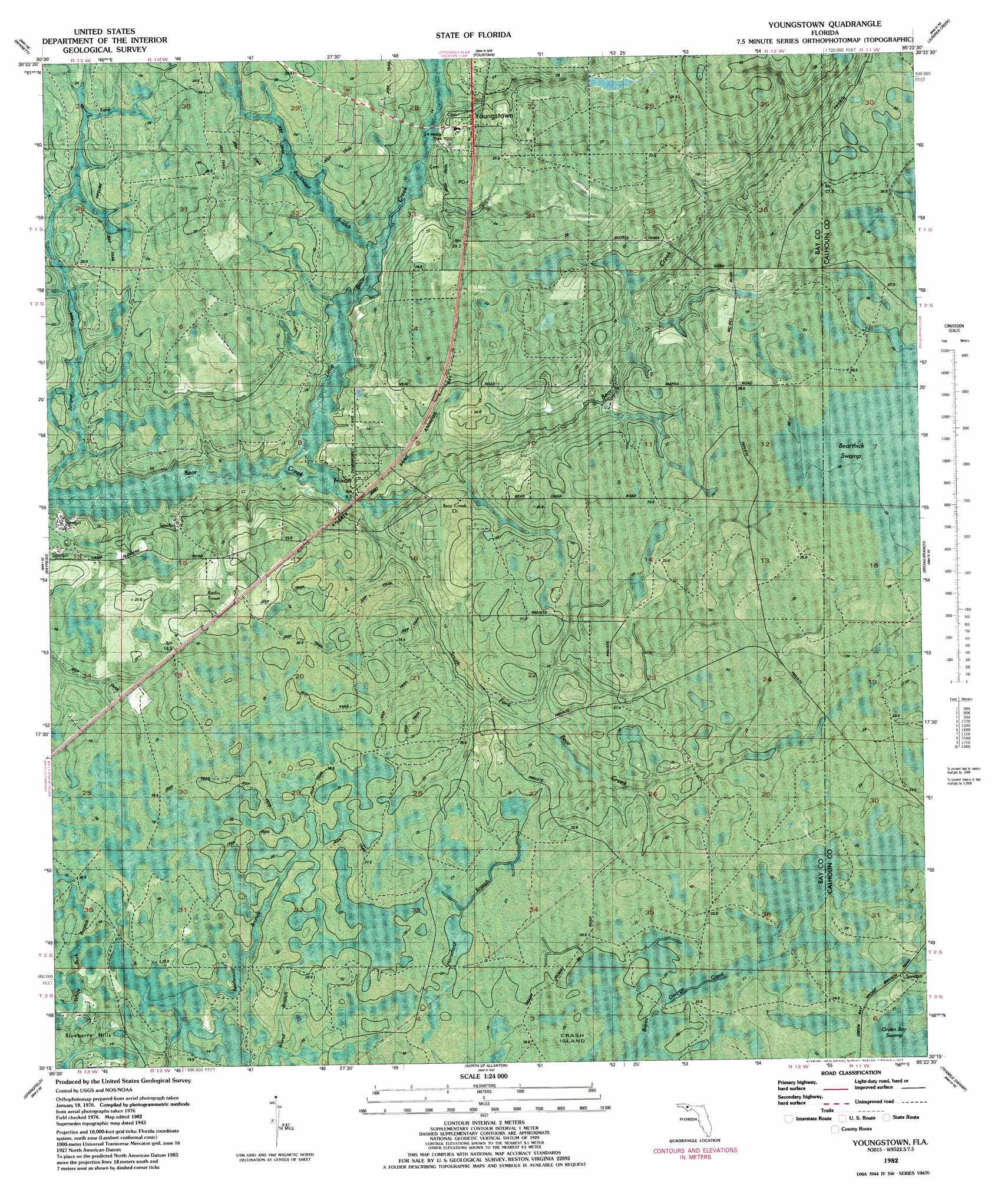
USGS Topo Quad 30085c4 - 1:24,000 scale
| Topo Map Name: | Youngstown |
| USGS Topo Quad ID: | 30085c4 |
| Print Size: | ca. 21 1/4" wide x 27" high |
| Southeast Coordinates: | 30.25° N latitude / 85.375° W longitude |
| Map Center Coordinates: | 30.3125° N latitude / 85.4375° W longitude |
| U.S. State: | FL |
| Filename: | P30085c4.jpg |
| Download Map JPG Image: | Youngstown topo map 1:24,000 scale |
| Map Type: | Orthophoto |
| Topo Series: | 7.5´ |
| Map Scale: | 1:24,000 |
| Source of Map Images: | United States Geological Survey (USGS) |
| Alternate Map Versions: |
Youngstown FL 1945, updated 1960 Download PDF Buy paper map Youngstown FL 2012 Download PDF Buy paper map Youngstown FL 2015 Download PDF Buy paper map |
1:24,000 Topo Quads surrounding Youngstown
Vernon |
Gap Lake |
Compass Lake |
Alford Se |
Altha West |
Crystal Lake |
Bennett |
Fountain |
Juniper Creek |
Clarksville |
Southport |
Bayhead |
Youngstown |
Broad Branch |
Frink |
Panama City |
Springfield |
North Of Allanton |
Tenmile Swamp |
Dead Lake |
Beacon Beach |
Long Point |
Allanton |
Wetappo Creek |
Wewahitchka |
> Back to 30085a1 at 1:100,000 scale
> Back to 30084a1 at 1:250,000 scale
> Back to U.S. Topo Maps home
Youngstown topo map: Gazetteer
Youngstown: Bays
Bayou George elevation 20m 65′Youngstown: Populated Places
Cairo elevation 20m 65′Nixon elevation 11m 36′
Youngstown elevation 26m 85′
Youngstown: Streams
Bird Pond Slough elevation 13m 42′Buckhead Branch elevation 8m 26′
Little Bear Creek elevation 4m 13′
South Fork Bear Creek elevation 4m 13′
Youngstown: Swamps
Bayou George elevation 20m 65′Bearthick Swamp elevation 26m 85′
Grape Swamp elevation 17m 55′
Youngstown digital topo map on disk
Buy this Youngstown topo map showing relief, roads, GPS coordinates and other geographical features, as a high-resolution digital map file on DVD:
Gulf Coast (LA, MS, AL, FL) & Southwestern Georgia
Buy digital topo maps: Gulf Coast (LA, MS, AL, FL) & Southwestern Georgia
 & Southwestern Georgia map DVD")