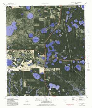
Crystal Lake Topo Map Florida
To zoom in, hover over the map of Crystal Lake
USGS Topo Quad 30085d6 - 1:24,000 scale
| Topo Map Name: | Crystal Lake |
| USGS Topo Quad ID: | 30085d6 |
| Print Size: | ca. 21 1/4" wide x 27" high |
| Southeast Coordinates: | 30.375° N latitude / 85.625° W longitude |
| Map Center Coordinates: | 30.4375° N latitude / 85.6875° W longitude |
| U.S. State: | FL |
| Filename: | P30085D6.jpg |
| Download Map JPG Image: | Crystal Lake topo map 1:24,000 scale |
| Map Type: | Orthophoto |
| Topo Series: | 7.5´ |
| Map Scale: | 1:24,000 |
| Source of Map Images: | United States Geological Survey (USGS) |
| Alternate Map Versions: |
Crystal Lake FL 1944, updated 1964 Download PDF Buy paper map Crystal Lake FL 1945, updated 1960 Download PDF Buy paper map Crystal Lake FL 1982, updated 1983 Download PDF Buy paper map Crystal Lake FL 1982, updated 1983 Download PDF Buy paper map Crystal Lake FL 2012 Download PDF Buy paper map Crystal Lake FL 2015 Download PDF Buy paper map |
1:24,000 Topo Quads surrounding Crystal Lake
> Back to 30085a1 at 1:100,000 scale
> Back to 30084a1 at 1:250,000 scale
> Back to U.S. Topo Maps home
Crystal Lake topo map: Gazetteer
Crystal Lake: Airports
CML Airport elevation 28m 91′Crystal Lake: Guts
Long Lake Slough elevation 32m 104′Crystal Lake: Lakes
Bait Lake elevation 22m 72′Big Blue Lake elevation 22m 72′
Big Island Lake elevation 17m 55′
Bird Lake elevation 28m 91′
Black Pond elevation 28m 91′
Bream Lake elevation 17m 55′
Brit Lake elevation 16m 52′
Calf Lake elevation 25m 82′
Compass Lake elevation 16m 52′
Court Martial Lake elevation 27m 88′
Crystal Lake elevation 18m 59′
Fivemile Lake elevation 16m 52′
Gator Pond elevation 13m 42′
Island Pond elevation 28m 91′
Lake Five-O elevation 17m 55′
Little Blue Lake elevation 15m 49′
Little Island Lake elevation 14m 45′
Log Cart Pond elevation 21m 68′
Long Lake elevation 25m 82′
Lower Spring Ponds elevation 18m 59′
Major Lake elevation 22m 72′
Merial Lake elevation 15m 49′
North Spring Lake elevation 18m 59′
Open Lake elevation 26m 85′
Piney Lake elevation 15m 49′
Rattlesnake Lake elevation 17m 55′
River Lake elevation 17m 55′
Sand Lake elevation 16m 52′
Shirt Tail Lake elevation 13m 42′
Sunset Lake elevation 20m 65′
Tank Pond elevation 19m 62′
Turkey Pond elevation 39m 127′
Tyson Lake elevation 24m 78′
Wash Pond elevation 40m 131′
White Western Lake elevation 16m 52′
Woody Pond elevation 15m 49′
Crystal Lake: Populated Places
Crystal Lake elevation 31m 101′Crystal Lake: Streams
Clearwater Branch elevation 12m 39′Crystal Lake digital topo map on disk
Buy this Crystal Lake topo map showing relief, roads, GPS coordinates and other geographical features, as a high-resolution digital map file on DVD:
Gulf Coast (LA, MS, AL, FL) & Southwestern Georgia
Buy digital topo maps: Gulf Coast (LA, MS, AL, FL) & Southwestern Georgia


