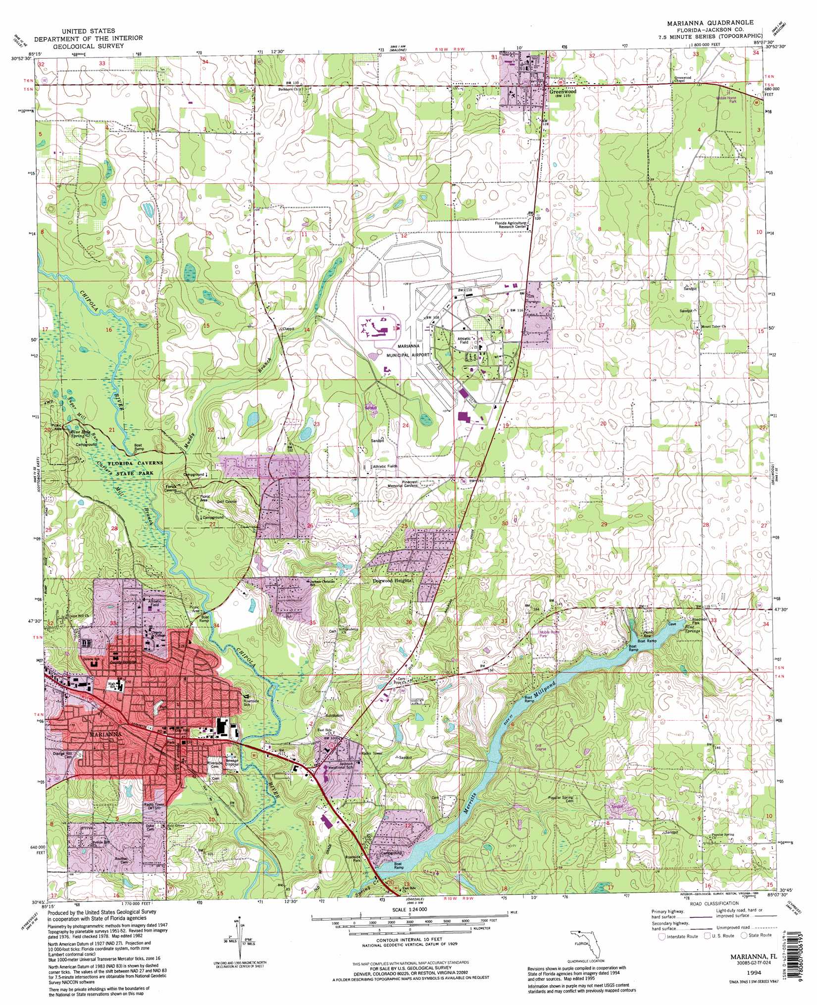
Marianna Topo Map Florida
To zoom in, hover over the map of Marianna
USGS Topo Quad 30085g2 - 1:24,000 scale
| Topo Map Name: | Marianna |
| USGS Topo Quad ID: | 30085g2 |
| Print Size: | ca. 21 1/4" wide x 27" high |
| Southeast Coordinates: | 30.75° N latitude / 85.125° W longitude |
| Map Center Coordinates: | 30.8125° N latitude / 85.1875° W longitude |
| U.S. State: | FL |
| Filename: | O30085G2.jpg |
| Download Map JPG Image: | Marianna topo map 1:24,000 scale |
| Map Type: | Topographic |
| Topo Series: | 7.5´ |
| Map Scale: | 1:24,000 |
| Source of Map Images: | United States Geological Survey (USGS) |
| Alternate Map Versions: |
Marianna FL 1952, updated 1953 Download PDF Buy paper map Marianna FL 1952, updated 1969 Download PDF Buy paper map Marianna FL 1982, updated 1983 Download PDF Buy paper map Marianna FL 1994, updated 1995 Download PDF Buy paper map Marianna FL 2012 Download PDF Buy paper map Marianna FL 2015 Download PDF Buy paper map |
1:24,000 Topo Quads surrounding Marianna
Madrid |
Cottonwood |
Grangeburg |
Saffold |
Donalsonville West |
Campbellton |
Sills |
Malone |
Bascom |
Steam Mill |
Cottondale West |
Cottondale East |
Marianna |
Dellwood |
Fairchild |
Alford |
Kynesville |
Oakdale |
Cypress |
Sneads |
Compass Lake |
Alford Se |
Altha West |
Altha East |
Rock Bluff |
> Back to 30085e1 at 1:100,000 scale
> Back to 30084a1 at 1:250,000 scale
> Back to U.S. Topo Maps home
Marianna topo map: Gazetteer
Marianna: Airports
Jackson County Hospital Heliport elevation 47m 154′Marianna Municipal Airport elevation 33m 108′
Marianna: Parks
Florida Caverns State Park elevation 21m 68′Marianna: Populated Places
Chipola Terrace elevation 37m 121′Greenwood elevation 35m 114′
Mallory Heights elevation 41m 134′
Marianna elevation 51m 167′
Marianna: Reservoirs
Merritts Mill Pond elevation 20m 65′Marianna: Springs
Baltzell Spring elevation 22m 72′Blue Hot Spring elevation 24m 78′
Blue Spring elevation 23m 75′
Marianna digital topo map on disk
Buy this Marianna topo map showing relief, roads, GPS coordinates and other geographical features, as a high-resolution digital map file on DVD:
Gulf Coast (LA, MS, AL, FL) & Southwestern Georgia
Buy digital topo maps: Gulf Coast (LA, MS, AL, FL) & Southwestern Georgia
 & Southwestern Georgia map DVD")