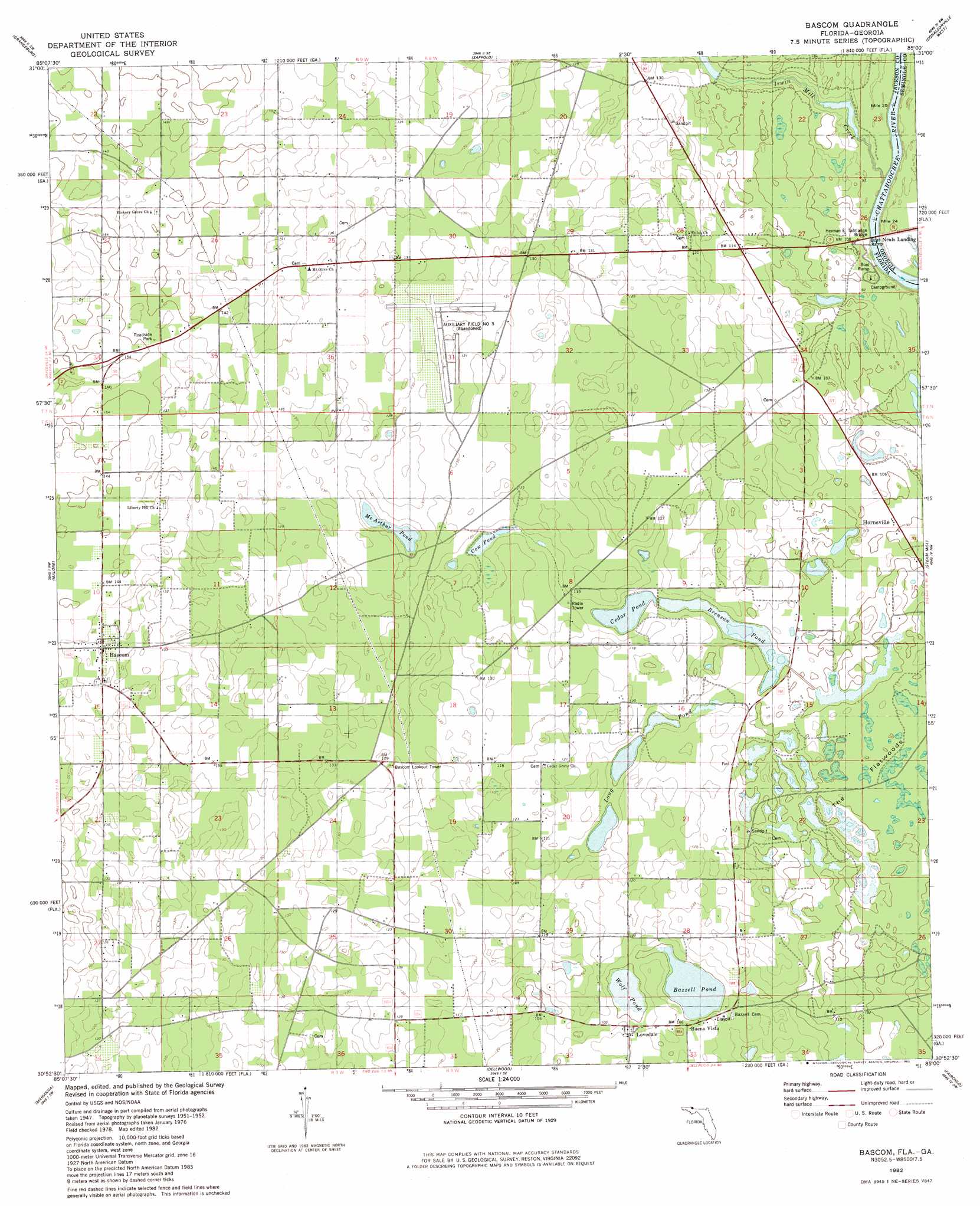
Bascom Topo Map Florida
To zoom in, hover over the map of Bascom
USGS Topo Quad 30085h1 - 1:24,000 scale
| Topo Map Name: | Bascom |
| USGS Topo Quad ID: | 30085h1 |
| Print Size: | ca. 21 1/4" wide x 27" high |
| Southeast Coordinates: | 30.875° N latitude / 85° W longitude |
| Map Center Coordinates: | 30.9375° N latitude / 85.0625° W longitude |
| U.S. States: | FL, GA |
| Filename: | O30085H1.jpg |
| Download Map JPG Image: | Bascom topo map 1:24,000 scale |
| Map Type: | Topographic |
| Topo Series: | 7.5´ |
| Map Scale: | 1:24,000 |
| Source of Map Images: | United States Geological Survey (USGS) |
| Alternate Map Versions: |
Bascom FL 1952, updated 1953 Download PDF Buy paper map Bascom FL 1982, updated 1982 Download PDF Buy paper map Bascom FL 1994, updated 1998 Download PDF Buy paper map Bascom FL 2011 Download PDF Buy paper map Bascom FL 2012 Download PDF Buy paper map Bascom FL 2015 Download PDF Buy paper map |
1:24,000 Topo Quads surrounding Bascom
Dothan East |
Ashford |
Gordon |
Lucile |
Donalsonville Ne |
Cottonwood |
Grangeburg |
Saffold |
Donalsonville West |
Donalsonville East |
Sills |
Malone |
Bascom |
Steam Mill |
Desser |
Cottondale East |
Marianna |
Dellwood |
Fairchild |
Reynoldsville |
Kynesville |
Oakdale |
Cypress |
Sneads |
Chattahoochee |
> Back to 30085e1 at 1:100,000 scale
> Back to 30084a1 at 1:250,000 scale
> Back to U.S. Topo Maps home
Bascom topo map: Gazetteer
Bascom: Airports
North American Farms Airport elevation 43m 141′Bascom: Flats
The Flatwoods elevation 31m 101′Bascom: Lakes
Bazzell Pond elevation 29m 95′Brenson Pond elevation 29m 95′
Cedar Pond elevation 29m 95′
Cow Pond elevation 33m 108′
McArthur Pond elevation 32m 104′
Wolf Pond elevation 28m 91′
Bascom: Populated Places
Bascom elevation 43m 141′Buena Vista elevation 31m 101′
Hornsville elevation 30m 98′
Lovedale elevation 33m 108′
Neals Landing elevation 24m 78′
Bascom: Streams
Irwin Mill Creek elevation 24m 78′Bascom digital topo map on disk
Buy this Bascom topo map showing relief, roads, GPS coordinates and other geographical features, as a high-resolution digital map file on DVD:
Gulf Coast (LA, MS, AL, FL) & Southwestern Georgia
Buy digital topo maps: Gulf Coast (LA, MS, AL, FL) & Southwestern Georgia
 & Southwestern Georgia map DVD")