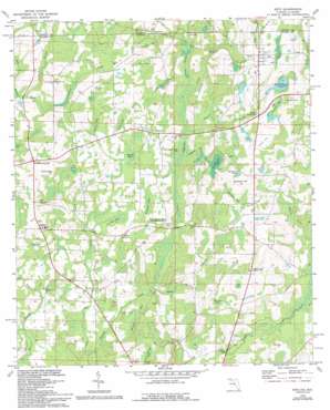
Esto Topo Map Florida
To zoom in, hover over the map of Esto
USGS Topo Quad 30085h6 - 1:24,000 scale
| Topo Map Name: | Esto |
| USGS Topo Quad ID: | 30085h6 |
| Print Size: | ca. 21 1/4" wide x 27" high |
| Southeast Coordinates: | 30.875° N latitude / 85.625° W longitude |
| Map Center Coordinates: | 30.9375° N latitude / 85.6875° W longitude |
| U.S. States: | FL, AL |
| Filename: | O30085H6.jpg |
| Download Map JPG Image: | Esto topo map 1:24,000 scale |
| Map Type: | Topographic |
| Topo Series: | 7.5´ |
| Map Scale: | 1:24,000 |
| Source of Map Images: | United States Geological Survey (USGS) |
| Alternate Map Versions: |
Esto FL 1950, updated 1970 Download PDF Buy paper map Esto FL 1951 Download PDF Buy paper map Esto FL 1982, updated 1983 Download PDF Buy paper map Esto FL 1982, updated 1993 Download PDF Buy paper map Esto FL 2012 Download PDF Buy paper map Esto FL 2015 Download PDF Buy paper map |
1:24,000 Topo Quads surrounding Esto
> Back to 30085e1 at 1:100,000 scale
> Back to 30084a1 at 1:250,000 scale
> Back to U.S. Topo Maps home
Esto topo map: Gazetteer
Esto: Lakes
Blackburn Pond elevation 48m 157′J H Miller Junior Pond elevation 39m 127′
Sand Hammock Pond elevation 59m 193′
Susan Pond elevation 28m 91′
Esto: Populated Places
Ards Crossroads elevation 43m 141′Bethlehem elevation 44m 144′
Esto elevation 71m 232′
Highnote elevation 54m 177′
Holland Crossroads elevation 59m 193′
Miller Crossroads elevation 55m 180′
Esto: Streams
Big Branch elevation 33m 108′Boggy Branch elevation 39m 127′
Cannon Branch elevation 36m 118′
Coates Branch elevation 38m 124′
John Branch elevation 38m 124′
Little Creek elevation 22m 72′
Rice Machine Branch elevation 27m 88′
Rolland Branch elevation 32m 104′
Texas Branch elevation 35m 114′
Esto: Summits
Blackburn Hill elevation 62m 203′Coates Hill elevation 70m 229′
Corbett Hill elevation 76m 249′
Old Hammock Hill elevation 40m 131′
Taylor Hill elevation 65m 213′
Esto: Swamps
Blackburn Bay elevation 48m 157′Burkett Bay Swamp elevation 27m 88′
Carswell Bay elevation 57m 187′
Clarks Bay elevation 55m 180′
Coates Bay elevation 49m 160′
Kirkland Bay elevation 37m 121′
Larkin Holland Bay elevation 29m 95′
Lauflin Bay elevation 35m 114′
Mandy Bay elevation 38m 124′
Old Buzzard Bay elevation 37m 121′
Osborne Bay elevation 42m 137′
Pate Bay elevation 54m 177′
Register Branch elevation 37m 121′
Williams Bay elevation 33m 108′
Yates Bay elevation 42m 137′
Esto digital topo map on disk
Buy this Esto topo map showing relief, roads, GPS coordinates and other geographical features, as a high-resolution digital map file on DVD:
Gulf Coast (LA, MS, AL, FL) & Southwestern Georgia
Buy digital topo maps: Gulf Coast (LA, MS, AL, FL) & Southwestern Georgia


