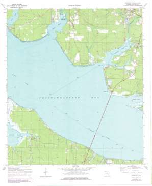
Freeport Topo Map Florida
To zoom in, hover over the map of Freeport
USGS Topo Quad 30086d2 - 1:24,000 scale
| Topo Map Name: | Freeport |
| USGS Topo Quad ID: | 30086d2 |
| Print Size: | ca. 21 1/4" wide x 27" high |
| Southeast Coordinates: | 30.375° N latitude / 86.125° W longitude |
| Map Center Coordinates: | 30.4375° N latitude / 86.1875° W longitude |
| U.S. State: | FL |
| Filename: | O30086D2.jpg |
| Download Map JPG Image: | Freeport topo map 1:24,000 scale |
| Map Type: | Topographic |
| Topo Series: | 7.5´ |
| Map Scale: | 1:24,000 |
| Source of Map Images: | United States Geological Survey (USGS) |
| Alternate Map Versions: |
Freeport FL 1970, updated 1972 Download PDF Buy paper map Freeport FL 1970, updated 1977 Download PDF Buy paper map Freeport FL 2012 Download PDF Buy paper map Freeport FL 2015 Download PDF Buy paper map |
1:24,000 Topo Quads surrounding Freeport
> Back to 30086a1 at 1:100,000 scale
> Back to 30086a1 at 1:250,000 scale
> Back to U.S. Topo Maps home
Freeport topo map: Gazetteer
Freeport: Bays
Alaqua Bayou elevation 0m 0′Basin Bayou elevation 0m 0′
Hogtown Bayou elevation 0m 0′
Jolly Bay elevation 0m 0′
LaGrange Bayou elevation 0m 0′
Mallet Bayou elevation 0m 0′
Freeport: Capes
Alaqua Point elevation 1m 3′Alligator Point elevation 1m 3′
Live Oak Point elevation 0m 0′
Motes Point elevation 3m 9′
Piney Point elevation 1m 3′
Wheeler Point elevation 1m 3′
Freeport: Parks
Basin Bayou State Recreation Area elevation 3m 9′Lion Park elevation 1m 3′
Freeport: Populated Places
Bay View elevation 2m 6′Choctaw Bay Estates elevation 1m 3′
Fluffy Landing elevation 1m 3′
Freeport elevation 10m 32′
La Grange Point elevation 0m 0′
Santa Rosa Beach elevation 1m 3′
Freeport: Streams
Alaqua Creek elevation 0m 0′Bear Creek elevation 0m 0′
Bear Creek elevation 1m 3′
Bowman Bayou elevation 0m 0′
Churchill Bayou elevation 0m 0′
Fourmile Creek elevation 0m 0′
Goodwin Creek elevation 0m 0′
Lafayette Creek elevation 1m 3′
Littles Bayou elevation 1m 3′
McQuage Bayou elevation 0m 0′
Nancys Cutoff elevation 0m 0′
Ramsey Branch elevation 0m 0′
West Bayou elevation 0m 0′
Freeport digital topo map on disk
Buy this Freeport topo map showing relief, roads, GPS coordinates and other geographical features, as a high-resolution digital map file on DVD:
Gulf Coast (LA, MS, AL, FL) & Southwestern Georgia
Buy digital topo maps: Gulf Coast (LA, MS, AL, FL) & Southwestern Georgia


