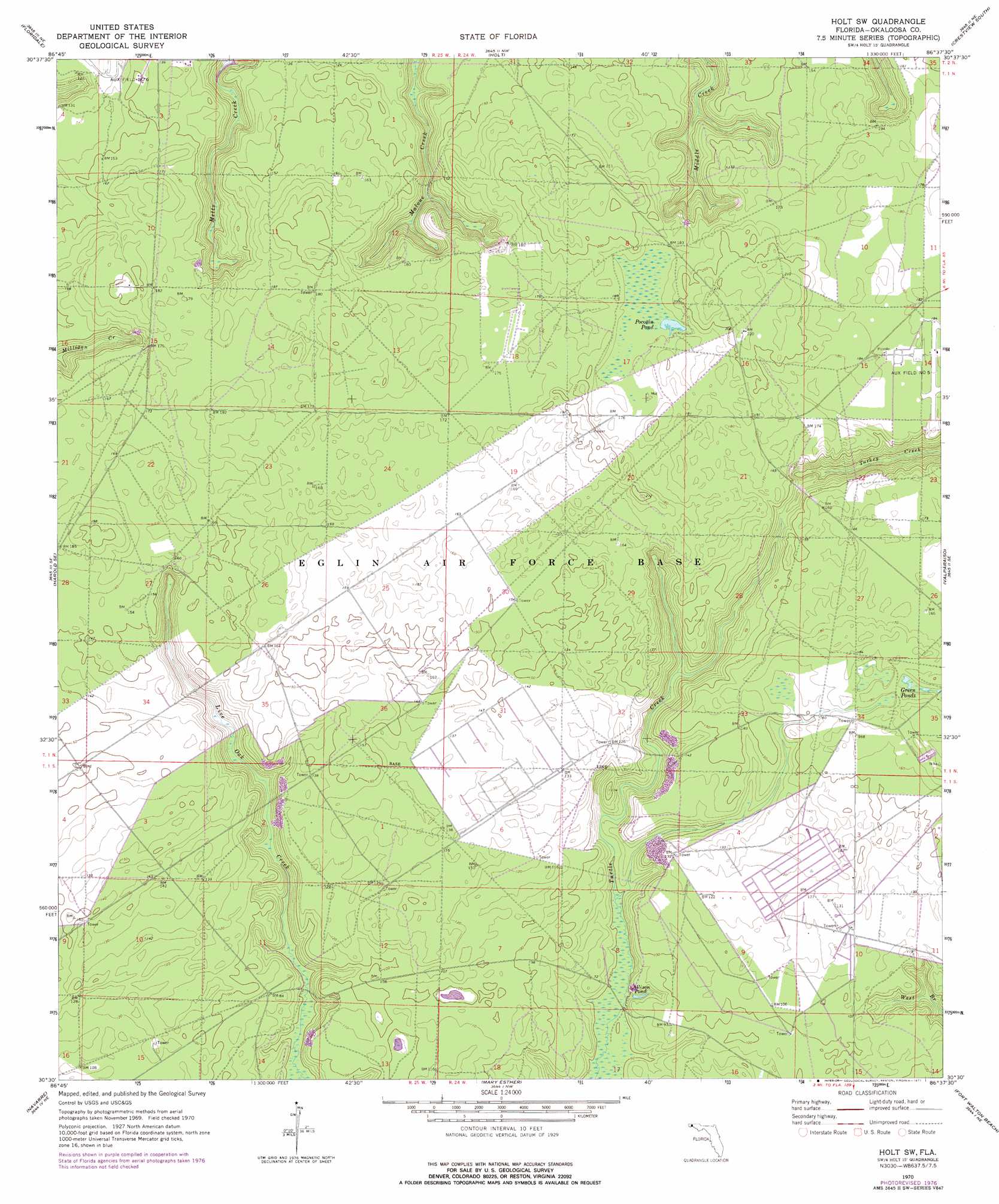
Holt Sw Topo Map Florida
To zoom in, hover over the map of Holt Sw
USGS Topo Quad 30086e6 - 1:24,000 scale
| Topo Map Name: | Holt Sw |
| USGS Topo Quad ID: | 30086e6 |
| Print Size: | ca. 21 1/4" wide x 27" high |
| Southeast Coordinates: | 30.5° N latitude / 86.625° W longitude |
| Map Center Coordinates: | 30.5625° N latitude / 86.6875° W longitude |
| U.S. State: | FL |
| Filename: | O30086E6.jpg |
| Download Map JPG Image: | Holt Sw topo map 1:24,000 scale |
| Map Type: | Topographic |
| Topo Series: | 7.5´ |
| Map Scale: | 1:24,000 |
| Source of Map Images: | United States Geological Survey (USGS) |
| Alternate Map Versions: |
Holt SW FL 1970, updated 1972 Download PDF Buy paper map Holt SW FL 1970, updated 1977 Download PDF Buy paper map Holt SW FL 2012 Download PDF Buy paper map Holt SW FL 2015 Download PDF Buy paper map |
1:24,000 Topo Quads surrounding Holt Sw
Spring Hill |
Munson |
Baker |
Crestview North |
Dorcas |
Harold |
Floridale |
Holt |
Crestview South |
Spencer Flats |
Ward Basin |
Harold Se |
Holt Sw |
Valparaiso |
Niceville |
Holley |
Navarre |
Mary Esther |
Fort Walton Beach |
Destin |
South Of Holley |
> Back to 30086e1 at 1:100,000 scale
> Back to 30086a1 at 1:250,000 scale
> Back to U.S. Topo Maps home
Holt Sw topo map: Gazetteer
Holt Sw: Lakes
Allison Pond elevation 18m 59′Green Pond elevation 55m 180′
Pocosin Pond elevation 54m 177′
Holt Sw digital topo map on disk
Buy this Holt Sw topo map showing relief, roads, GPS coordinates and other geographical features, as a high-resolution digital map file on DVD:
Gulf Coast (LA, MS, AL, FL) & Southwestern Georgia
Buy digital topo maps: Gulf Coast (LA, MS, AL, FL) & Southwestern Georgia
 & Southwestern Georgia map DVD")