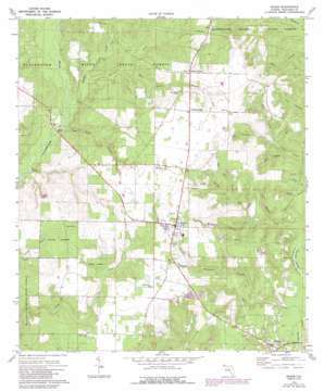
Baker Topo Map Florida
To zoom in, hover over the map of Baker
USGS Topo Quad 30086g6 - 1:24,000 scale
| Topo Map Name: | Baker |
| USGS Topo Quad ID: | 30086g6 |
| Print Size: | ca. 21 1/4" wide x 27" high |
| Southeast Coordinates: | 30.75° N latitude / 86.625° W longitude |
| Map Center Coordinates: | 30.8125° N latitude / 86.6875° W longitude |
| U.S. State: | FL |
| Filename: | O30086G6.jpg |
| Download Map JPG Image: | Baker topo map 1:24,000 scale |
| Map Type: | Topographic |
| Topo Series: | 7.5´ |
| Map Scale: | 1:24,000 |
| Source of Map Images: | United States Geological Survey (USGS) |
| Alternate Map Versions: |
Baker FL 1973, updated 1976 Download PDF Buy paper map Baker FL 1973, updated 1987 Download PDF Buy paper map Baker FL 2012 Download PDF Buy paper map Baker FL 2015 Download PDF Buy paper map |
1:24,000 Topo Quads surrounding Baker
> Back to 30086e1 at 1:100,000 scale
> Back to 30086a1 at 1:250,000 scale
> Back to U.S. Topo Maps home
Baker topo map: Gazetteer
Baker: Airports
Dotson Airport elevation 76m 249′Lonesome Pines Airport elevation 74m 242′
Sky Ranch elevation 75m 246′
Baker: Bridges
Cotton Bridge elevation 21m 68′Baker: Channels
Griffith Ferry Stretch elevation 17m 55′Baker: Lakes
A A Hilton Pond elevation 41m 134′Baker: Populated Places
Baker elevation 76m 249′Cannon Town elevation 72m 236′
Milligan elevation 31m 101′
Nubbin Ridge elevation 76m 249′
Baker: Streams
Bear Creek elevation 29m 95′Gum Springs Branch elevation 34m 111′
Gunn Creek elevation 17m 55′
Henderson Branch elevation 27m 88′
Hog Pen Branch elevation 36m 118′
Island Branch elevation 31m 101′
Long Branch elevation 23m 75′
Mill Creek elevation 15m 49′
Narrows Creek elevation 24m 78′
Panther Creek elevation 21m 68′
Pyron Spring Branch elevation 30m 98′
Red Wash Branch elevation 21m 68′
Surveyor Creek elevation 29m 95′
Tan Vat Branch elevation 17m 55′
Threemile Branch elevation 21m 68′
Baker: Valleys
Deer Head elevation 27m 88′Baker digital topo map on disk
Buy this Baker topo map showing relief, roads, GPS coordinates and other geographical features, as a high-resolution digital map file on DVD:
Gulf Coast (LA, MS, AL, FL) & Southwestern Georgia
Buy digital topo maps: Gulf Coast (LA, MS, AL, FL) & Southwestern Georgia


