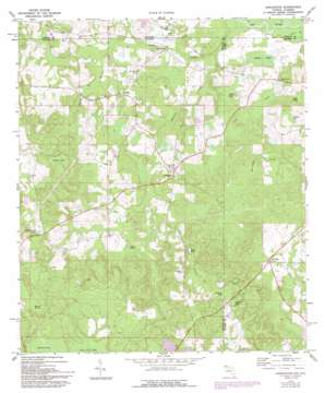
Darlington Topo Map Florida
To zoom in, hover over the map of Darlington
USGS Topo Quad 30086h1 - 1:24,000 scale
| Topo Map Name: | Darlington |
| USGS Topo Quad ID: | 30086h1 |
| Print Size: | ca. 21 1/4" wide x 27" high |
| Southeast Coordinates: | 30.875° N latitude / 86° W longitude |
| Map Center Coordinates: | 30.9375° N latitude / 86.0625° W longitude |
| U.S. States: | FL, AL |
| Filename: | O30086H1.jpg |
| Download Map JPG Image: | Darlington topo map 1:24,000 scale |
| Map Type: | Topographic |
| Topo Series: | 7.5´ |
| Map Scale: | 1:24,000 |
| Source of Map Images: | United States Geological Survey (USGS) |
| Alternate Map Versions: |
Darlington FL 1973, updated 1975 Download PDF Buy paper map Darlington FL 1973, updated 1988 Download PDF Buy paper map Darlington FL 1987, updated 1993 Download PDF Buy paper map Darlington FL 2012 Download PDF Buy paper map Darlington FL 2015 Download PDF Buy paper map |
1:24,000 Topo Quads surrounding Darlington
> Back to 30086e1 at 1:100,000 scale
> Back to 30086a1 at 1:250,000 scale
> Back to U.S. Topo Maps home
Darlington topo map: Gazetteer
Darlington: Lakes
Alder Pond elevation 56m 183′Burgess Pond elevation 37m 121′
Collinsworth Pond elevation 57m 187′
Cook Pond elevation 37m 121′
Miller Pond elevation 50m 164′
Darlington: Populated Places
Darlington elevation 59m 193′Leonia elevation 62m 203′
Darlington: Springs
Weaver Springs elevation 70m 229′Darlington: Streams
Chestnut Creek elevation 29m 95′Dry Branch elevation 39m 127′
Limestone Creek elevation 26m 85′
Spring Branch elevation 35m 114′
Darlington: Swamps
Dukes Bay elevation 57m 187′Ealum Bay elevation 75m 246′
Grassy Bay elevation 51m 167′
Green Pond elevation 70m 229′
Johnson Lakes elevation 55m 180′
Johnson Lakes elevation 33m 108′
Mack Bay elevation 41m 134′
Peavey Bay elevation 68m 223′
Pikehole Bay elevation 66m 216′
Porter Bay elevation 36m 118′
Darlington digital topo map on disk
Buy this Darlington topo map showing relief, roads, GPS coordinates and other geographical features, as a high-resolution digital map file on DVD:
Gulf Coast (LA, MS, AL, FL) & Southwestern Georgia
Buy digital topo maps: Gulf Coast (LA, MS, AL, FL) & Southwestern Georgia


