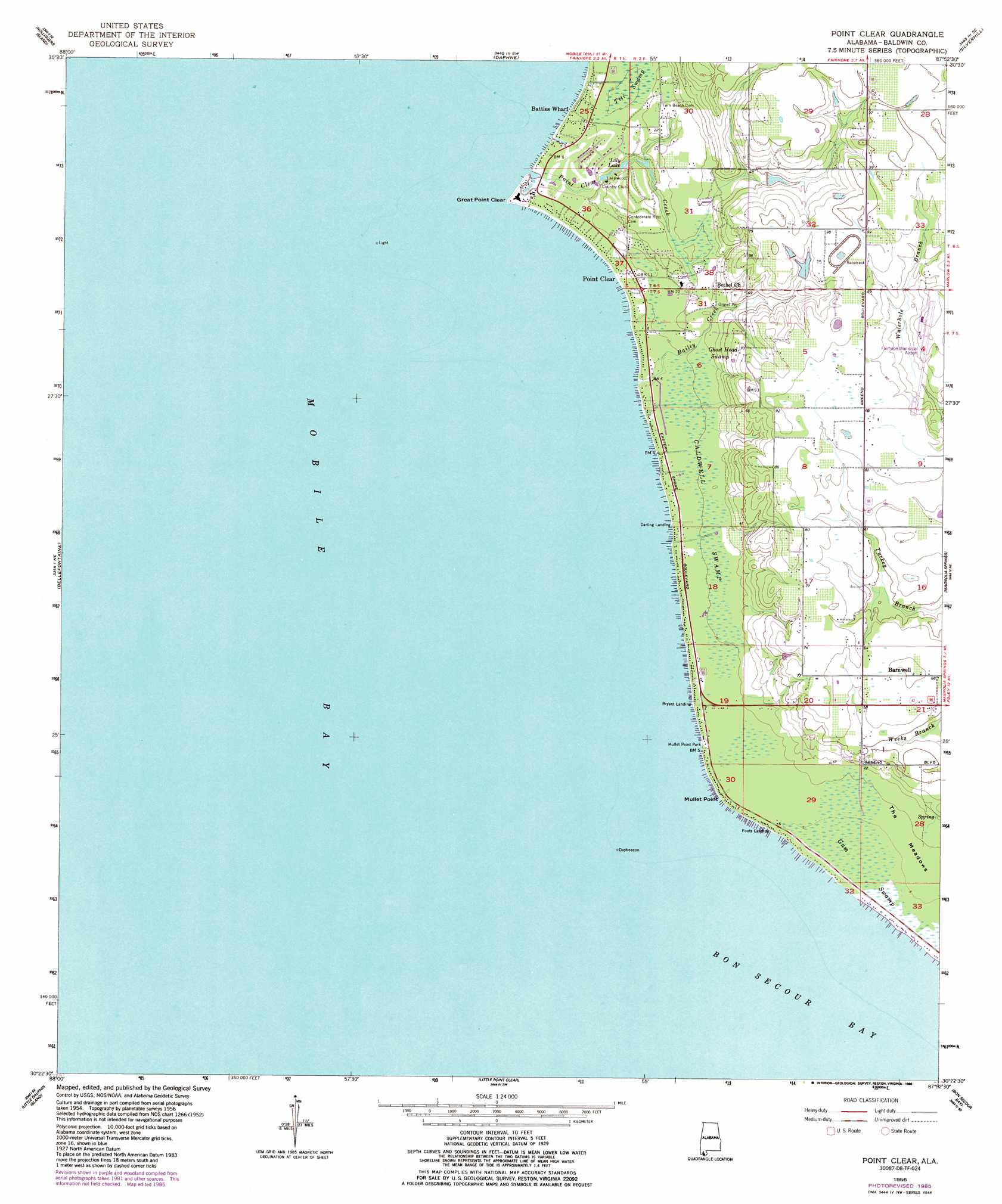
Point Clear Topo Map Alabama
To zoom in, hover over the map of Point Clear
USGS Topo Quad 30087d8 - 1:24,000 scale
| Topo Map Name: | Point Clear |
| USGS Topo Quad ID: | 30087d8 |
| Print Size: | ca. 21 1/4" wide x 27" high |
| Southeast Coordinates: | 30.375° N latitude / 87.875° W longitude |
| Map Center Coordinates: | 30.4375° N latitude / 87.9375° W longitude |
| U.S. State: | AL |
| Filename: | o30087d8.jpg |
| Download Map JPG Image: | Point Clear topo map 1:24,000 scale |
| Map Type: | Topographic |
| Topo Series: | 7.5´ |
| Map Scale: | 1:24,000 |
| Source of Map Images: | United States Geological Survey (USGS) |
| Alternate Map Versions: |
Point Clear AL 1956, updated 1956 Download PDF Buy paper map Point Clear AL 1956, updated 1986 Download PDF Buy paper map Point Clear AL 1966, updated 1975 Download PDF Buy paper map Point Clear AL 2011 Download PDF Buy paper map Point Clear AL 2014 Download PDF Buy paper map |
1:24,000 Topo Quads surrounding Point Clear
Spring Hill |
Mobile |
Bridgehead |
Stapleton |
Steelwood Lake |
Theodore |
Hollingers Island |
Daphne |
Silverhill |
Robertsdale |
Coden |
Bellefontaine |
Point Clear |
Magnolia Springs |
Foley |
Heron Bay |
Little Dauphin Island |
Little Point Clear |
Bon Secour Bay |
Gulf Shores |
Fort Morgan Nw |
Fort Morgan |
Saint Andrews Bay |
Pine Beach |
> Back to 30087a1 at 1:100,000 scale
> Back to 30086a1 at 1:250,000 scale
> Back to U.S. Topo Maps home
Point Clear topo map: Gazetteer
Point Clear: Airports
Fairhope Municipal Airport elevation 23m 75′Point Clear: Capes
Great Point Clear elevation 2m 6′Mullet Point elevation 0m 0′
Point Clear: Lakes
Lily Lake elevation 2m 6′Point Clear: Oilfields
Barnwell Gas Field elevation 19m 62′Point Clear: Parks
Mullet Point Park elevation 2m 6′Point Clear: Populated Places
Barnwell elevation 22m 72′Battles Wharf elevation 2m 6′
Point Clear elevation 3m 9′
Point Clear: Streams
Bailey Creek elevation 0m 0′Point Clear Creek elevation 0m 0′
Point Clear: Swamps
Caldwell Swamp elevation 3m 9′Ghost Head Swamp elevation 3m 9′
Gum Swamp elevation 1m 3′
Titi Swamp elevation 4m 13′
Point Clear digital topo map on disk
Buy this Point Clear topo map showing relief, roads, GPS coordinates and other geographical features, as a high-resolution digital map file on DVD:
Gulf Coast (LA, MS, AL, FL) & Southwestern Georgia
Buy digital topo maps: Gulf Coast (LA, MS, AL, FL) & Southwestern Georgia
 & Southwestern Georgia map DVD")