Seminole Topo Map Alabama
To zoom in, hover over the map of Seminole
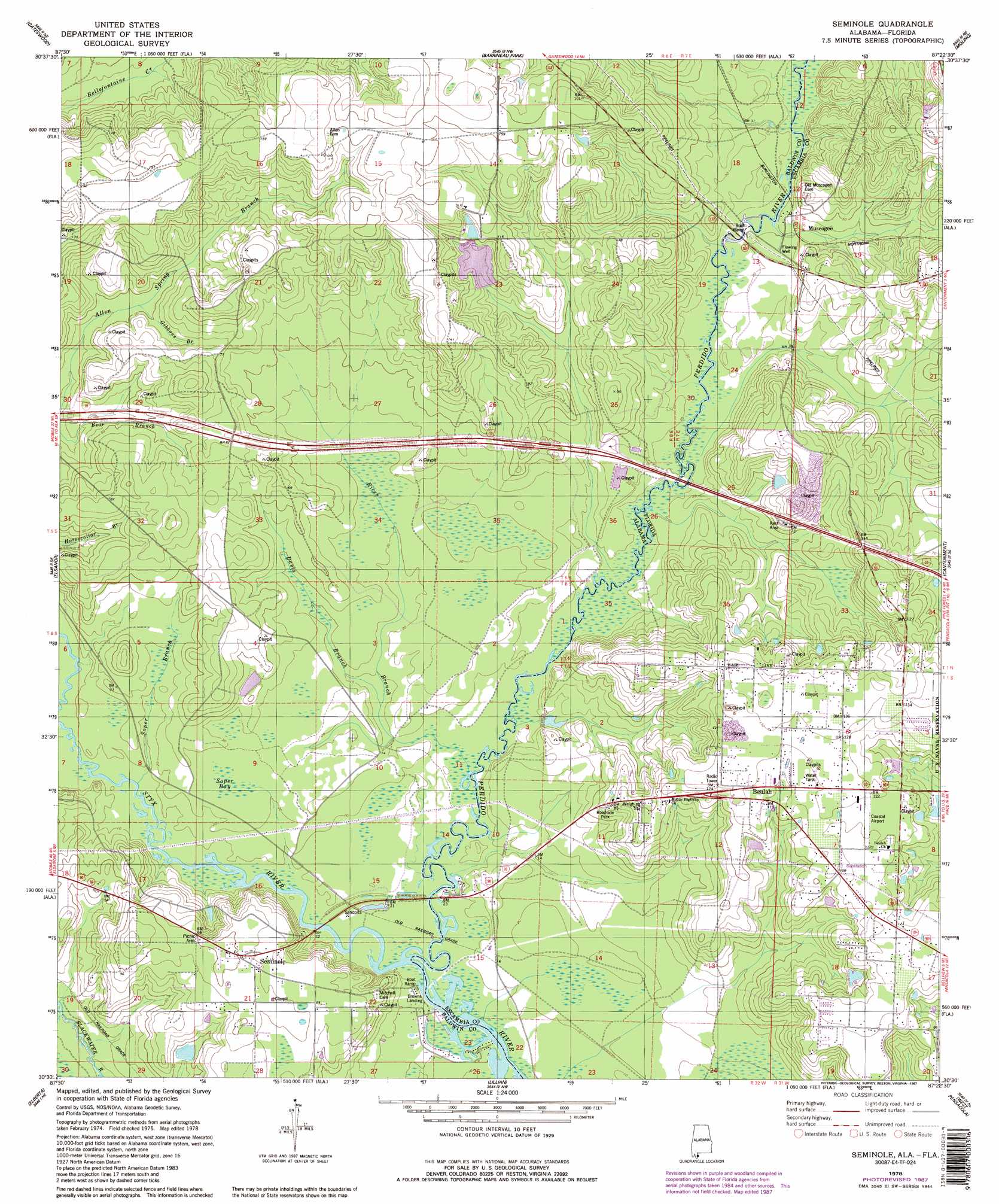
USGS Topo Quad 30087e4 - 1:24,000 scale
| Topo Map Name: | Seminole |
| USGS Topo Quad ID: | 30087e4 |
| Print Size: | ca. 21 1/4" wide x 27" high |
| Southeast Coordinates: | 30.5° N latitude / 87.375° W longitude |
| Map Center Coordinates: | 30.5625° N latitude / 87.4375° W longitude |
| U.S. States: | AL, FL |
| Filename: | o30087e4.jpg |
| Download Map JPG Image: | Seminole topo map 1:24,000 scale |
| Map Type: | Topographic |
| Topo Series: | 7.5´ |
| Map Scale: | 1:24,000 |
| Source of Map Images: | United States Geological Survey (USGS) |
| Alternate Map Versions: |
Seminole AL 1978, updated 1978 Download PDF Buy paper map Seminole AL 1978, updated 1987 Download PDF Buy paper map Seminole AL 1978, updated 1987 Download PDF Buy paper map Seminole AL 2011 Download PDF Buy paper map Seminole AL 2014 Download PDF Buy paper map |
1:24,000 Topo Quads surrounding Seminole
Dogwood Creek |
Enon |
Bay Springs |
Mcdavid |
Chumuckla |
Steelwood Lake |
Gateswood |
Barrineau Park |
Molino |
Wallace |
Robertsdale |
Elsanor |
Seminole |
Cantonment |
Pace |
Foley |
Elberta |
Lillian |
West Pensacola |
Pensacola |
Gulf Shores |
Orange Beach |
Perdido Bay |
Fort Barrancas |
Gulf Breeze |
> Back to 30087e1 at 1:100,000 scale
> Back to 30086a1 at 1:250,000 scale
> Back to U.S. Topo Maps home
Seminole topo map: Gazetteer
Seminole: Crossings
Nunez Ferry (historical) elevation 3m 9′Seminole: Populated Places
Beulah elevation 36m 118′Muscogee elevation 10m 32′
Seminole elevation 30m 98′
Seminole: Streams
Davis Branch elevation 3m 9′Gibbons Branch elevation 13m 42′
Rices Branch elevation 2m 6′
Soper Branch elevation 1m 3′
Styx River elevation 2m 6′
Seminole: Swamps
Soper Bay elevation 7m 22′Seminole digital topo map on disk
Buy this Seminole topo map showing relief, roads, GPS coordinates and other geographical features, as a high-resolution digital map file on DVD:
Gulf Coast (LA, MS, AL, FL) & Southwestern Georgia
Buy digital topo maps: Gulf Coast (LA, MS, AL, FL) & Southwestern Georgia
 & Southwestern Georgia map DVD")