Stapleton Topo Map Alabama
To zoom in, hover over the map of Stapleton
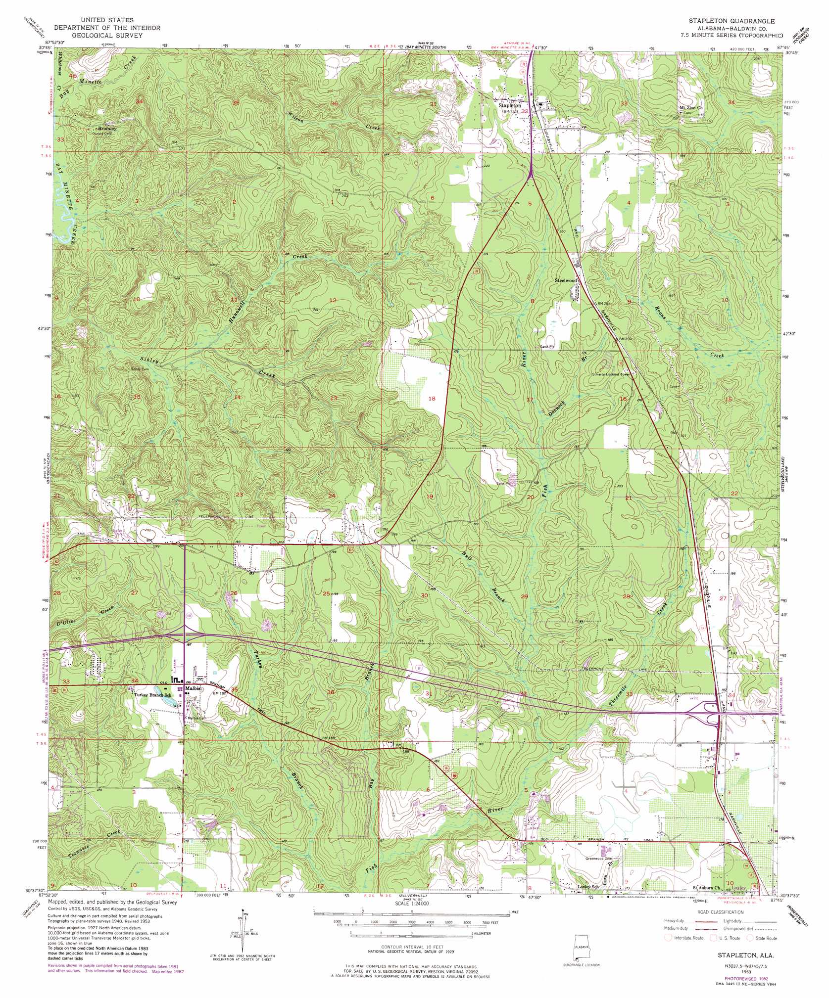
USGS Topo Quad 30087f7 - 1:24,000 scale
| Topo Map Name: | Stapleton |
| USGS Topo Quad ID: | 30087f7 |
| Print Size: | ca. 21 1/4" wide x 27" high |
| Southeast Coordinates: | 30.625° N latitude / 87.75° W longitude |
| Map Center Coordinates: | 30.6875° N latitude / 87.8125° W longitude |
| U.S. State: | AL |
| Filename: | o30087f7.jpg |
| Download Map JPG Image: | Stapleton topo map 1:24,000 scale |
| Map Type: | Topographic |
| Topo Series: | 7.5´ |
| Map Scale: | 1:24,000 |
| Source of Map Images: | United States Geological Survey (USGS) |
| Alternate Map Versions: |
Stapleton AL 1953, updated 1955 Download PDF Buy paper map Stapleton AL 1953, updated 1968 Download PDF Buy paper map Stapleton AL 1953, updated 1983 Download PDF Buy paper map Stapleton AL 2011 Download PDF Buy paper map Stapleton AL 2014 Download PDF Buy paper map |
1:24,000 Topo Quads surrounding Stapleton
Creola |
The Basin |
Bay Minette North |
Dyas |
Walnut Hill |
Chickasaw |
Hurricane |
Bay Minette South |
Dogwood Creek |
Enon |
Mobile |
Bridgehead |
Stapleton |
Steelwood Lake |
Gateswood |
Hollingers Island |
Daphne |
Silverhill |
Robertsdale |
Elsanor |
Bellefontaine |
Point Clear |
Magnolia Springs |
Foley |
Elberta |
> Back to 30087e1 at 1:100,000 scale
> Back to 30086a1 at 1:250,000 scale
> Back to U.S. Topo Maps home
Stapleton topo map: Gazetteer
Stapleton: Crossings
Interchange 38 elevation 56m 183′Interchange 44 elevation 55m 180′
Stapleton: Dams
Paul Childress Junior Lake Dam elevation 59m 193′Stapleton: Populated Places
Bromley elevation 28m 91′Ellisville elevation 52m 170′
Malbis elevation 59m 193′
Pine Haven elevation 62m 203′
Stapleton elevation 68m 223′
Steelwood elevation 66m 216′
Stapleton: Reservoirs
Paul Childress Junior Lake elevation 59m 193′Stapleton: Streams
Bay Branch elevation 23m 75′Bull Branch elevation 34m 111′
Doeneck Branch elevation 43m 141′
Hunawell Creek elevation 7m 22′
Threemile Creek elevation 30m 98′
Whitehouse Creek elevation 3m 9′
Stapleton digital topo map on disk
Buy this Stapleton topo map showing relief, roads, GPS coordinates and other geographical features, as a high-resolution digital map file on DVD:
Gulf Coast (LA, MS, AL, FL) & Southwestern Georgia
Buy digital topo maps: Gulf Coast (LA, MS, AL, FL) & Southwestern Georgia
 & Southwestern Georgia map DVD")