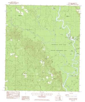
Easen Hill Topo Map Mississippi
To zoom in, hover over the map of Easen Hill
USGS Topo Quad 30088f6 - 1:24,000 scale
| Topo Map Name: | Easen Hill |
| USGS Topo Quad ID: | 30088f6 |
| Print Size: | ca. 21 1/4" wide x 27" high |
| Southeast Coordinates: | 30.625° N latitude / 88.625° W longitude |
| Map Center Coordinates: | 30.6875° N latitude / 88.6875° W longitude |
| U.S. State: | MS |
| Filename: | o30088f6.jpg |
| Download Map JPG Image: | Easen Hill topo map 1:24,000 scale |
| Map Type: | Topographic |
| Topo Series: | 7.5´ |
| Map Scale: | 1:24,000 |
| Source of Map Images: | United States Geological Survey (USGS) |
| Alternate Map Versions: |
Easen Hill MS 1982, updated 1983 Download PDF Buy paper map Easen Hill MS 1982, updated 1983 Download PDF Buy paper map Easen Hill MS 2012 Download PDF Buy paper map Easen Hill MS 2015 Download PDF Buy paper map |
1:24,000 Topo Quads surrounding Easen Hill
> Back to 30088e1 at 1:100,000 scale
> Back to 30088a1 at 1:250,000 scale
> Back to U.S. Topo Maps home
Easen Hill topo map: Gazetteer
Easen Hill: Canals
Mills Ditch elevation 4m 13′Easen Hill: Capes
Webbs Point elevation 5m 16′Easen Hill: Cliffs
Red Bluff elevation 10m 32′Easen Hill: Crossings
Holders Ferry (historical) elevation 3m 9′Easen Hill: Guts
Sandy Slough elevation 3m 9′Easen Hill: Lakes
Berlson Lake elevation 5m 16′Boggy Lake elevation 5m 16′
Brewton Lake elevation 3m 9′
Cane Lake elevation 4m 13′
Carter Lake elevation 4m 13′
Cypress Lake elevation 5m 16′
Davis Dead River elevation 5m 16′
Dead Lake (historical) elevation 5m 16′
Dogged Dead River elevation 5m 16′
Ellick Lake elevation 5m 16′
Ferrell Dead River elevation 6m 19′
Fletcher Lake elevation 3m 9′
Galloway Lake elevation 5m 16′
Goggle Eye Lake elevation 5m 16′
Lower Carter Lake elevation 5m 16′
Lower Ramsey Lake elevation 5m 16′
Round Lake elevation 4m 13′
Sims Mill Pond elevation 10m 32′
Stead Dead River elevation 4m 13′
Tucker Lake elevation 3m 9′
Upper Carter Lake elevation 5m 16′
Upper Ramsey Lake elevation 5m 16′
Wilson Lake elevation 5m 16′
Easen Hill: Populated Places
Holly Landing elevation 9m 29′Easen Hill: Streams
Alligator Branch elevation 23m 75′Big Black Creek elevation 3m 9′
Big Branch elevation 19m 62′
Big Cedar Creek elevation 4m 13′
Black Creek elevation 4m 13′
Boggy Branch elevation 27m 88′
Boggy Slough elevation 3m 9′
Brushy Creek elevation 6m 19′
Clay Creek elevation 5m 16′
Fivemile Branch elevation 21m 68′
Flagler Branch elevation 25m 82′
Fourmile Branch elevation 23m 75′
Foxhead Branch elevation 24m 78′
Green Head Branch elevation 27m 88′
Gum Branch elevation 15m 49′
Holly Branch elevation 5m 16′
Indian Creek elevation 4m 13′
Jack Branch elevation 19m 62′
Jump Branch elevation 6m 19′
Long Branch elevation 24m 78′
Mill Branch elevation 4m 13′
Narrow Gap Branch elevation 20m 65′
Peach Branch elevation 5m 16′
Red Creek elevation 5m 16′
Smith Branch elevation 18m 59′
Smith Branch elevation 4m 13′
Spring Branch elevation 24m 78′
Threemile Branch elevation 20m 65′
Tom Clark Branch elevation 20m 65′
Easen Hill: Summits
Carrol Hill elevation 47m 154′Easen Hill elevation 26m 85′
Ladnier Hill elevation 42m 137′
Easen Hill: Swamps
Duck Roost elevation 6m 19′Easen Hill digital topo map on disk
Buy this Easen Hill topo map showing relief, roads, GPS coordinates and other geographical features, as a high-resolution digital map file on DVD:
Gulf Coast (LA, MS, AL, FL) & Southwestern Georgia
Buy digital topo maps: Gulf Coast (LA, MS, AL, FL) & Southwestern Georgia


