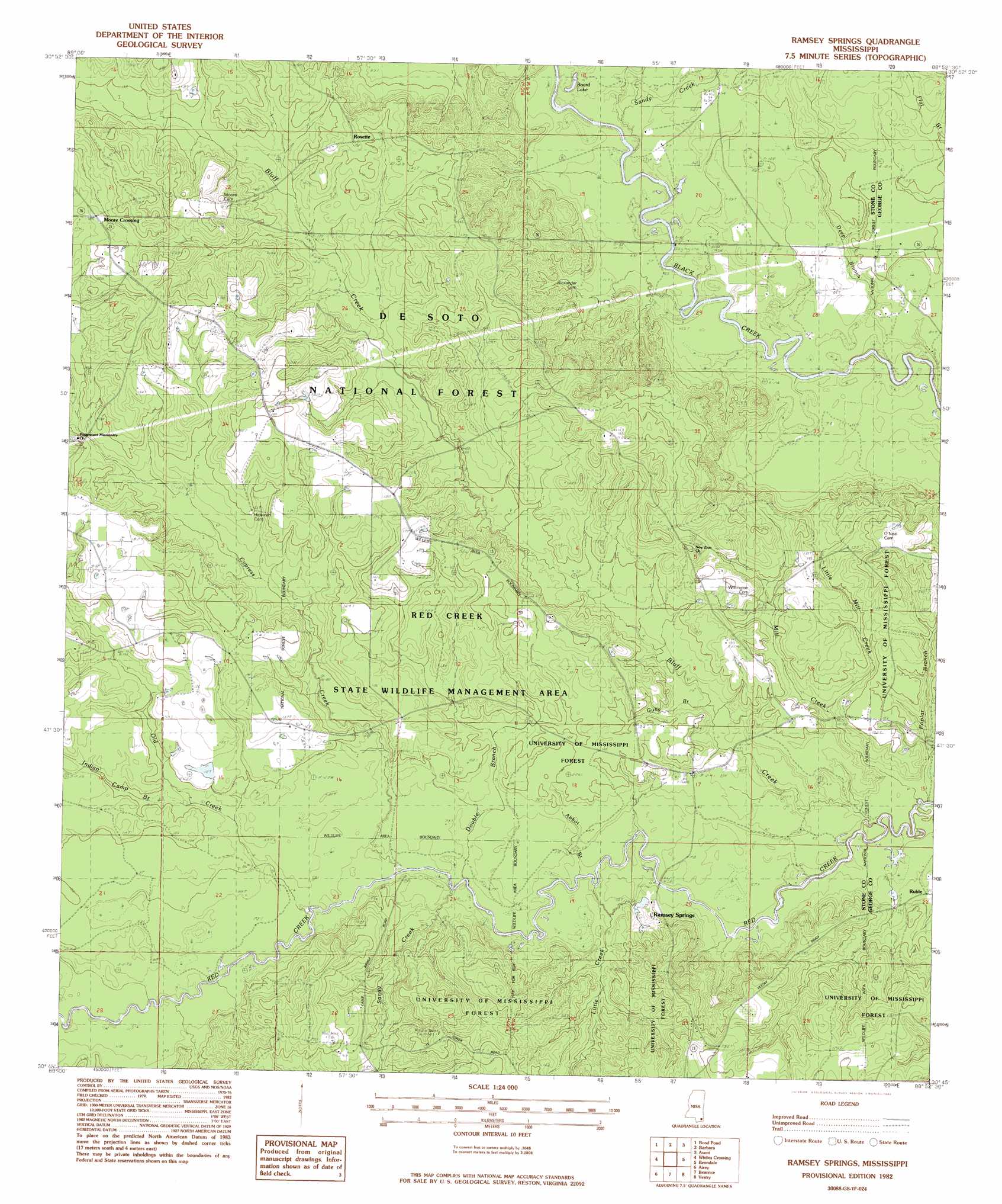
Ramsey Springs Topo Map Mississippi
To zoom in, hover over the map of Ramsey Springs
USGS Topo Quad 30088g8 - 1:24,000 scale
| Topo Map Name: | Ramsey Springs |
| USGS Topo Quad ID: | 30088g8 |
| Print Size: | ca. 21 1/4" wide x 27" high |
| Southeast Coordinates: | 30.75° N latitude / 88.875° W longitude |
| Map Center Coordinates: | 30.8125° N latitude / 88.9375° W longitude |
| U.S. State: | MS |
| Filename: | o30088g8.jpg |
| Download Map JPG Image: | Ramsey Springs topo map 1:24,000 scale |
| Map Type: | Topographic |
| Topo Series: | 7.5´ |
| Map Scale: | 1:24,000 |
| Source of Map Images: | United States Geological Survey (USGS) |
| Alternate Map Versions: |
Ramsey Springs MS 1982, updated 1982 Download PDF Buy paper map Ramsey Springs MS 2000, updated 2002 Download PDF Buy paper map Ramsey Springs MS 2012 Download PDF Buy paper map Ramsey Springs MS 2015 Download PDF Buy paper map |
| FStopo: | US Forest Service topo Ramsey Springs is available: Download FStopo PDF Download FStopo TIF |
1:24,000 Topo Quads surrounding Ramsey Springs
Brooklyn |
Janice |
Taylor Hill |
Mclain |
Leakesville Sw |
Bond |
Bond Pond |
Barbara |
Avent |
Merrill |
Wiggins |
Whites Crossing |
Ramsey Springs |
Benndale |
Basin |
Mchenry |
Airey |
Beatrice |
Vestry |
Easen Hill |
Wortham |
Success |
White Plains |
Latimer |
Vancleave |
> Back to 30088e1 at 1:100,000 scale
> Back to 30088a1 at 1:250,000 scale
> Back to U.S. Topo Maps home
Ramsey Springs topo map: Gazetteer
Ramsey Springs: Bridges
Alexander Bridge elevation 19m 62′Parker Bridge elevation 15m 49′
Ramsey Springs: Dams
Baggett Lake Dam elevation 20m 65′O'Neal Lake Dam elevation 38m 124′
R O'Neal Lake Dam elevation 41m 134′
Ramsey Springs: Lakes
Board Lake elevation 18m 59′Ramsey Springs: Populated Places
Ramsey Springs elevation 23m 75′Ramsey Springs: Streams
Abbot Branch elevation 17m 55′Bluff Creek elevation 15m 49′
Cypress Creek elevation 19m 62′
Deep Branch elevation 18m 59′
Double Branch elevation 19m 62′
Gully Branch elevation 25m 82′
Hogpen Branch elevation 21m 68′
Indian Camp Branch elevation 27m 88′
Little Creek elevation 19m 62′
Little Mill Creek elevation 21m 68′
Mill Creek elevation 15m 49′
Old Creek elevation 20m 65′
Poplar Branch elevation 14m 45′
Sandy Creek elevation 17m 55′
Sandy Creek elevation 22m 72′
Ramsey Springs digital topo map on disk
Buy this Ramsey Springs topo map showing relief, roads, GPS coordinates and other geographical features, as a high-resolution digital map file on DVD:
Gulf Coast (LA, MS, AL, FL) & Southwestern Georgia
Buy digital topo maps: Gulf Coast (LA, MS, AL, FL) & Southwestern Georgia
 & Southwestern Georgia map DVD")