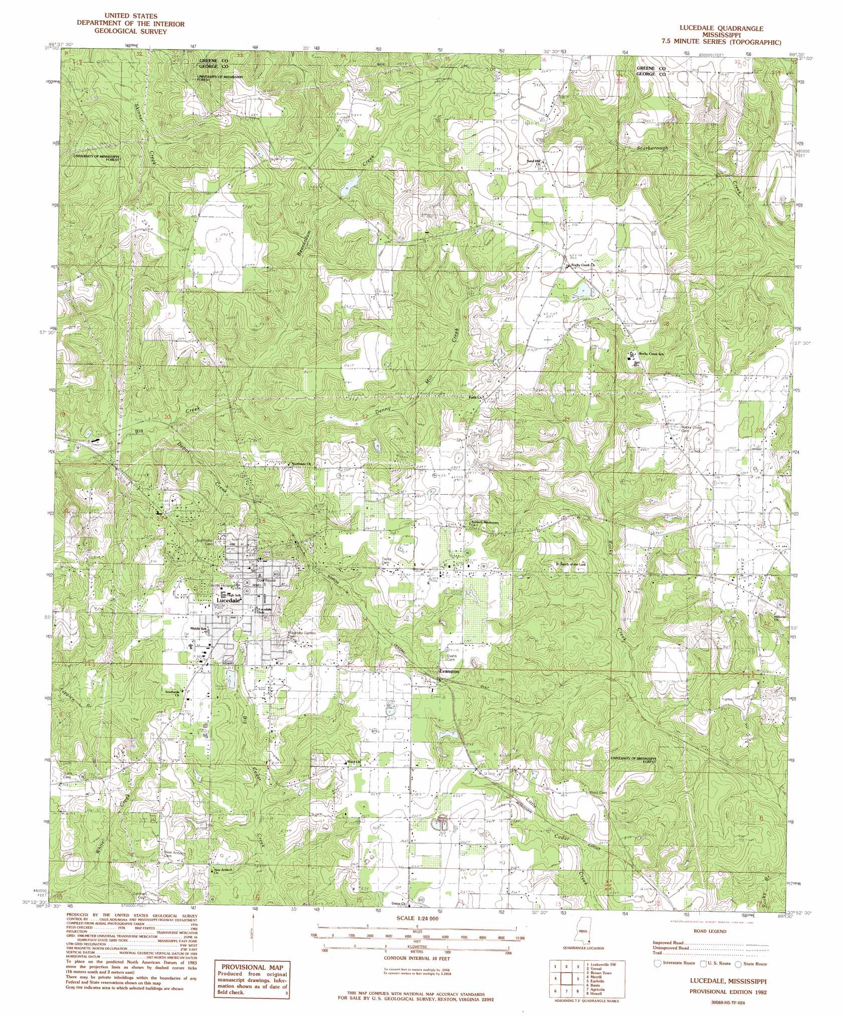
Lucedale Topo Map Mississippi
To zoom in, hover over the map of Lucedale
USGS Topo Quad 30088h5 - 1:24,000 scale
| Topo Map Name: | Lucedale |
| USGS Topo Quad ID: | 30088h5 |
| Print Size: | ca. 21 1/4" wide x 27" high |
| Southeast Coordinates: | 30.875° N latitude / 88.5° W longitude |
| Map Center Coordinates: | 30.9375° N latitude / 88.5625° W longitude |
| U.S. State: | MS |
| Filename: | o30088h5.jpg |
| Download Map JPG Image: | Lucedale topo map 1:24,000 scale |
| Map Type: | Topographic |
| Topo Series: | 7.5´ |
| Map Scale: | 1:24,000 |
| Source of Map Images: | United States Geological Survey (USGS) |
| Alternate Map Versions: |
Lucedale MS 1982, updated 1982 Download PDF Buy paper map Lucedale MS 2012 Download PDF Buy paper map Lucedale MS 2015 Download PDF Buy paper map |
1:24,000 Topo Quads surrounding Lucedale
Neely |
Jonathan |
Leakesville |
Rounsaville |
Deer Park |
Mclain |
Leakesville Sw |
Vernal |
Brown Town |
Citronelle West |
Avent |
Merrill |
Lucedale |
Earlville |
Georgetown |
Benndale |
Basin |
Agricola |
Howell |
Semmes |
Vestry |
Easen Hill |
Harleston |
Hurley |
Tanner Williams |
> Back to 30088e1 at 1:100,000 scale
> Back to 30088a1 at 1:250,000 scale
> Back to U.S. Topo Maps home
Lucedale topo map: Gazetteer
Lucedale: Dams
Henderson Lake Dam elevation 68m 223′Lucedale Lagoon Dam elevation 74m 242′
Lucedale: Populated Places
Donovan (historical) elevation 37m 121′Evanston elevation 84m 275′
Isabell (historical) elevation 41m 134′
Lucedale elevation 90m 295′
Rock Creek elevation 69m 226′
Lucedale: Streams
Beaverdam Creek elevation 40m 131′Denny Mill Creek elevation 40m 131′
Depot Creek elevation 40m 131′
Lucedale digital topo map on disk
Buy this Lucedale topo map showing relief, roads, GPS coordinates and other geographical features, as a high-resolution digital map file on DVD:
Gulf Coast (LA, MS, AL, FL) & Southwestern Georgia
Buy digital topo maps: Gulf Coast (LA, MS, AL, FL) & Southwestern Georgia
 & Southwestern Georgia map DVD")