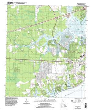
Waveland Topo Map Mississippi
To zoom in, hover over the map of Waveland
USGS Topo Quad 30089c4 - 1:24,000 scale
| Topo Map Name: | Waveland |
| USGS Topo Quad ID: | 30089c4 |
| Print Size: | ca. 21 1/4" wide x 27" high |
| Southeast Coordinates: | 30.25° N latitude / 89.375° W longitude |
| Map Center Coordinates: | 30.3125° N latitude / 89.4375° W longitude |
| U.S. State: | MS |
| Filename: | o30089c4.jpg |
| Download Map JPG Image: | Waveland topo map 1:24,000 scale |
| Map Type: | Topographic |
| Topo Series: | 7.5´ |
| Map Scale: | 1:24,000 |
| Source of Map Images: | United States Geological Survey (USGS) |
| Alternate Map Versions: |
Waveland MS 1956, updated 1960 Download PDF Buy paper map Waveland MS 1956, updated 1968 Download PDF Buy paper map Waveland MS 1956, updated 1971 Download PDF Buy paper map Waveland MS 1956, updated 1978 Download PDF Buy paper map Waveland MS 1956, updated 1978 Download PDF Buy paper map Waveland MS 1997, updated 1999 Download PDF Buy paper map Waveland MS 2012 Download PDF Buy paper map Waveland MS 2015 Download PDF Buy paper map |
1:24,000 Topo Quads surrounding Waveland
> Back to 30089a1 at 1:100,000 scale
> Back to 30088a1 at 1:250,000 scale
> Back to U.S. Topo Maps home
Waveland topo map: Gazetteer
Waveland: Airports
Diamondhead Airport elevation 2m 6′Stennis International Airport elevation 4m 13′
Waveland: Crossings
Interchange 13 elevation 2m 6′Interchange 16 elevation 12m 39′
Waveland: Guts
Breath Bayou elevation 1m 3′Catfish Bayou elevation 0m 0′
Cutoff Bayou elevation 0m 0′
Four Dollar Bayou elevation 1m 3′
Sand Bayou elevation 1m 3′
Waveland: Islands
Cameron Island elevation 1m 3′Waveland: Lakes
Cutoff Lake elevation 0m 0′Waveland: Parks
Buccaneer State Park elevation 3m 9′Elwood Memorial Park elevation 5m 16′
Waveland: Populated Places
Bayside Park elevation 4m 13′Clermont Harbor elevation 4m 13′
Gulfside elevation 3m 9′
Shoreline Park elevation 1m 3′
Waveland elevation 5m 16′
Waveland: Ridges
Jackson Ridge elevation 2m 6′Waveland: Streams
Bayou L' Enciente elevation 0m 0′Bayou Lacroix elevation 0m 0′
Bayou Marone elevation 0m 0′
Bayou Philip elevation 0m 0′
Edwards Bayou elevation 1m 3′
Grand Bayou elevation 0m 0′
Gum Branch elevation 0m 0′
Umbrella Bayou elevation 0m 0′
Waveland: Swamps
Jackson Marsh elevation 1m 3′Mud Bayou elevation 1m 3′
Waveland digital topo map on disk
Buy this Waveland topo map showing relief, roads, GPS coordinates and other geographical features, as a high-resolution digital map file on DVD:
Gulf Coast (LA, MS, AL, FL) & Southwestern Georgia
Buy digital topo maps: Gulf Coast (LA, MS, AL, FL) & Southwestern Georgia


