Logtown Topo Map Mississippi
To zoom in, hover over the map of Logtown
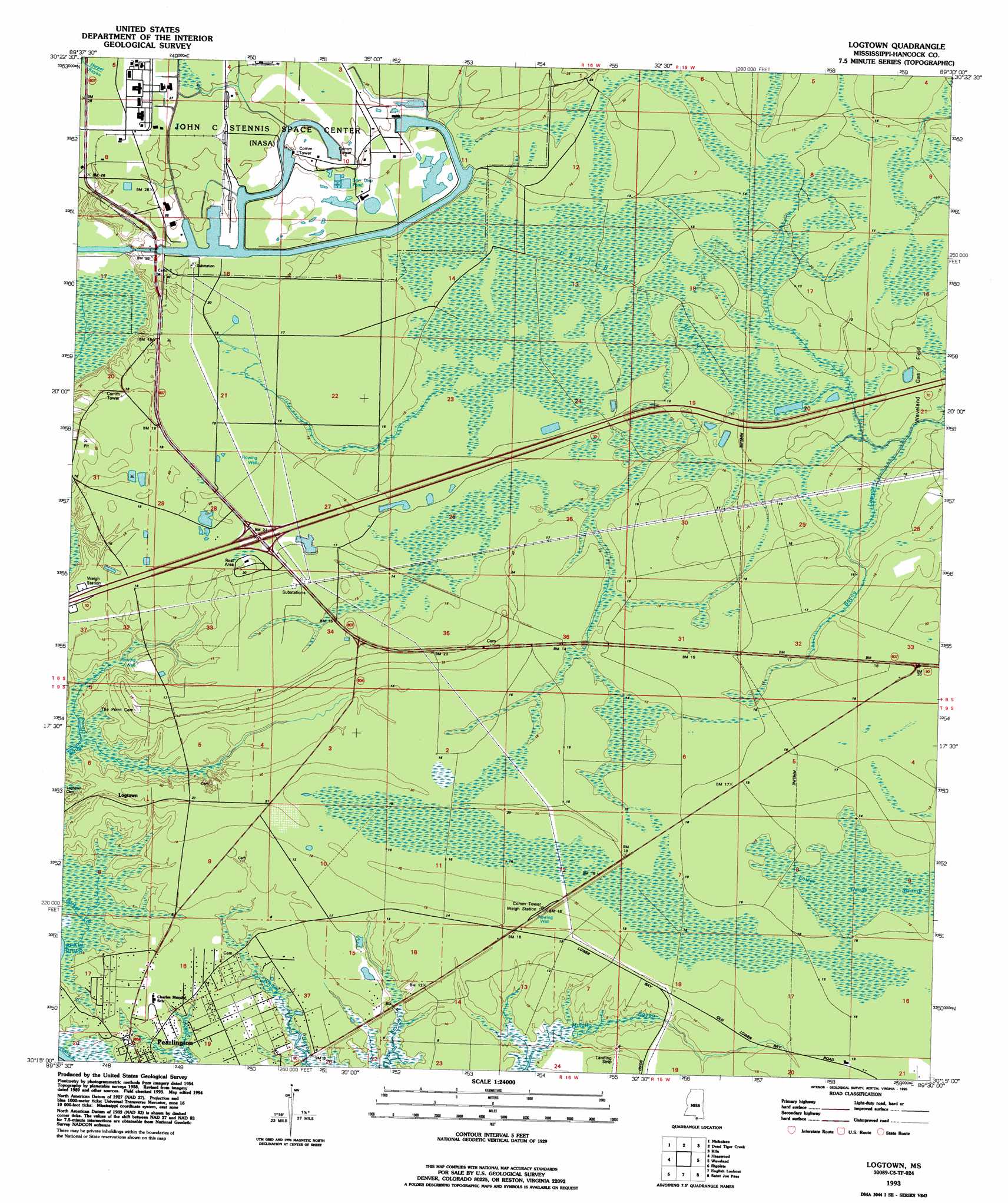
USGS Topo Quad 30089c5 - 1:24,000 scale
| Topo Map Name: | Logtown |
| USGS Topo Quad ID: | 30089c5 |
| Print Size: | ca. 21 1/4" wide x 27" high |
| Southeast Coordinates: | 30.25° N latitude / 89.5° W longitude |
| Map Center Coordinates: | 30.3125° N latitude / 89.5625° W longitude |
| U.S. States: | MS, LA |
| Filename: | o30089c5.jpg |
| Download Map JPG Image: | Logtown topo map 1:24,000 scale |
| Map Type: | Topographic |
| Topo Series: | 7.5´ |
| Map Scale: | 1:24,000 |
| Source of Map Images: | United States Geological Survey (USGS) |
| Alternate Map Versions: |
Logtown MS 1958, updated 1959 Download PDF Buy paper map Logtown MS 1958, updated 1965 Download PDF Buy paper map Logtown MS 1958, updated 1971 Download PDF Buy paper map Logtown MS 1958, updated 1984 Download PDF Buy paper map Logtown MS 1993, updated 1995 Download PDF Buy paper map Logtown MS 2012 Download PDF Buy paper map Logtown MS 2015 Download PDF Buy paper map |
1:24,000 Topo Quads surrounding Logtown
Industrial |
Picayune |
Caesar |
Necaise |
Sellers |
Hickory |
Nicholson |
Dead Tiger Creek |
Kiln |
Vidalia |
Slidell |
Haaswood |
Logtown |
Waveland |
Bay Saint Louis |
North Shore |
Rigolets |
English Lookout |
Grand Island Pass |
|
Chef Menteur |
Alligator Point |
False Mouth Bayou |
Malheureux Point |
Three Mile Bay |
> Back to 30089a1 at 1:100,000 scale
> Back to 30088a1 at 1:250,000 scale
> Back to U.S. Topo Maps home
Logtown topo map: Gazetteer
Logtown: Crossings
Interchange 2 elevation 5m 16′Logtown: Populated Places
Logtown elevation 3m 9′Westonia (historical) elevation 7m 22′
Logtown: Swamps
Devils Swamp elevation 3m 9′Lower Devils Swamp elevation 5m 16′
Logtown digital topo map on disk
Buy this Logtown topo map showing relief, roads, GPS coordinates and other geographical features, as a high-resolution digital map file on DVD:
Gulf Coast (LA, MS, AL, FL) & Southwestern Georgia
Buy digital topo maps: Gulf Coast (LA, MS, AL, FL) & Southwestern Georgia
 & Southwestern Georgia map DVD")