Saint Tammany Topo Map Louisiana
To zoom in, hover over the map of Saint Tammany
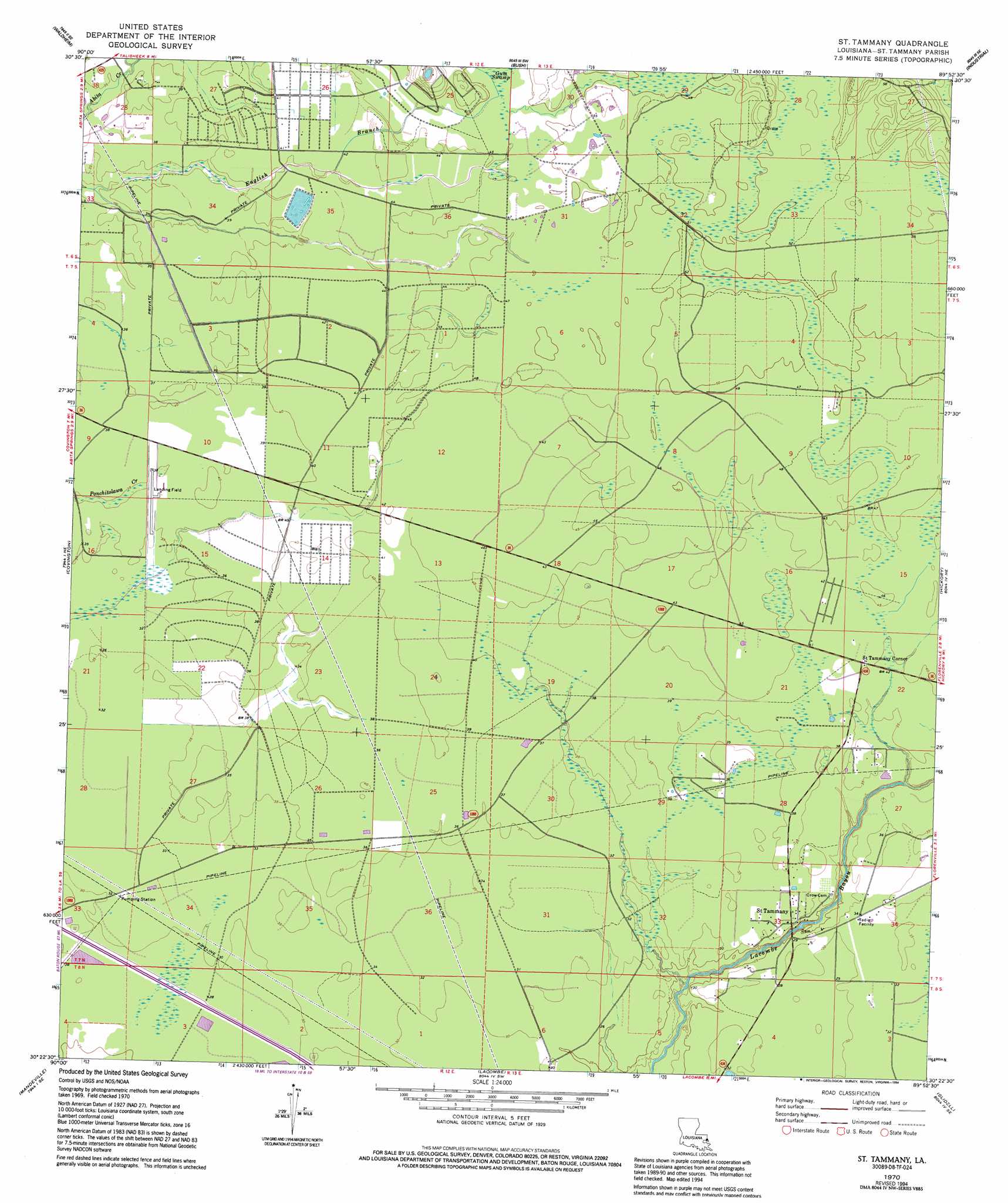
USGS Topo Quad 30089d8 - 1:24,000 scale
| Topo Map Name: | Saint Tammany |
| USGS Topo Quad ID: | 30089d8 |
| Print Size: | ca. 21 1/4" wide x 27" high |
| Southeast Coordinates: | 30.375° N latitude / 89.875° W longitude |
| Map Center Coordinates: | 30.4375° N latitude / 89.9375° W longitude |
| U.S. State: | LA |
| Filename: | o30089d8.jpg |
| Download Map JPG Image: | Saint Tammany topo map 1:24,000 scale |
| Map Type: | Topographic |
| Topo Series: | 7.5´ |
| Map Scale: | 1:24,000 |
| Source of Map Images: | United States Geological Survey (USGS) |
| Alternate Map Versions: |
St. Tammany LA 1970, updated 1972 Download PDF Buy paper map St. Tammany LA 1970, updated 1980 Download PDF Buy paper map St. Tammany LA 1970, updated 1994 Download PDF Buy paper map Saint Tammany LA 2012 Download PDF Buy paper map Saint Tammany LA 2015 Download PDF Buy paper map |
1:24,000 Topo Quads surrounding Saint Tammany
Folsom |
Enon |
Sun |
Henleyfield |
Mcneill |
Martinville |
Waldheim |
Bush |
Industrial |
Picayune |
Madisonville |
Covington |
Saint Tammany |
Hickory |
Nicholson |
Covington Sw |
Mandeville |
Lacombe |
Slidell |
Haaswood |
Spanish Fort Ne |
South Point |
North Shore |
Rigolets |
> Back to 30089a1 at 1:100,000 scale
> Back to 30088a1 at 1:250,000 scale
> Back to U.S. Topo Maps home
Saint Tammany topo map: Gazetteer
Saint Tammany: Airports
Greater Saint Tammany Airport elevation 11m 36′Saint Tammany: Dams
T L James Pond Dam elevation 12m 39′Saint Tammany: Populated Places
Saint Tammany elevation 9m 29′Saint Tammany Corner elevation 13m 42′
Saint Tammany: Swamps
Gum Swamp elevation 14m 45′Saint Tammany digital topo map on disk
Buy this Saint Tammany topo map showing relief, roads, GPS coordinates and other geographical features, as a high-resolution digital map file on DVD:
Gulf Coast (LA, MS, AL, FL) & Southwestern Georgia
Buy digital topo maps: Gulf Coast (LA, MS, AL, FL) & Southwestern Georgia
 & Southwestern Georgia map DVD")