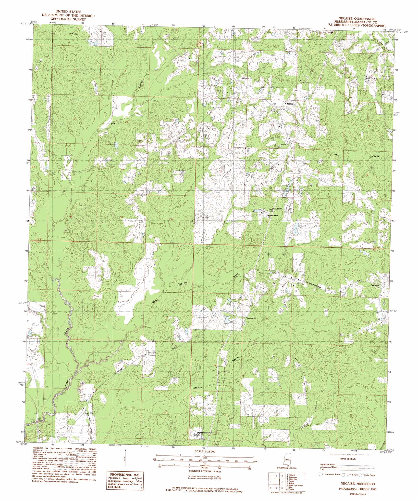
Necaise Topo Map Mississippi
To zoom in, hover over the map of Necaise
USGS Topo Quad 30089e4 - 1:24,000 scale
| Topo Map Name: | Necaise |
| USGS Topo Quad ID: | 30089e4 |
| Print Size: | ca. 21 1/4" wide x 27" high |
| Southeast Coordinates: | 30.5° N latitude / 89.375° W longitude |
| Map Center Coordinates: | 30.5625° N latitude / 89.4375° W longitude |
| U.S. State: | MS |
| Filename: | o30089e4.jpg |
| Download Map JPG Image: | Necaise topo map 1:24,000 scale |
| Map Type: | Topographic |
| Topo Series: | 7.5´ |
| Map Scale: | 1:24,000 |
| Source of Map Images: | United States Geological Survey (USGS) |
| Alternate Map Versions: |
Necaise MS 1982, updated 1983 Download PDF Buy paper map Necaise MS 2012 Download PDF Buy paper map Necaise MS 2015 Download PDF Buy paper map |
1:24,000 Topo Quads surrounding Necaise
White Sand |
Poplarville |
Big Swamp |
Browns Lake |
Wiggins |
Mcneill |
Millard |
Savannah |
Silver Run |
Mchenry |
Picayune |
Caesar |
Necaise |
Sellers |
Wortham |
Nicholson |
Dead Tiger Creek |
Kiln |
Vidalia |
Gulfport Nw |
Haaswood |
Logtown |
Waveland |
Bay Saint Louis |
Pass Christian |
> Back to 30089e1 at 1:100,000 scale
> Back to 30088a1 at 1:250,000 scale
> Back to U.S. Topo Maps home
Necaise topo map: Gazetteer
Necaise: Dams
B M Brignse Lake Dam elevation 36m 118′Bobby Sides Lake Dam elevation 44m 144′
Cuevas Lake Dam elevation 35m 114′
Necaise Lake Dam elevation 36m 118′
Smith Lake Dam elevation 42m 137′
Necaise: Populated Places
Bennett (historical) elevation 46m 150′Crane Creek elevation 74m 242′
Necaise elevation 59m 193′
Standard elevation 59m 193′
Necaise: Streams
White Cypress Creek elevation 12m 39′Necaise digital topo map on disk
Buy this Necaise topo map showing relief, roads, GPS coordinates and other geographical features, as a high-resolution digital map file on DVD:
Gulf Coast (LA, MS, AL, FL) & Southwestern Georgia
Buy digital topo maps: Gulf Coast (LA, MS, AL, FL) & Southwestern Georgia
 & Southwestern Georgia map DVD")