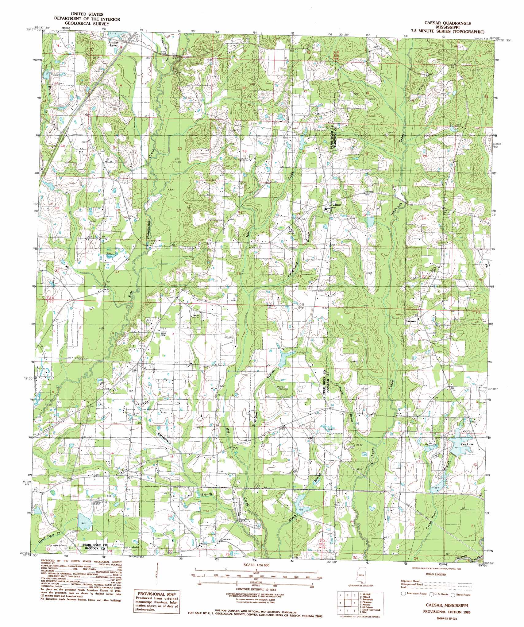
Caesar Topo Map Mississippi
To zoom in, hover over the map of Caesar
USGS Topo Quad 30089e5 - 1:24,000 scale
| Topo Map Name: | Caesar |
| USGS Topo Quad ID: | 30089e5 |
| Print Size: | ca. 21 1/4" wide x 27" high |
| Southeast Coordinates: | 30.5° N latitude / 89.5° W longitude |
| Map Center Coordinates: | 30.5625° N latitude / 89.5625° W longitude |
| U.S. State: | MS |
| Filename: | o30089e5.jpg |
| Download Map JPG Image: | Caesar topo map 1:24,000 scale |
| Map Type: | Topographic |
| Topo Series: | 7.5´ |
| Map Scale: | 1:24,000 |
| Source of Map Images: | United States Geological Survey (USGS) |
| Alternate Map Versions: |
Caesar MS 1986, updated 1986 Download PDF Buy paper map Caesar MS 2012 Download PDF Buy paper map Caesar MS 2015 Download PDF Buy paper map |
1:24,000 Topo Quads surrounding Caesar
Bogalusa East |
White Sand |
Poplarville |
Big Swamp |
Browns Lake |
Henleyfield |
Mcneill |
Millard |
Savannah |
Silver Run |
Industrial |
Picayune |
Caesar |
Necaise |
Sellers |
Hickory |
Nicholson |
Dead Tiger Creek |
Kiln |
Vidalia |
Slidell |
Haaswood |
Logtown |
Waveland |
Bay Saint Louis |
> Back to 30089e1 at 1:100,000 scale
> Back to 30088a1 at 1:250,000 scale
> Back to U.S. Topo Maps home
Caesar topo map: Gazetteer
Caesar: Airports
Belle-Terre Airport elevation 27m 88′Lees Field elevation 40m 131′
Caesar: Crossings
Interchange 10 elevation 52m 170′Caesar: Dams
Bounds Lake Dam elevation 24m 78′Chester Lee Lake Dam elevation 23m 75′
Crosby Lake Dam elevation 29m 95′
H H Pepper Lake Dam elevation 32m 104′
Lee Lake Dam elevation 32m 104′
Lee Lake Dam elevation 25m 82′
Lee Lake Dam elevation 31m 101′
Caesar: Populated Places
Caesar elevation 54m 177′Center (historical) elevation 58m 190′
Leetown elevation 46m 150′
Caesar: Reservoirs
Anchor Lake elevation 34m 111′Lee Lake elevation 26m 85′
Caesar: Streams
Blacksnake Branch elevation 15m 49′Boardpile Branch elevation 19m 62′
Davis Branch elevation 14m 45′
Playground Branch elevation 38m 124′
Stanfield Creek elevation 25m 82′
Caesar digital topo map on disk
Buy this Caesar topo map showing relief, roads, GPS coordinates and other geographical features, as a high-resolution digital map file on DVD:
Gulf Coast (LA, MS, AL, FL) & Southwestern Georgia
Buy digital topo maps: Gulf Coast (LA, MS, AL, FL) & Southwestern Georgia
 & Southwestern Georgia map DVD")