Silver Run Topo Map Mississippi
To zoom in, hover over the map of Silver Run
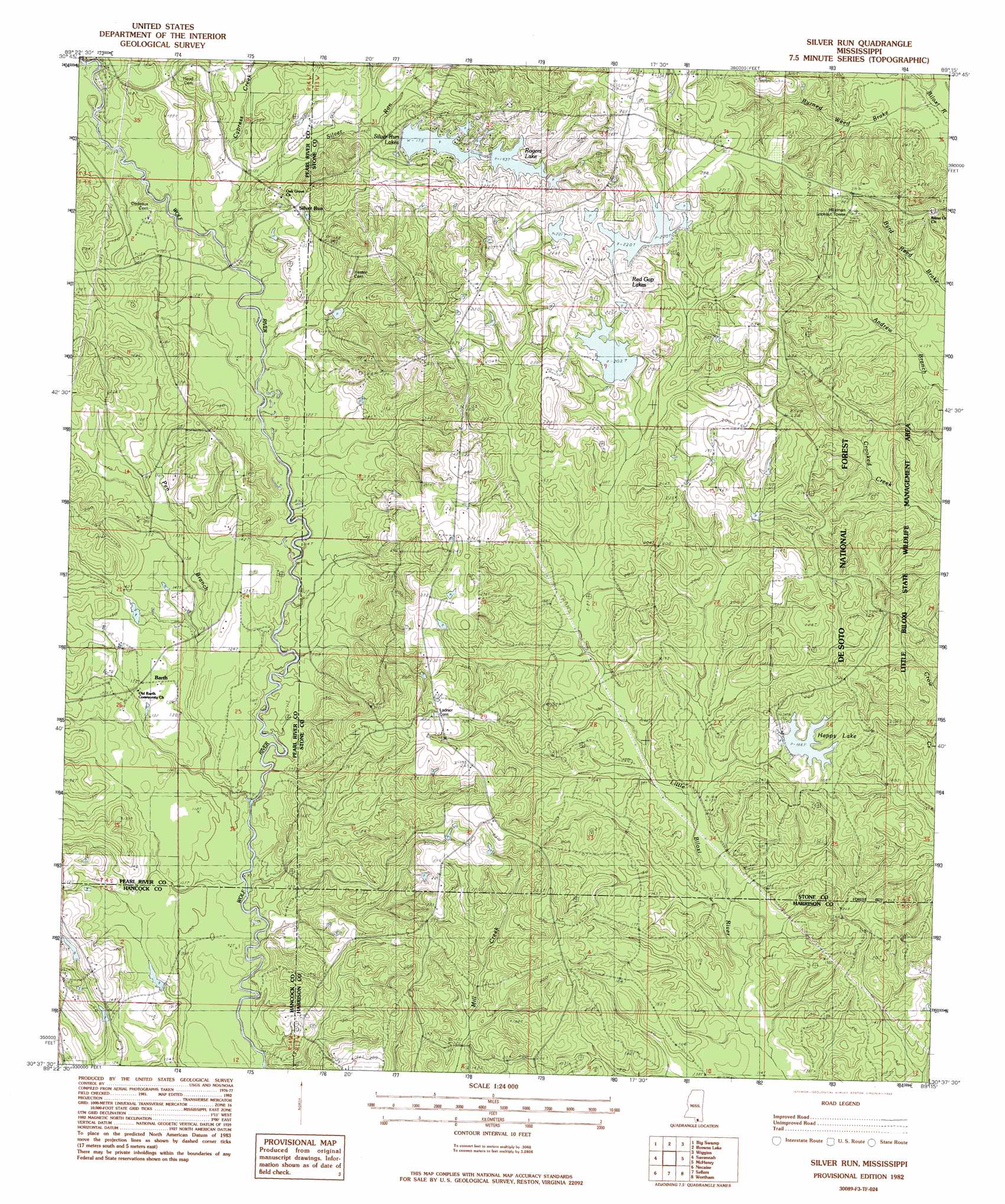
USGS Topo Quad 30089f3 - 1:24,000 scale
| Topo Map Name: | Silver Run |
| USGS Topo Quad ID: | 30089f3 |
| Print Size: | ca. 21 1/4" wide x 27" high |
| Southeast Coordinates: | 30.625° N latitude / 89.25° W longitude |
| Map Center Coordinates: | 30.6875° N latitude / 89.3125° W longitude |
| U.S. State: | MS |
| Filename: | o30089f3.jpg |
| Download Map JPG Image: | Silver Run topo map 1:24,000 scale |
| Map Type: | Topographic |
| Topo Series: | 7.5´ |
| Map Scale: | 1:24,000 |
| Source of Map Images: | United States Geological Survey (USGS) |
| Alternate Map Versions: |
Silver Run MS 1982, updated 1983 Download PDF Buy paper map Silver Run MS 2000, updated 2002 Download PDF Buy paper map Silver Run MS 2012 Download PDF Buy paper map Silver Run MS 2015 Download PDF Buy paper map |
| FStopo: | US Forest Service topo Silver Run is available: Download FStopo PDF Download FStopo TIF |
1:24,000 Topo Quads surrounding Silver Run
Orvisburg |
Hillsdale |
Carnes |
Bond |
Bond Pond |
Poplarville |
Big Swamp |
Browns Lake |
Wiggins |
Whites Crossing |
Millard |
Savannah |
Silver Run |
Mchenry |
Airey |
Caesar |
Necaise |
Sellers |
Wortham |
Success |
Dead Tiger Creek |
Kiln |
Vidalia |
Gulfport Nw |
Gulfport North |
> Back to 30089e1 at 1:100,000 scale
> Back to 30088a1 at 1:250,000 scale
> Back to U.S. Topo Maps home
Silver Run topo map: Gazetteer
Silver Run: Dams
Beesum Lake Dam elevation 66m 216′Happy Lake Dam elevation 51m 167′
Harsh Lake Dam elevation 67m 219′
Harsh Lake Dam elevation 73m 239′
Harsh Lake Dam elevation 71m 232′
Leo Harrolds Lake Dam elevation 37m 121′
Red Gap Lake Dam elevation 55m 180′
Rogers Lake Dam elevation 50m 164′
Rufus Shaw Lake Dam elevation 28m 91′
Silver Run Lake Dam elevation 53m 173′
Silver Run Lake Dam elevation 54m 177′
Silver Run: Populated Places
Barth elevation 40m 131′Silver Run elevation 52m 170′
Silver Run: Reservoirs
Happy Lake elevation 51m 167′Red Gap Lake elevation 60m 196′
Red Gap Lakes elevation 67m 219′
Rogers Lake elevation 57m 187′
Silver Run Lake elevation 53m 173′
Silver Run Lakes elevation 53m 173′
Silver Run: Streams
Cypress Creek elevation 33m 108′Pen Branch elevation 27m 88′
Silver Run elevation 33m 108′
Silver Run digital topo map on disk
Buy this Silver Run topo map showing relief, roads, GPS coordinates and other geographical features, as a high-resolution digital map file on DVD:
Gulf Coast (LA, MS, AL, FL) & Southwestern Georgia
Buy digital topo maps: Gulf Coast (LA, MS, AL, FL) & Southwestern Georgia
 & Southwestern Georgia map DVD")