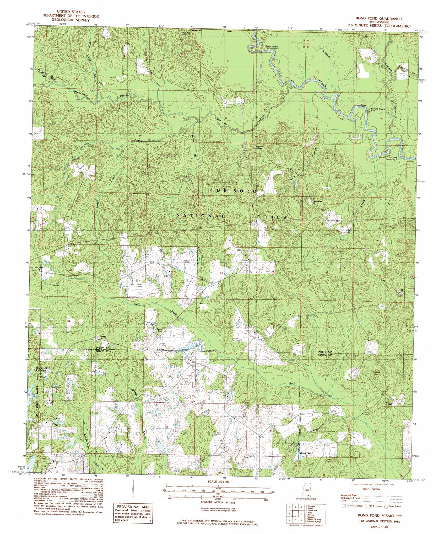
Bond Pond Topo Map Mississippi
To zoom in, hover over the map of Bond Pond
USGS Topo Quad 30089h1 - 1:24,000 scale
| Topo Map Name: | Bond Pond |
| USGS Topo Quad ID: | 30089h1 |
| Print Size: | ca. 21 1/4" wide x 27" high |
| Southeast Coordinates: | 30.875° N latitude / 89° W longitude |
| Map Center Coordinates: | 30.9375° N latitude / 89.0625° W longitude |
| U.S. State: | MS |
| Filename: | o30089h1.jpg |
| Download Map JPG Image: | Bond Pond topo map 1:24,000 scale |
| Map Type: | Topographic |
| Topo Series: | 7.5´ |
| Map Scale: | 1:24,000 |
| Source of Map Images: | United States Geological Survey (USGS) |
| Alternate Map Versions: |
Bond Pond MS 1983, updated 1983 Download PDF Buy paper map Bond Pond MS 2000, updated 2002 Download PDF Buy paper map Bond Pond MS 2012 Download PDF Buy paper map Bond Pond MS 2015 Download PDF Buy paper map |
| FStopo: | US Forest Service topo Bond Pond is available: Download FStopo PDF Download FStopo TIF |
1:24,000 Topo Quads surrounding Bond Pond
Dixie |
Mclaurin |
New Augusta |
Beaumont |
Neely |
Rock Hill |
Brooklyn |
Janice |
Taylor Hill |
Mclain |
Carnes |
Bond |
Bond Pond |
Barbara |
Avent |
Browns Lake |
Wiggins |
Whites Crossing |
Ramsey Springs |
Benndale |
Silver Run |
Mchenry |
Airey |
Beatrice |
Vestry |
> Back to 30089e1 at 1:100,000 scale
> Back to 30088a1 at 1:250,000 scale
> Back to U.S. Topo Maps home
Bond Pond topo map: Gazetteer
Bond Pond: Dams
Haynes Lake Dam elevation 66m 216′Haynes Lake Dam elevation 67m 219′
Prescott Lake Dam elevation 70m 229′
Bond Pond: Lakes
Bond Pond elevation 71m 232′Bond Pond: Parks
Cypress Creek Landing Recreation Site elevation 28m 91′Janice Landing Recreation Site elevation 33m 108′
Bond Pond: Streams
Beaverdam Creek elevation 28m 91′Black Branch elevation 27m 88′
Blue Goose Branch elevation 43m 141′
Clear Creek elevation 50m 164′
Cypress Creek elevation 27m 88′
Griffin Spring Branch elevation 44m 144′
Jumping Creek elevation 40m 131′
Mill Creek elevation 26m 85′
Mossy Creek elevation 45m 147′
Sandy Run elevation 36m 118′
Stillhouse Branch elevation 30m 98′
Thomas Bay Branch elevation 40m 131′
Thomas Branch elevation 29m 95′
Bond Pond digital topo map on disk
Buy this Bond Pond topo map showing relief, roads, GPS coordinates and other geographical features, as a high-resolution digital map file on DVD:
Gulf Coast (LA, MS, AL, FL) & Southwestern Georgia
Buy digital topo maps: Gulf Coast (LA, MS, AL, FL) & Southwestern Georgia
 & Southwestern Georgia map DVD")