Carnes Topo Map Mississippi
To zoom in, hover over the map of Carnes
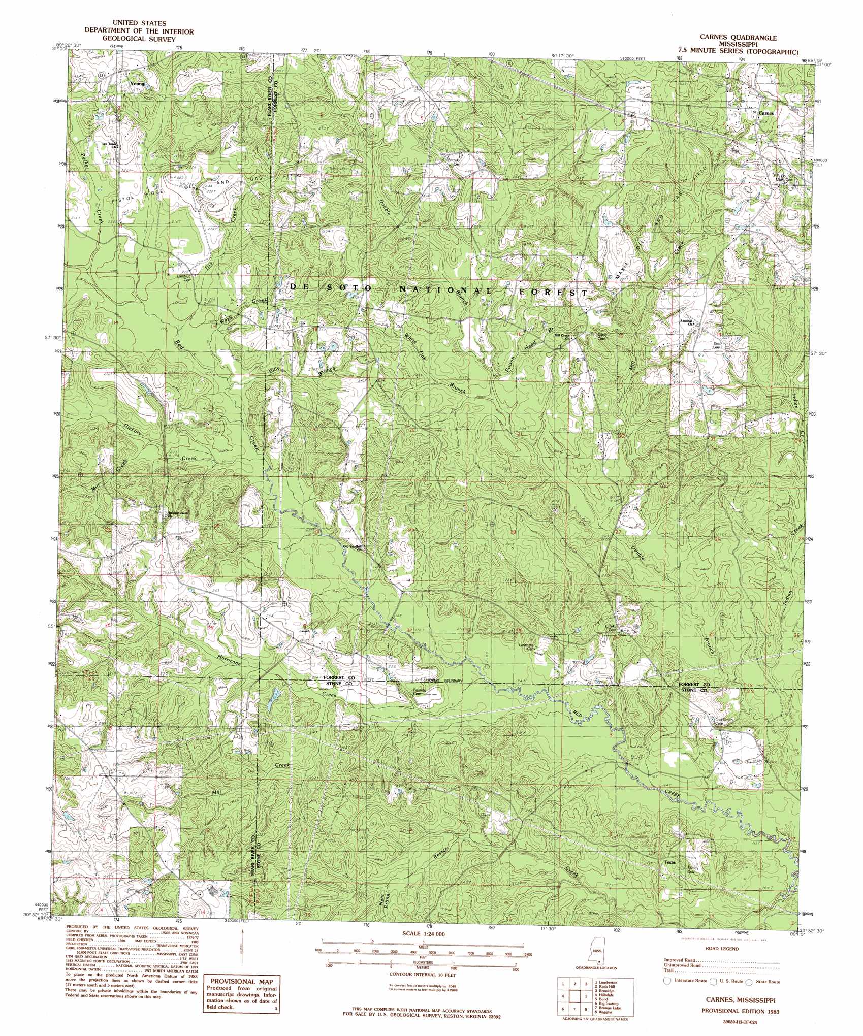
USGS Topo Quad 30089h3 - 1:24,000 scale
| Topo Map Name: | Carnes |
| USGS Topo Quad ID: | 30089h3 |
| Print Size: | ca. 21 1/4" wide x 27" high |
| Southeast Coordinates: | 30.875° N latitude / 89.25° W longitude |
| Map Center Coordinates: | 30.9375° N latitude / 89.3125° W longitude |
| U.S. State: | MS |
| Filename: | o30089h3.jpg |
| Download Map JPG Image: | Carnes topo map 1:24,000 scale |
| Map Type: | Topographic |
| Topo Series: | 7.5´ |
| Map Scale: | 1:24,000 |
| Source of Map Images: | United States Geological Survey (USGS) |
| Alternate Map Versions: |
Carnes MS 1983, updated 1983 Download PDF Buy paper map Carnes MS 2000, updated 2002 Download PDF Buy paper map Carnes MS 2012 Download PDF Buy paper map Carnes MS 2015 Download PDF Buy paper map |
| FStopo: | US Forest Service topo Carnes is available: Download FStopo PDF Download FStopo TIF |
1:24,000 Topo Quads surrounding Carnes
Baxterville Ne |
Purvis |
Dixie |
Mclaurin |
New Augusta |
Baxterville |
Lumberton |
Rock Hill |
Brooklyn |
Janice |
Orvisburg |
Hillsdale |
Carnes |
Bond |
Bond Pond |
Poplarville |
Big Swamp |
Browns Lake |
Wiggins |
Whites Crossing |
Millard |
Savannah |
Silver Run |
Mchenry |
Airey |
> Back to 30089e1 at 1:100,000 scale
> Back to 30088a1 at 1:250,000 scale
> Back to U.S. Topo Maps home
Carnes topo map: Gazetteer
Carnes: Oilfields
Maxie Oil and Gas Field elevation 86m 282′Pistol Ridge Oil and Gas Field elevation 72m 236′
Carnes: Populated Places
Carnes elevation 99m 324′Texas elevation 69m 226′
Young elevation 80m 262′
Carnes: Streams
Billy Branch elevation 58m 190′Dry Creek elevation 59m 193′
Hickory Creek elevation 58m 190′
Hurricane Creek elevation 52m 170′
Indian Creek elevation 48m 157′
Mill Creek elevation 61m 200′
Mill Creek elevation 53m 173′
Mill Creek elevation 58m 190′
Mill Creek elevation 60m 196′
Near Prong Rester Creek elevation 44m 144′
Poison Head Branch elevation 65m 213′
Wash Creek elevation 58m 190′
White Oak Branch elevation 63m 206′
Carnes digital topo map on disk
Buy this Carnes topo map showing relief, roads, GPS coordinates and other geographical features, as a high-resolution digital map file on DVD:
Gulf Coast (LA, MS, AL, FL) & Southwestern Georgia
Buy digital topo maps: Gulf Coast (LA, MS, AL, FL) & Southwestern Georgia
 & Southwestern Georgia map DVD")