Mandeville Topo Map Louisiana
To zoom in, hover over the map of Mandeville
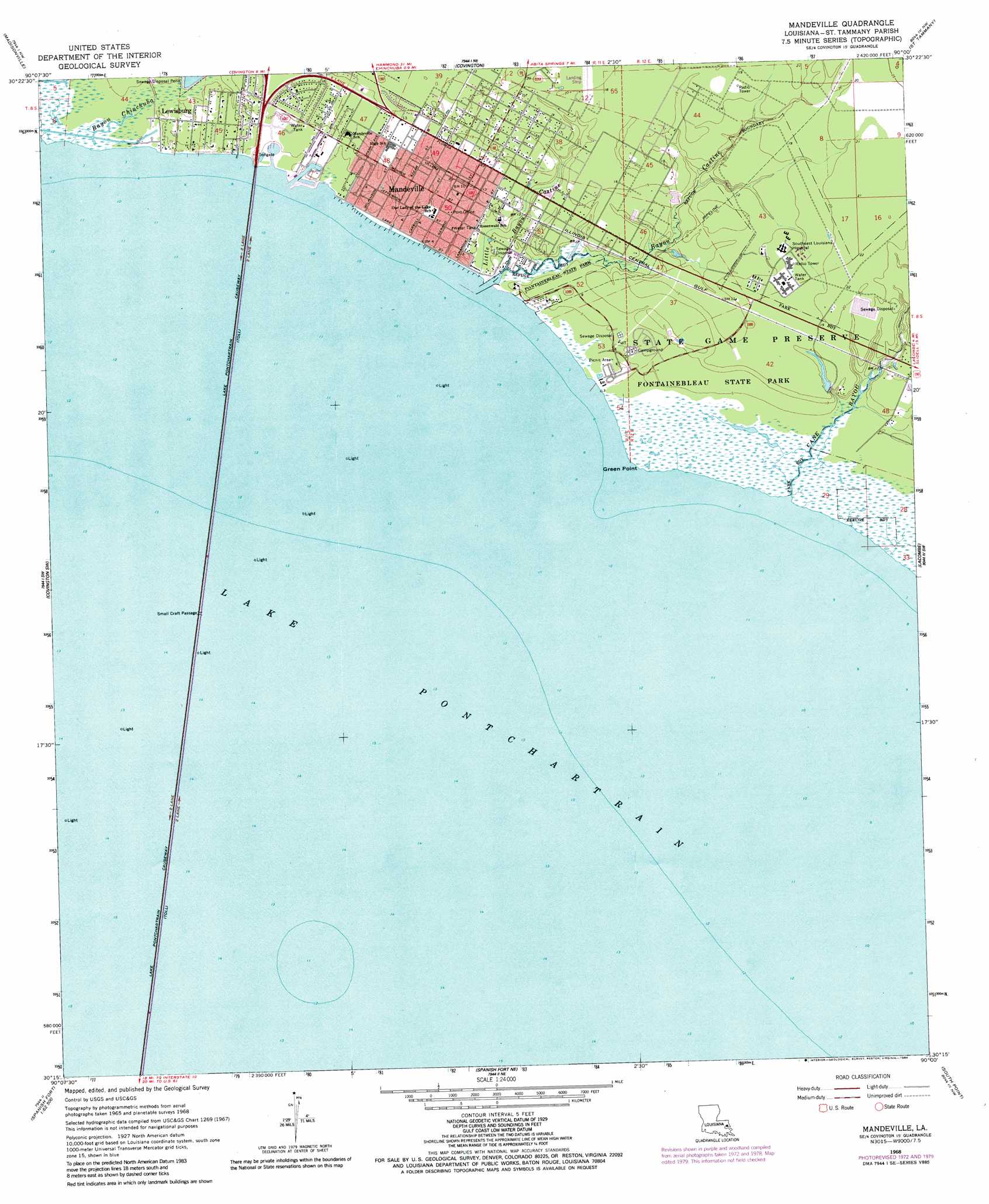
USGS Topo Quad 30090c1 - 1:24,000 scale
| Topo Map Name: | Mandeville |
| USGS Topo Quad ID: | 30090c1 |
| Print Size: | ca. 21 1/4" wide x 27" high |
| Southeast Coordinates: | 30.25° N latitude / 90° W longitude |
| Map Center Coordinates: | 30.3125° N latitude / 90.0625° W longitude |
| U.S. State: | LA |
| Filename: | o30090c1.jpg |
| Download Map JPG Image: | Mandeville topo map 1:24,000 scale |
| Map Type: | Topographic |
| Topo Series: | 7.5´ |
| Map Scale: | 1:24,000 |
| Source of Map Images: | United States Geological Survey (USGS) |
| Alternate Map Versions: |
Mandeville LA 1968, updated 1969 Download PDF Buy paper map Mandeville LA 1968, updated 1973 Download PDF Buy paper map Mandeville LA 1968, updated 1980 Download PDF Buy paper map Mandeville LA 1968, updated 1984 Download PDF Buy paper map Mandeville LA 1968, updated 1984 Download PDF Buy paper map Mandeville LA 1998, updated 2001 Download PDF Buy paper map Mandeville LA 1999, updated 2000 Download PDF Buy paper map Mandeville LA 2012 Download PDF Buy paper map Mandeville LA 2015 Download PDF Buy paper map |
1:24,000 Topo Quads surrounding Mandeville
Robert |
Martinville |
Waldheim |
Bush |
Industrial |
Ponchatoula Ne |
Madisonville |
Covington |
Saint Tammany |
Hickory |
Ponchatoula Se |
Covington Sw |
Mandeville |
Lacombe |
Slidell |
Bonnett Carre Ne |
Spanish Fort Ne |
South Point |
North Shore |
|
La Branche |
Indian Beach |
Spanish Fort |
Little Woods |
Chef Menteur |
> Back to 30090a1 at 1:100,000 scale
> Back to 30090a1 at 1:250,000 scale
> Back to U.S. Topo Maps home
Mandeville topo map: Gazetteer
Mandeville: Capes
Green Point elevation -1m -4′Mandeville: Parks
Fontainebleau State Park elevation 2m 6′Mandeville: Populated Places
Lewisburg elevation 2m 6′Mandeville elevation 2m 6′
Nott (historical) elevation 5m 16′
Mandeville: Post Offices
Mandeville Post Office elevation 2m 6′Mandeville: Streams
Bayou Castine elevation -1m -4′Bayou Chinchuba elevation -1m -4′
Cane Bayou elevation -1m -4′
Little Bayou Castine elevation 0m 0′
Mandeville digital topo map on disk
Buy this Mandeville topo map showing relief, roads, GPS coordinates and other geographical features, as a high-resolution digital map file on DVD: