Waldheim Topo Map Louisiana
To zoom in, hover over the map of Waldheim
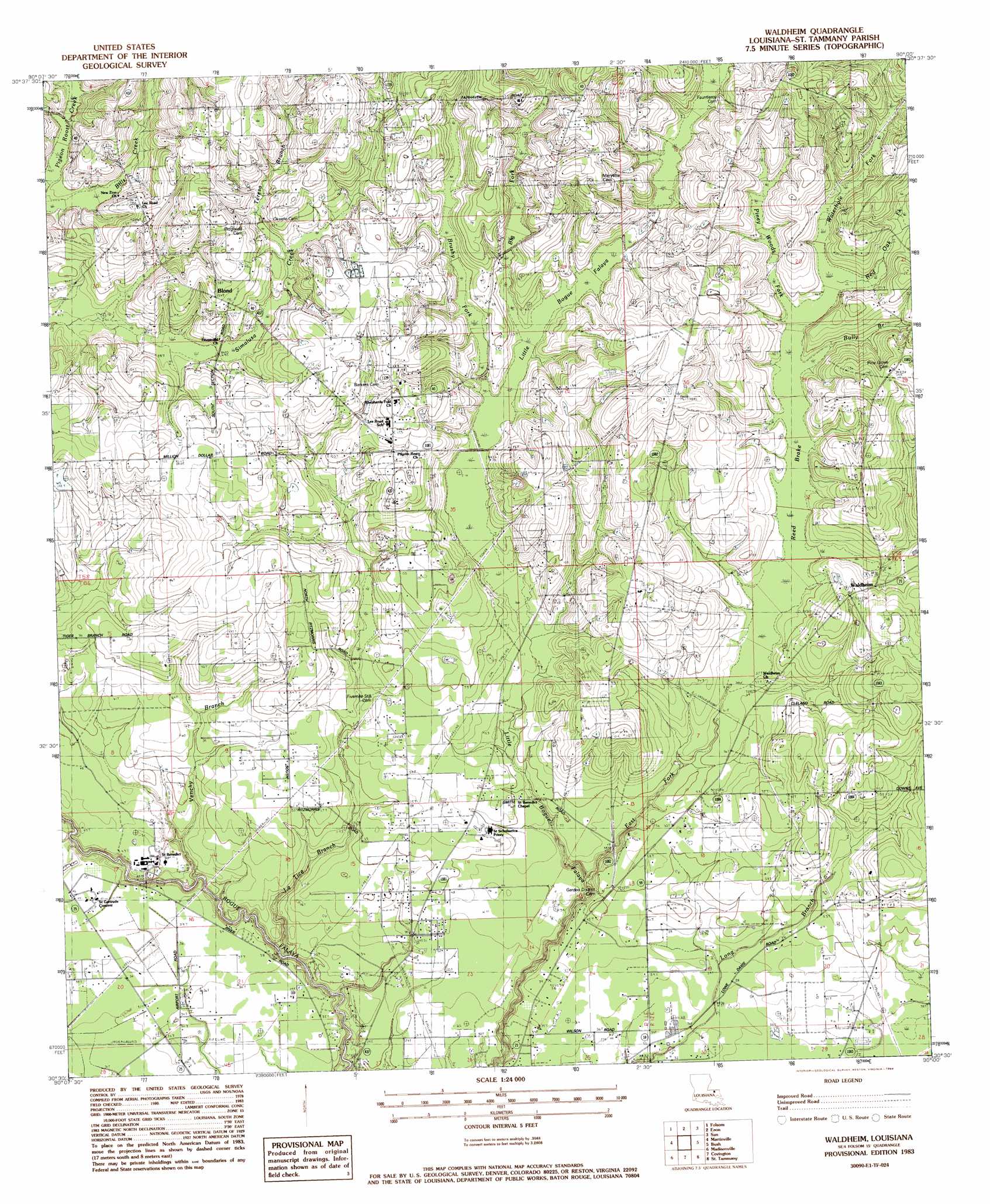
USGS Topo Quad 30090e1 - 1:24,000 scale
| Topo Map Name: | Waldheim |
| USGS Topo Quad ID: | 30090e1 |
| Print Size: | ca. 21 1/4" wide x 27" high |
| Southeast Coordinates: | 30.5° N latitude / 90° W longitude |
| Map Center Coordinates: | 30.5625° N latitude / 90.0625° W longitude |
| U.S. State: | LA |
| Filename: | o30090e1.jpg |
| Download Map JPG Image: | Waldheim topo map 1:24,000 scale |
| Map Type: | Topographic |
| Topo Series: | 7.5´ |
| Map Scale: | 1:24,000 |
| Source of Map Images: | United States Geological Survey (USGS) |
| Alternate Map Versions: |
Waldheim LA 1983, updated 1984 Download PDF Buy paper map Waldheim LA 2012 Download PDF Buy paper map Waldheim LA 2015 Download PDF Buy paper map |
1:24,000 Topo Quads surrounding Waldheim
Wilmer |
Franklinton |
Sheridan |
Bogalusa West |
Bogalusa East |
Husser |
Folsom |
Enon |
Sun |
Henleyfield |
Robert |
Martinville |
Waldheim |
Bush |
Industrial |
Ponchatoula Ne |
Madisonville |
Covington |
Saint Tammany |
Hickory |
Ponchatoula Se |
Covington Sw |
Mandeville |
Lacombe |
Slidell |
> Back to 30090e1 at 1:100,000 scale
> Back to 30090a1 at 1:250,000 scale
> Back to U.S. Topo Maps home
Waldheim topo map: Gazetteer
Waldheim: Dams
Abbeys Pond Dam elevation 9m 29′Waldheim: Populated Places
Blond elevation 41m 134′Saint Benedict elevation 13m 42′
Waldheim elevation 34m 111′
Waldheim: Reservoirs
Abbeys Pond elevation 9m 29′Waldheim: Streams
Big Fork elevation 27m 88′Brushy Fork elevation 25m 82′
Bully Branch elevation 26m 85′
East Fork Little Bogue Falaya elevation 10m 32′
La Tice Branch elevation 8m 26′
Piney Woods Fork elevation 27m 88′
Red Oak Fork elevation 29m 95′
Reed Brake elevation 18m 59′
Teresa Branch elevation 31m 101′
Venchy Branch elevation 7m 22′
Waterhole Fork elevation 29m 95′
Waldheim digital topo map on disk
Buy this Waldheim topo map showing relief, roads, GPS coordinates and other geographical features, as a high-resolution digital map file on DVD: