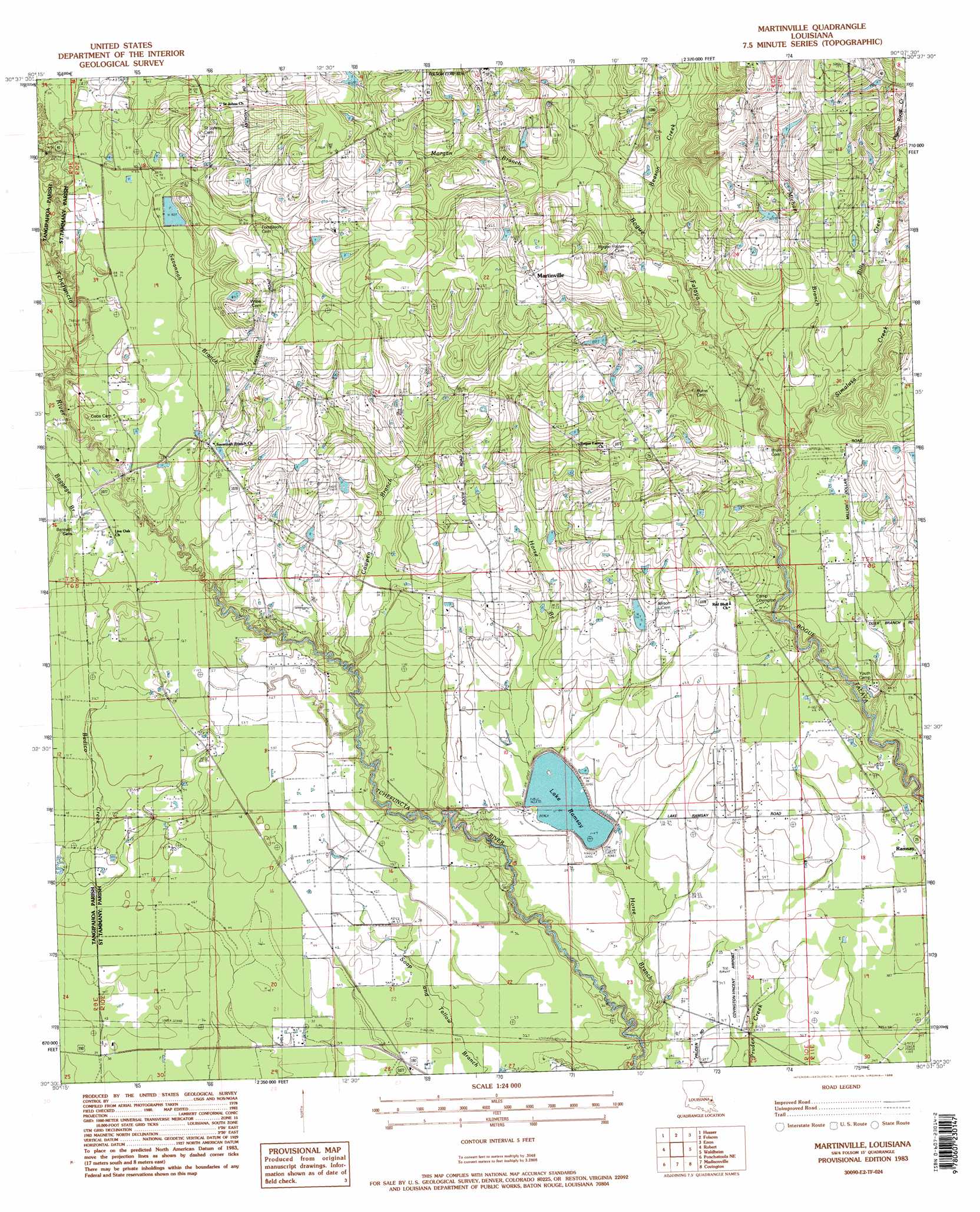
Martinville Topo Map Louisiana
To zoom in, hover over the map of Martinville
USGS Topo Quad 30090e2 - 1:24,000 scale
| Topo Map Name: | Martinville |
| USGS Topo Quad ID: | 30090e2 |
| Print Size: | ca. 21 1/4" wide x 27" high |
| Southeast Coordinates: | 30.5° N latitude / 90.125° W longitude |
| Map Center Coordinates: | 30.5625° N latitude / 90.1875° W longitude |
| U.S. State: | LA |
| Filename: | o30090e2.jpg |
| Download Map JPG Image: | Martinville topo map 1:24,000 scale |
| Map Type: | Topographic |
| Topo Series: | 7.5´ |
| Map Scale: | 1:24,000 |
| Source of Map Images: | United States Geological Survey (USGS) |
| Alternate Map Versions: |
Martinville LA 1983, updated 1984 Download PDF Buy paper map Martinville LA 1983, updated 1988 Download PDF Buy paper map Martinville LA 1983, updated 1988 Download PDF Buy paper map Martinville LA 2012 Download PDF Buy paper map Martinville LA 2015 Download PDF Buy paper map |
1:24,000 Topo Quads surrounding Martinville
Bolivar |
Wilmer |
Franklinton |
Sheridan |
Bogalusa West |
Loranger |
Husser |
Folsom |
Enon |
Sun |
Hammond |
Robert |
Martinville |
Waldheim |
Bush |
Ponchatoula |
Ponchatoula Ne |
Madisonville |
Covington |
Saint Tammany |
Manchac |
Ponchatoula Se |
Covington Sw |
Mandeville |
Lacombe |
> Back to 30090e1 at 1:100,000 scale
> Back to 30090a1 at 1:250,000 scale
> Back to U.S. Topo Maps home
Martinville topo map: Gazetteer
Martinville: Airports
Covington-Vincent Airport elevation 10m 32′Martinville: Dams
Lake Ramsey Dam elevation 15m 49′P+l Ranch Pond Dam elevation 23m 75′
Spells Pond Dam elevation 29m 95′
Martinville: Populated Places
Martinville elevation 40m 131′Ramsay elevation 15m 49′
Martinville: Reservoirs
Lake Ramsay elevation 15m 49′P+l Ranch Pond elevation 23m 75′
Spell Pond elevation 29m 95′
Martinville: Streams
Beason Creek elevation 21m 68′Bills Creek elevation 21m 68′
Bull Branch elevation 21m 68′
Cowpen Branch elevation 12m 39′
Horse Branch elevation 7m 22′
Michael Branch elevation 20m 65′
Morgan Branch elevation 23m 75′
Pigeon Roost Creek elevation 26m 85′
Savannah Branch elevation 16m 52′
Simalusa Creek elevation 18m 59′
Martinville digital topo map on disk
Buy this Martinville topo map showing relief, roads, GPS coordinates and other geographical features, as a high-resolution digital map file on DVD: