Hammond Topo Map Louisiana
To zoom in, hover over the map of Hammond
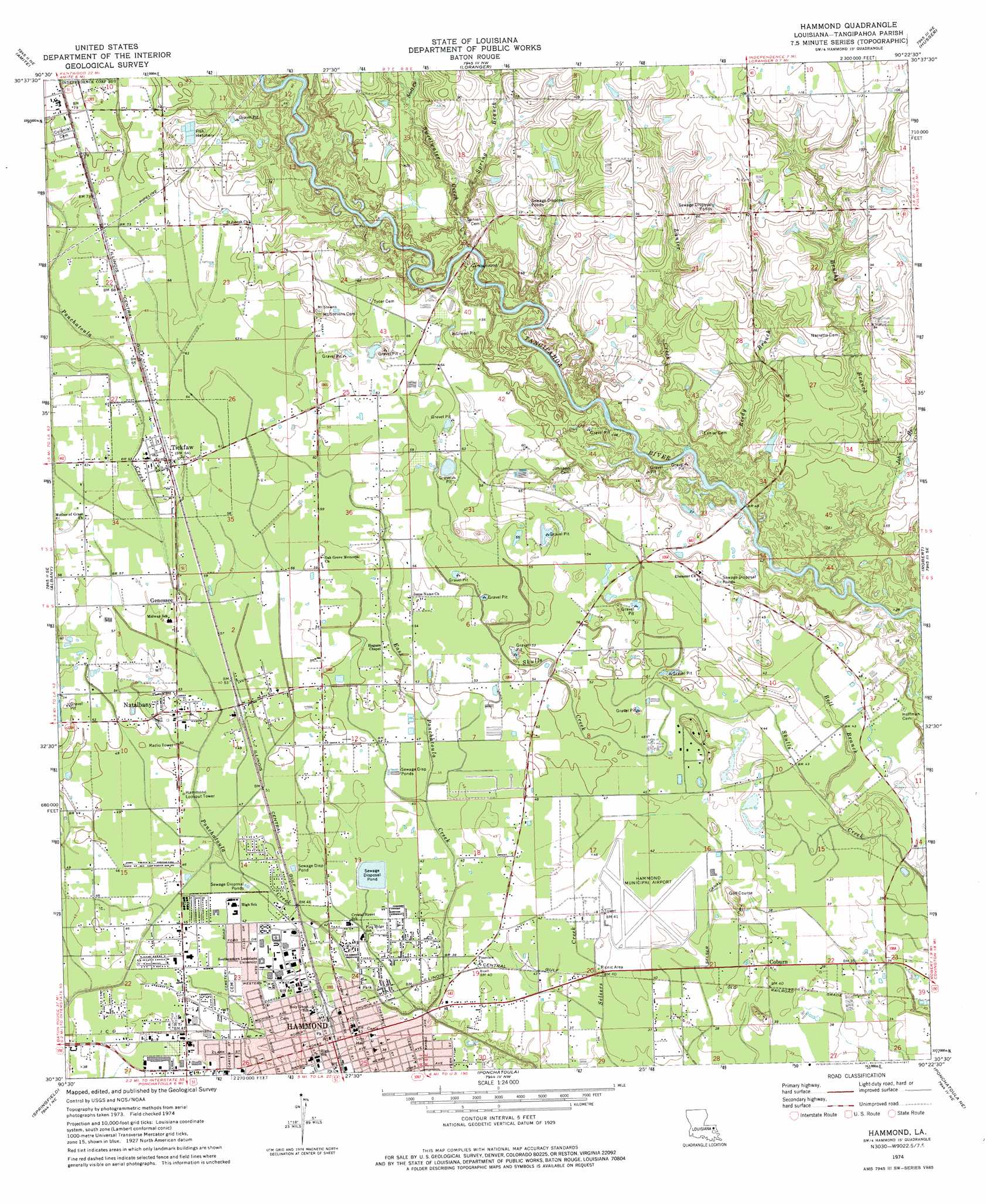
USGS Topo Quad 30090e4 - 1:24,000 scale
| Topo Map Name: | Hammond |
| USGS Topo Quad ID: | 30090e4 |
| Print Size: | ca. 21 1/4" wide x 27" high |
| Southeast Coordinates: | 30.5° N latitude / 90.375° W longitude |
| Map Center Coordinates: | 30.5625° N latitude / 90.4375° W longitude |
| U.S. State: | LA |
| Filename: | o30090e4.jpg |
| Download Map JPG Image: | Hammond topo map 1:24,000 scale |
| Map Type: | Topographic |
| Topo Series: | 7.5´ |
| Map Scale: | 1:24,000 |
| Source of Map Images: | United States Geological Survey (USGS) |
| Alternate Map Versions: |
Hammond LA 1974, updated 1977 Download PDF Buy paper map Hammond LA 1994, updated 1996 Download PDF Buy paper map Hammond LA 2012 Download PDF Buy paper map Hammond LA 2015 Download PDF Buy paper map |
1:24,000 Topo Quads surrounding Hammond
Greensburg |
Roseland |
Bolivar |
Wilmer |
Franklinton |
Montpelier |
Amite |
Loranger |
Husser |
Folsom |
Holden |
Albany |
Hammond |
Robert |
Martinville |
Frost |
Springfield |
Ponchatoula |
Ponchatoula Ne |
Madisonville |
Whitehall |
Killian |
Manchac |
Ponchatoula Se |
Covington Sw |
> Back to 30090e1 at 1:100,000 scale
> Back to 30090a1 at 1:250,000 scale
> Back to U.S. Topo Maps home
Hammond topo map: Gazetteer
Hammond: Airports
Hammond Municipal Airport elevation 12m 39′Lallie Kemp Regional Medical Center Heliport elevation 24m 78′
Hammond: Canals
Selser Canal elevation 12m 39′Hammond: Dams
Louisiana Noname 37 Dam elevation 13m 42′Hammond: Parks
Hammond Historic District elevation 13m 42′Hammond: Populated Places
Bellewood elevation 14m 45′Coburn elevation 12m 39′
Genessee elevation 17m 55′
Hammond elevation 13m 42′
Hollyridge elevation 11m 36′
Lincoln Park elevation 12m 39′
Mason (historical) elevation 16m 52′
Natalbany elevation 15m 49′
Oak Ridge elevation 14m 45′
South Bilt elevation 13m 42′
Tallow Wood elevation 12m 39′
Tickfaw elevation 19m 62′
University Place elevation 13m 42′
Westdale elevation 14m 45′
Whitmar Acres elevation 13m 42′
Woodbridge elevation 15m 49′
Woodland Park elevation 12m 39′
Hammond: Post Offices
Hammond Post Office elevation 13m 42′Natalbany Post Office elevation 16m 52′
Tickfaw Post Office elevation 19m 62′
Hammond: Streams
Bell Branch elevation 13m 42′Brushy Branch elevation 9m 29′
Davis Branch elevation 17m 55′
East Ponchatoula Creek elevation 12m 39′
John Branch elevation 13m 42′
Lanier Creek elevation 11m 36′
Reedy Branch elevation 10m 32′
Scott Creek elevation 15m 49′
Spring Branch elevation 15m 49′
Sweetwater Creek elevation 17m 55′
Hammond digital topo map on disk
Buy this Hammond topo map showing relief, roads, GPS coordinates and other geographical features, as a high-resolution digital map file on DVD: