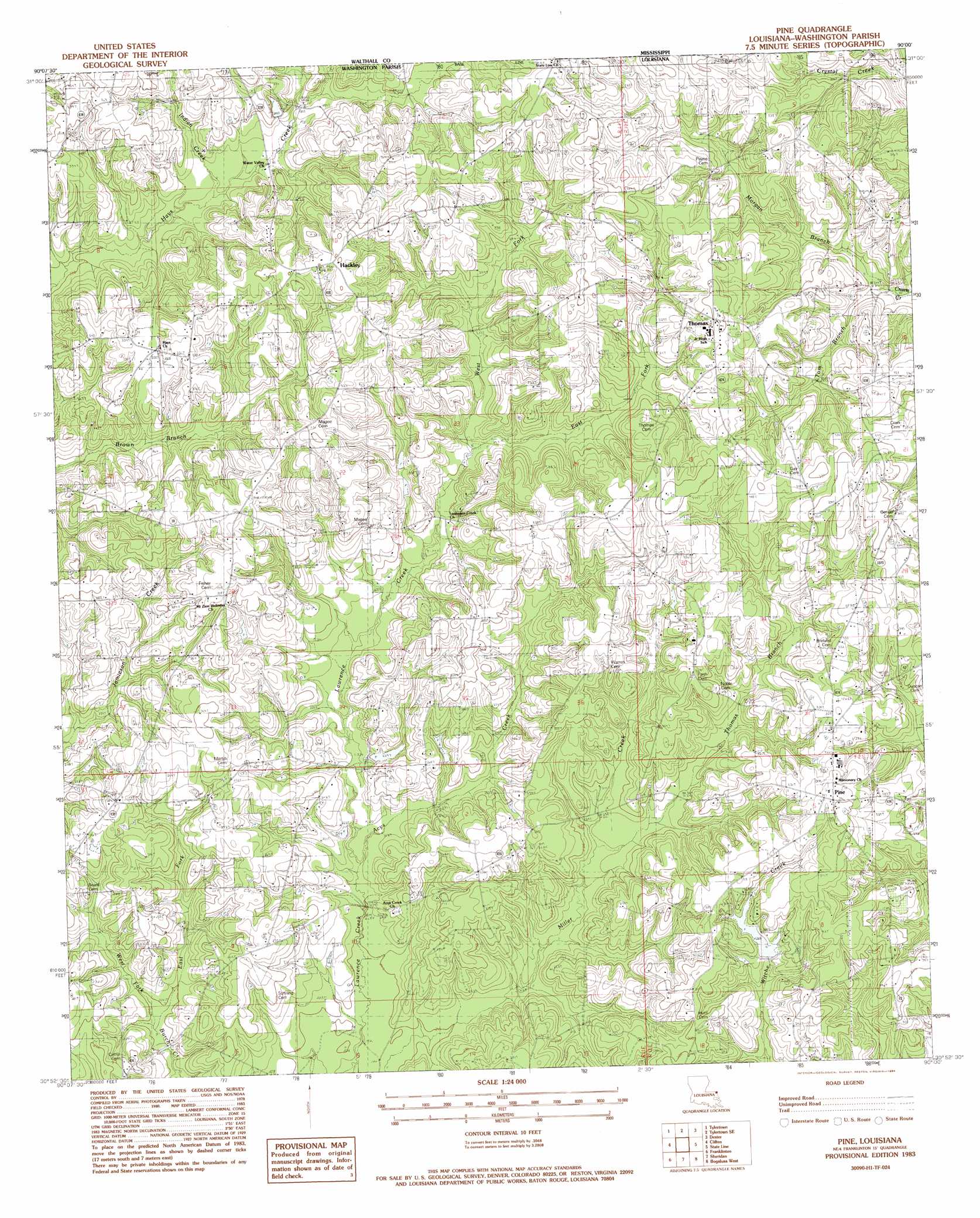
Pine Topo Map Louisiana
To zoom in, hover over the map of Pine
USGS Topo Quad 30090h1 - 1:24,000 scale
| Topo Map Name: | Pine |
| USGS Topo Quad ID: | 30090h1 |
| Print Size: | ca. 21 1/4" wide x 27" high |
| Southeast Coordinates: | 30.875° N latitude / 90° W longitude |
| Map Center Coordinates: | 30.9375° N latitude / 90.0625° W longitude |
| U.S. State: | LA |
| Filename: | o30090h1.jpg |
| Download Map JPG Image: | Pine topo map 1:24,000 scale |
| Map Type: | Topographic |
| Topo Series: | 7.5´ |
| Map Scale: | 1:24,000 |
| Source of Map Images: | United States Geological Survey (USGS) |
| Alternate Map Versions: |
Pine LA 1983, updated 1984 Download PDF Buy paper map Pine LA 2012 Download PDF Buy paper map Pine LA 2015 Download PDF Buy paper map |
1:24,000 Topo Quads surrounding Pine
Holmesville |
Mesa |
Kokomo |
Sandy Hook Nw |
Columbia South |
Progress |
Tylertown |
Tylertown Se |
Dexter |
Sandy Hook |
Sunny Hill |
Clifton |
Pine |
State Line |
Angie |
Wilmer |
Franklinton |
Sheridan |
Bogalusa West |
Bogalusa East |
Husser |
Folsom |
Enon |
Sun |
Henleyfield |
> Back to 30090e1 at 1:100,000 scale
> Back to 30090a1 at 1:250,000 scale
> Back to U.S. Topo Maps home
Pine topo map: Gazetteer
Pine: Populated Places
Camp Seven (historical) elevation 103m 337′Hackley elevation 104m 341′
Pine elevation 104m 341′
Thomas elevation 106m 347′
Pine: Streams
Acys Creek elevation 64m 209′Boggy Branch elevation 72m 236′
East Fork Burch Creek elevation 60m 196′
East Fork Lawrence Creek elevation 77m 252′
Indian Creek elevation 80m 262′
Morgan Branch elevation 73m 239′
Thomas Branch elevation 68m 223′
Tom Branch elevation 74m 242′
West Fork Burch Creek elevation 60m 196′
West Fork Lawrence Creek elevation 77m 252′
Pine digital topo map on disk
Buy this Pine topo map showing relief, roads, GPS coordinates and other geographical features, as a high-resolution digital map file on DVD: