Pigeon Topo Map Louisiana
To zoom in, hover over the map of Pigeon
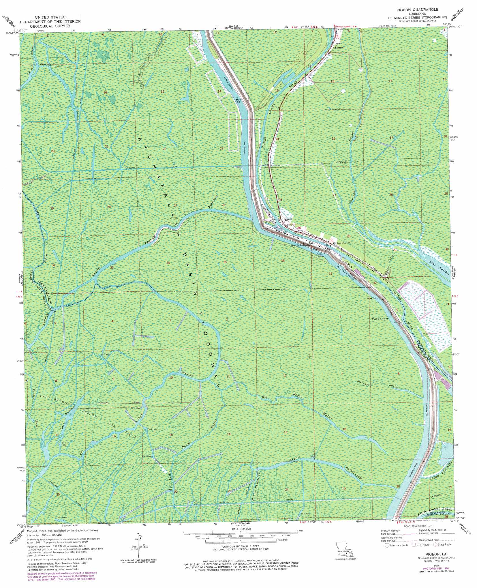
USGS Topo Quad 30091a3 - 1:24,000 scale
| Topo Map Name: | Pigeon |
| USGS Topo Quad ID: | 30091a3 |
| Print Size: | ca. 21 1/4" wide x 27" high |
| Southeast Coordinates: | 30° N latitude / 91.25° W longitude |
| Map Center Coordinates: | 30.0625° N latitude / 91.3125° W longitude |
| U.S. State: | LA |
| Filename: | o30091a3.jpg |
| Download Map JPG Image: | Pigeon topo map 1:24,000 scale |
| Map Type: | Topographic |
| Topo Series: | 7.5´ |
| Map Scale: | 1:24,000 |
| Source of Map Images: | United States Geological Survey (USGS) |
| Alternate Map Versions: |
Pigeon LA 1969, updated 1971 Download PDF Buy paper map Pigeon LA 1969, updated 1977 Download PDF Buy paper map Pigeon LA 1969, updated 1980 Download PDF Buy paper map Pigeon LA 2012 Download PDF Buy paper map Pigeon LA 2015 Download PDF Buy paper map |
1:24,000 Topo Quads surrounding Pigeon
Cow Bayou |
Grosse Tete Sw |
Addis |
Plaquemine |
Saint Gabriel |
Lake Mongoulois |
Grand River |
Bayou Sorrel |
White Castle |
Carville |
Jackass Bay |
Lake Chicot |
Pigeon |
Lone Star |
Belle Rose |
Charenton |
Centerville Nw |
Centerville Ne |
Pierre Part |
Napoleonville |
Franklin |
Centerville |
Tiger Island |
Napoleonville Sw |
Grassy Lake |
> Back to 30091a1 at 1:100,000 scale
> Back to 30090a1 at 1:250,000 scale
> Back to U.S. Topo Maps home
Pigeon topo map: Gazetteer
Pigeon: Capes
Pumpkin Point elevation 1m 3′Pigeon: Guts
Bayou Teche elevation 2m 6′Turkey Bayou elevation 1m 3′
Pigeon: Lakes
Lake Natchez elevation 0m 0′Lake Runnells elevation 1m 3′
Pigeon: Oilfields
East Bayou Pigeon Gas Field elevation 0m 0′North Bayou Pigeon Oil Field elevation 2m 6′
Pigeon: Populated Places
Pigeon elevation 3m 9′Pigeon: Streams
Bayou Indigo elevation 0m 0′Big Bayou Mallet elevation 1m 3′
Choctaw Bayou elevation 0m 0′
Cross Bayou elevation 1m 3′
Lower Grand River elevation 0m 0′
Stringer Bayou elevation 2m 6′
Pigeon digital topo map on disk
Buy this Pigeon topo map showing relief, roads, GPS coordinates and other geographical features, as a high-resolution digital map file on DVD: