Lake Chicot Topo Map Louisiana
To zoom in, hover over the map of Lake Chicot
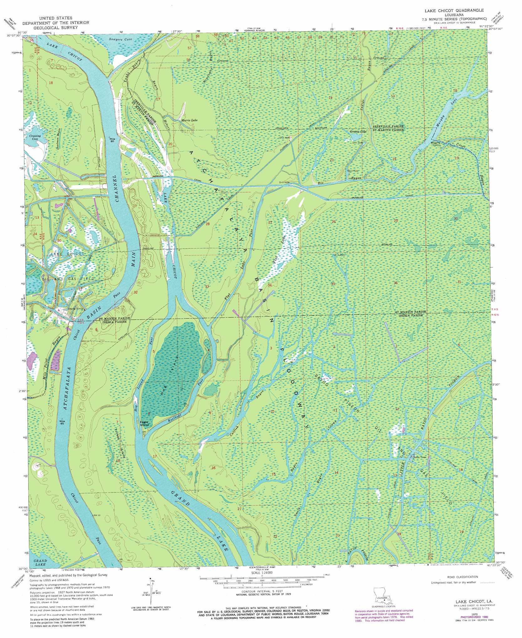
USGS Topo Quad 30091a4 - 1:24,000 scale
| Topo Map Name: | Lake Chicot |
| USGS Topo Quad ID: | 30091a4 |
| Print Size: | ca. 21 1/4" wide x 27" high |
| Southeast Coordinates: | 30° N latitude / 91.375° W longitude |
| Map Center Coordinates: | 30.0625° N latitude / 91.4375° W longitude |
| U.S. State: | LA |
| Filename: | o30091a4.jpg |
| Download Map JPG Image: | Lake Chicot topo map 1:24,000 scale |
| Map Type: | Topographic |
| Topo Series: | 7.5´ |
| Map Scale: | 1:24,000 |
| Source of Map Images: | United States Geological Survey (USGS) |
| Alternate Map Versions: |
Lake Chicot LA 1970, updated 1972 Download PDF Buy paper map Lake Chicot LA 1970, updated 1980 Download PDF Buy paper map Lake Chicot LA 2012 Download PDF Buy paper map Lake Chicot LA 2015 Download PDF Buy paper map |
1:24,000 Topo Quads surrounding Lake Chicot
Butte La Rose |
Cow Bayou |
Grosse Tete Sw |
Addis |
Plaquemine |
Catahoula |
Lake Mongoulois |
Grand River |
Bayou Sorrel |
White Castle |
Loreauville |
Jackass Bay |
Lake Chicot |
Pigeon |
Lone Star |
Jeanerette |
Charenton |
Centerville Nw |
Centerville Ne |
Pierre Part |
Kemper |
Franklin |
Centerville |
Tiger Island |
Napoleonville Sw |
> Back to 30091a1 at 1:100,000 scale
> Back to 30090a1 at 1:250,000 scale
> Back to U.S. Topo Maps home
Lake Chicot topo map: Gazetteer
Lake Chicot: Bays
Deadman Cove (historical) elevation 4m 13′Lake Chicot: Canals
Chicot Pass elevation 1m 3′Florida Canal elevation 2m 6′
Lake Chicot: Channels
Flat Lake Pass elevation 4m 13′Hog Island Pass elevation 0m 0′
Keelboat Pass elevation 0m 0′
Lake Chicot: Guts
Bayou Cowan elevation 1m 3′Bayou Nimrod elevation 1m 3′
Catfish Bayou elevation 0m 0′
Deadman Bayou elevation 2m 6′
Yanks Bayou elevation 4m 13′
Lake Chicot: Islands
Eagle Island elevation 0m 0′Hog Island elevation 2m 6′
Lake Chicot: Lakes
Crossing Cove elevation 1m 3′Grassy Lake elevation 1m 3′
Morris Lake elevation 4m 13′
Murphy Lake elevation 1m 3′
Lake Chicot: Oilfields
Bayou Pigeon Oil and Gas Field elevation 1m 3′Lake Chicot Oil and Gas Field elevation 2m 6′
Lake Murphy Oil Field elevation 1m 3′
Lake Chicot: Streams
Bayou Chene elevation 4m 13′Bayou Hebert elevation 1m 3′
Bee Bayou elevation 1m 3′
Cannon Bayou elevation 1m 3′
Indigo Bayou elevation 1m 3′
Newcomer Bayou elevation 3m 9′
Tarleton Bayou elevation 2m 6′
Lake Chicot: Swamps
Flat Lake elevation 1m 3′Turkey Island elevation 2m 6′
Lake Chicot digital topo map on disk
Buy this Lake Chicot topo map showing relief, roads, GPS coordinates and other geographical features, as a high-resolution digital map file on DVD: