Parks Topo Map Louisiana
To zoom in, hover over the map of Parks
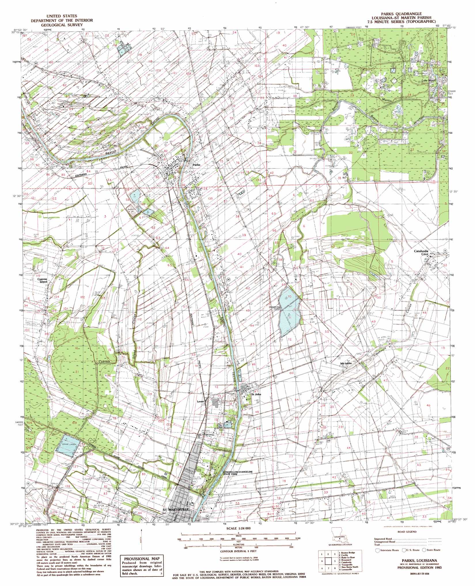
USGS Topo Quad 30091b7 - 1:24,000 scale
| Topo Map Name: | Parks |
| USGS Topo Quad ID: | 30091b7 |
| Print Size: | ca. 21 1/4" wide x 27" high |
| Southeast Coordinates: | 30.125° N latitude / 91.75° W longitude |
| Map Center Coordinates: | 30.1875° N latitude / 91.8125° W longitude |
| U.S. State: | LA |
| Filename: | o30091b7.jpg |
| Download Map JPG Image: | Parks topo map 1:24,000 scale |
| Map Type: | Topographic |
| Topo Series: | 7.5´ |
| Map Scale: | 1:24,000 |
| Source of Map Images: | United States Geological Survey (USGS) |
| Alternate Map Versions: |
Parks LA 1983, updated 1983 Download PDF Buy paper map Parks LA 2012 Download PDF Buy paper map Parks LA 2015 Download PDF Buy paper map |
1:24,000 Topo Quads surrounding Parks
Sunset |
Arnaudville |
Portage |
Maringouin Nw |
Maringouin |
Carencro |
Breaux Bridge |
Cecilia |
Butte La Rose |
Cow Bayou |
Lafayette |
Broussard |
Parks |
Catahoula |
Lake Mongoulois |
Milton |
Youngsville |
New Iberia North |
Loreauville |
Jackass Bay |
Abbeville East |
Delcambre |
New Iberia South |
Jeanerette |
Charenton |
> Back to 30091a1 at 1:100,000 scale
> Back to 30090a1 at 1:250,000 scale
> Back to U.S. Topo Maps home
Parks topo map: Gazetteer
Parks: Airports
Gary Landing Strip elevation 7m 22′Skyview Ranch Airport elevation 5m 16′
Parks: Canals
Cypress Island Coulee Canal elevation 4m 13′Parks: Dams
Louisiana Noname 44 Dam elevation 6m 19′Louisiana Noname 45 Dam elevation 4m 13′
Parks: Lakes
Lake Martin elevation 1m 3′Parks: Oilfields
East Saint Martinville Gas Field elevation 4m 13′Saint Martinville Oil and Gas Field elevation 4m 13′
Section 28 Oil and Gas Field elevation 2m 6′
Parks: Parks
Longfellow-Evangeline State Historic Site elevation 3m 9′North Side Park elevation 7m 22′
Parks: Populated Places
Azema (historical) elevation 7m 22′Banker Plantation elevation 5m 16′
Gauthier (historical) elevation 6m 19′
Isle Labbe elevation 5m 16′
Levert elevation 7m 22′
Parks elevation 8m 26′
Saint John elevation 6m 19′
Saint Martinville elevation 7m 22′
Parks: Streams
Bayou Martin elevation 1m 3′Cypress Island Coulee elevation 6m 19′
Parks digital topo map on disk
Buy this Parks topo map showing relief, roads, GPS coordinates and other geographical features, as a high-resolution digital map file on DVD: