Maringouin Topo Map Louisiana
To zoom in, hover over the map of Maringouin
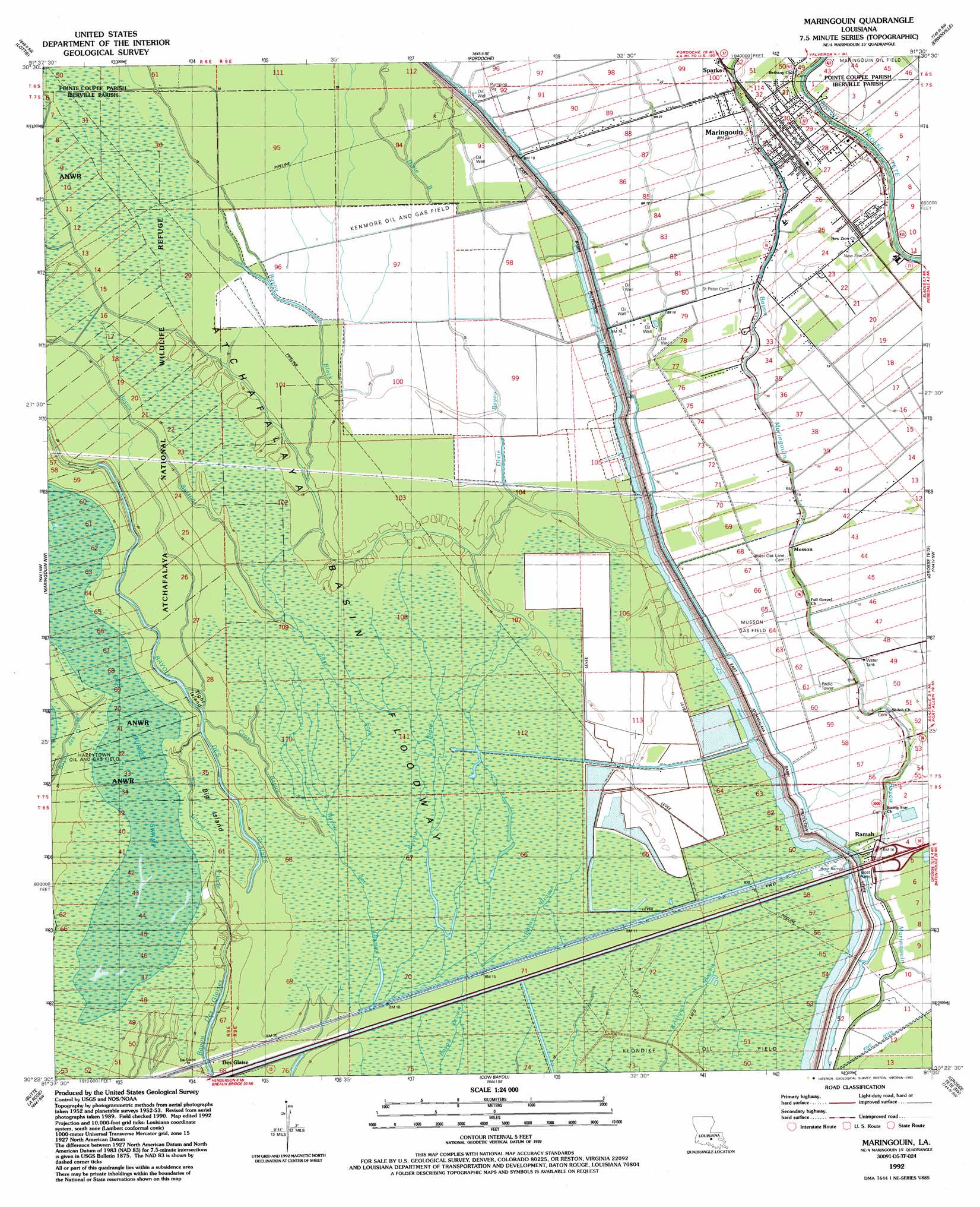
USGS Topo Quad 30091d5 - 1:24,000 scale
| Topo Map Name: | Maringouin |
| USGS Topo Quad ID: | 30091d5 |
| Print Size: | ca. 21 1/4" wide x 27" high |
| Southeast Coordinates: | 30.375° N latitude / 91.5° W longitude |
| Map Center Coordinates: | 30.4375° N latitude / 91.5625° W longitude |
| U.S. State: | LA |
| Filename: | o30091d5.jpg |
| Download Map JPG Image: | Maringouin topo map 1:24,000 scale |
| Map Type: | Topographic |
| Topo Series: | 7.5´ |
| Map Scale: | 1:24,000 |
| Source of Map Images: | United States Geological Survey (USGS) |
| Alternate Map Versions: |
Maringouin LA 1953, updated 1954 Download PDF Buy paper map Maringouin LA 1953, updated 1961 Download PDF Buy paper map Maringouin LA 1969, updated 1970 Download PDF Buy paper map Maringouin LA 1969, updated 1975 Download PDF Buy paper map Maringouin LA 1992, updated 1992 Download PDF Buy paper map Maringouin LA 1999, updated 2001 Download PDF Buy paper map Maringouin LA 1999, updated 2001 Download PDF Buy paper map Maringouin LA 2012 Download PDF Buy paper map Maringouin LA 2015 Download PDF Buy paper map |
1:24,000 Topo Quads surrounding Maringouin
Swayze Lake |
Melville |
Morganza |
New Roads |
Port Hudson |
Krotz Springs |
Lottie |
Fordoche |
Erwinville |
Walls |
Portage |
Maringouin Nw |
Maringouin |
Grosse Tete |
Lobdell |
Cecilia |
Butte La Rose |
Cow Bayou |
Grosse Tete Sw |
Addis |
Parks |
Catahoula |
Lake Mongoulois |
Grand River |
Bayou Sorrel |
> Back to 30091a1 at 1:100,000 scale
> Back to 30090a1 at 1:250,000 scale
> Back to U.S. Topo Maps home
Maringouin topo map: Gazetteer
Maringouin: Crossings
Interchange 135 elevation 4m 13′Maringouin: Islands
Big Island elevation 4m 13′Tight Island elevation 4m 13′
Maringouin: Oilfields
Happytown Oil and Gas Field elevation 4m 13′Kenmore Oil and Gas Field elevation 5m 16′
Musson Gas Field elevation 4m 13′
Maringouin: Populated Places
Des Glaise elevation 4m 13′Maringouin elevation 6m 19′
Musson elevation 5m 16′
Ramah elevation 5m 16′
Sparks elevation 7m 22′
Maringouin: Streams
Bayou Black elevation 3m 9′Bayou Burron elevation 4m 13′
Big Island Chute elevation 6m 19′
Brown Bayou elevation 2m 6′
Cross Bayou elevation 4m 13′
Dixie Bayou elevation 4m 13′
Maringouin: Swamps
Des Ourses Swamp elevation 4m 13′Maringouin digital topo map on disk
Buy this Maringouin topo map showing relief, roads, GPS coordinates and other geographical features, as a high-resolution digital map file on DVD: