Maringouin Nw Topo Map Louisiana
To zoom in, hover over the map of Maringouin Nw
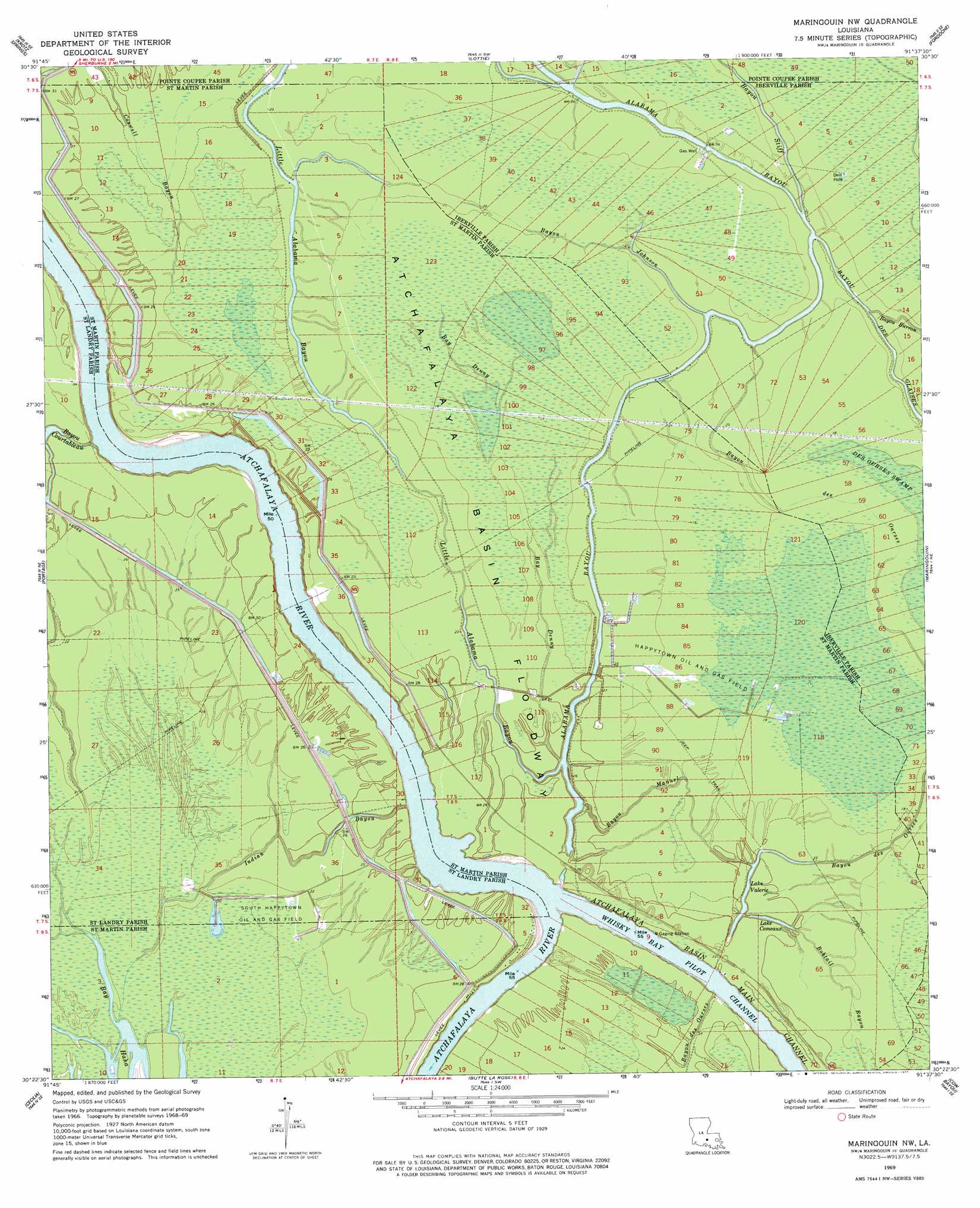
USGS Topo Quad 30091d6 - 1:24,000 scale
| Topo Map Name: | Maringouin Nw |
| USGS Topo Quad ID: | 30091d6 |
| Print Size: | ca. 21 1/4" wide x 27" high |
| Southeast Coordinates: | 30.375° N latitude / 91.625° W longitude |
| Map Center Coordinates: | 30.4375° N latitude / 91.6875° W longitude |
| U.S. State: | LA |
| Filename: | o30091d6.jpg |
| Download Map JPG Image: | Maringouin Nw topo map 1:24,000 scale |
| Map Type: | Topographic |
| Topo Series: | 7.5´ |
| Map Scale: | 1:24,000 |
| Source of Map Images: | United States Geological Survey (USGS) |
| Alternate Map Versions: |
Maringouin NW LA 1969, updated 1971 Download PDF Buy paper map Maringouin NW LA 1969, updated 1977 Download PDF Buy paper map Maringouin NW LA 1969, updated 1977 Download PDF Buy paper map Maringouin NW LA 1999, updated 2000 Download PDF Buy paper map Maringouin NW LA 2012 Download PDF Buy paper map Maringouin NW LA 2015 Download PDF Buy paper map |
1:24,000 Topo Quads surrounding Maringouin Nw
Palmetto |
Swayze Lake |
Melville |
Morganza |
New Roads |
Port Barre |
Krotz Springs |
Lottie |
Fordoche |
Erwinville |
Arnaudville |
Portage |
Maringouin Nw |
Maringouin |
Grosse Tete |
Breaux Bridge |
Cecilia |
Butte La Rose |
Cow Bayou |
Grosse Tete Sw |
Broussard |
Parks |
Catahoula |
Lake Mongoulois |
Grand River |
> Back to 30091a1 at 1:100,000 scale
> Back to 30090a1 at 1:250,000 scale
> Back to U.S. Topo Maps home
Maringouin Nw topo map: Gazetteer
Maringouin Nw: Lakes
Lake Comeaux elevation 7m 22′Lake Valerie elevation 5m 16′
Maringouin Nw: Oilfields
Alabama Bayou Gas Field elevation 7m 22′Happytown Oil and Gas Field elevation 5m 16′
Lake Valerie Oil Field elevation 6m 19′
South Happytown Oil and Gas Field elevation 4m 13′
Maringouin Nw: Parks
Sherburne Wildlife Management Area elevation 6m 19′Maringouin Nw: Streams
Bay Denny elevation 8m 26′Bayou Courtableau elevation 1m 3′
Bayou des Ourses elevation 8m 26′
Bayou Johnson elevation 7m 22′
Bayou Manuel elevation 7m 22′
Bayou Stiff elevation 7m 22′
Bobtail Bayou elevation 7m 22′
Coswell Bayou elevation 6m 19′
Indian Bayou elevation 3m 9′
Maringouin Nw digital topo map on disk
Buy this Maringouin Nw topo map showing relief, roads, GPS coordinates and other geographical features, as a high-resolution digital map file on DVD: