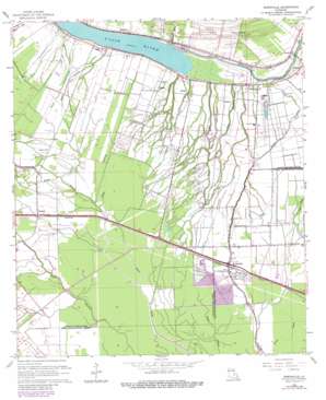
Erwinville Topo Map Louisiana
To zoom in, hover over the map of Erwinville
USGS Topo Quad 30091e4 - 1:24,000 scale
| Topo Map Name: | Erwinville |
| USGS Topo Quad ID: | 30091e4 |
| Print Size: | ca. 21 1/4" wide x 27" high |
| Southeast Coordinates: | 30.5° N latitude / 91.375° W longitude |
| Map Center Coordinates: | 30.5625° N latitude / 91.4375° W longitude |
| U.S. State: | LA |
| Filename: | o30091e4.jpg |
| Download Map JPG Image: | Erwinville topo map 1:24,000 scale |
| Map Type: | Topographic |
| Topo Series: | 7.5´ |
| Map Scale: | 1:24,000 |
| Source of Map Images: | United States Geological Survey (USGS) |
| Alternate Map Versions: |
Erwinville LA 1954, updated 1955 Download PDF Buy paper map Erwinville LA 1962, updated 1964 Download PDF Buy paper map Erwinville LA 1962, updated 1980 Download PDF Buy paper map Erwinville LA 2012 Download PDF Buy paper map Erwinville LA 2015 Download PDF Buy paper map |
1:24,000 Topo Quads surrounding Erwinville
> Back to 30091e1 at 1:100,000 scale
> Back to 30090a1 at 1:250,000 scale
> Back to U.S. Topo Maps home
Erwinville topo map: Gazetteer
Erwinville: Dams
False River Drainage Structure Dam elevation 4m 13′Erwinville: Oilfields
False River Gas Field elevation 9m 29′Erwinville: Populated Places
Alma elevation 10m 32′Chenal elevation 10m 32′
Erwinville elevation 7m 22′
Ingleside elevation 8m 26′
Jarreau elevation 10m 32′
Knapp elevation 10m 32′
Lakeland elevation 9m 29′
Majors elevation 9m 29′
Oakland elevation 10m 32′
Oscar elevation 10m 32′
Torbert elevation 6m 19′
Erwinville: Post Offices
Erwinville Post Office elevation 7m 22′Lakeland Post Office elevation 7m 22′
Oscar Post Office elevation 11m 36′
Torbert Post Office elevation 7m 22′
Erwinville: Reservoirs
False River elevation 4m 13′Erwinville: Streams
Bayou Boidore elevation 5m 16′Bayou Cotonier elevation 6m 19′
Bayou Fusilier elevation 8m 26′
Bayou Lanquedoc elevation 5m 16′
Bayou Sere elevation 1m 3′
Bayou Sterling elevation 5m 16′
Discharge Bayou elevation 4m 13′
Erwinville: Swamps
Greeves Swamp elevation 4m 13′Erwinville digital topo map on disk
Buy this Erwinville topo map showing relief, roads, GPS coordinates and other geographical features, as a high-resolution digital map file on DVD:


