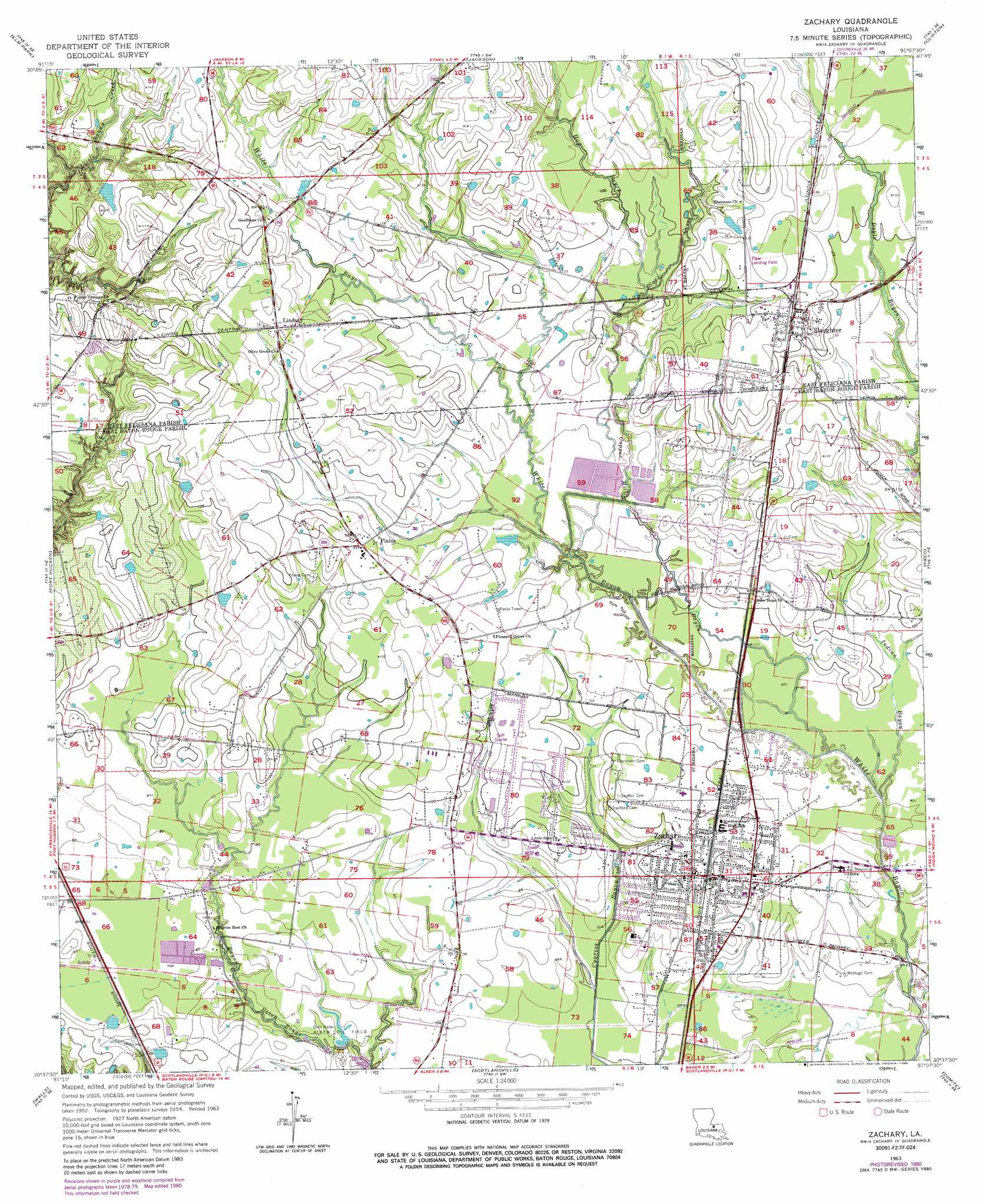
Zachary Topo Map Louisiana
To zoom in, hover over the map of Zachary
USGS Topo Quad 30091f2 - 1:24,000 scale
| Topo Map Name: | Zachary |
| USGS Topo Quad ID: | 30091f2 |
| Print Size: | ca. 21 1/4" wide x 27" high |
| Southeast Coordinates: | 30.625° N latitude / 91.125° W longitude |
| Map Center Coordinates: | 30.6875° N latitude / 91.1875° W longitude |
| U.S. State: | LA |
| Filename: | o30091f2.jpg |
| Download Map JPG Image: | Zachary topo map 1:24,000 scale |
| Map Type: | Topographic |
| Topo Series: | 7.5´ |
| Map Scale: | 1:24,000 |
| Source of Map Images: | United States Geological Survey (USGS) |
| Alternate Map Versions: |
Zachary LA 1954, updated 1955 Download PDF Buy paper map Zachary LA 1963, updated 1964 Download PDF Buy paper map Zachary LA 1963, updated 1973 Download PDF Buy paper map Zachary LA 1963, updated 1981 Download PDF Buy paper map Zachary LA 1963, updated 1986 Download PDF Buy paper map Zachary LA 2012 Download PDF Buy paper map Zachary LA 2015 Download PDF Buy paper map |
1:24,000 Topo Quads surrounding Zachary
Weyanoke |
Laurel Hill |
Rogillioville |
Wilson |
Woodland |
Saint Francisville |
Elm Park |
Jackson |
Clinton |
Bluff Creek |
New Roads |
Port Hudson |
Zachary |
Fred |
Pride |
Erwinville |
Walls |
Scotlandville |
Comite |
Watson |
Grosse Tete |
Lobdell |
Baton Rouge West |
Baton Rouge East |
Denham Springs |
> Back to 30091e1 at 1:100,000 scale
> Back to 30090a1 at 1:250,000 scale
> Back to U.S. Topo Maps home
Zachary topo map: Gazetteer
Zachary: Airports
Brians Ultralight Airport elevation 33m 108′Piker Airport elevation 42m 137′
Zachary: Oilfields
Alsen Oil Field elevation 24m 78′Zachary: Parks
Lion Park elevation 26m 85′Zachary: Populated Places
Ambrosia (historical) elevation 29m 95′Jackson Road (historical) elevation 35m 114′
Lindsay elevation 43m 141′
Plains elevation 38m 124′
Slaughter elevation 40m 131′
Zachary elevation 31m 101′
Zachary: Streams
Black Creek elevation 30m 98′Copper Mill Bayou elevation 24m 78′
Hog Bayou elevation 35m 114′
Indian Bayou elevation 23m 75′
Zachary digital topo map on disk
Buy this Zachary topo map showing relief, roads, GPS coordinates and other geographical features, as a high-resolution digital map file on DVD: