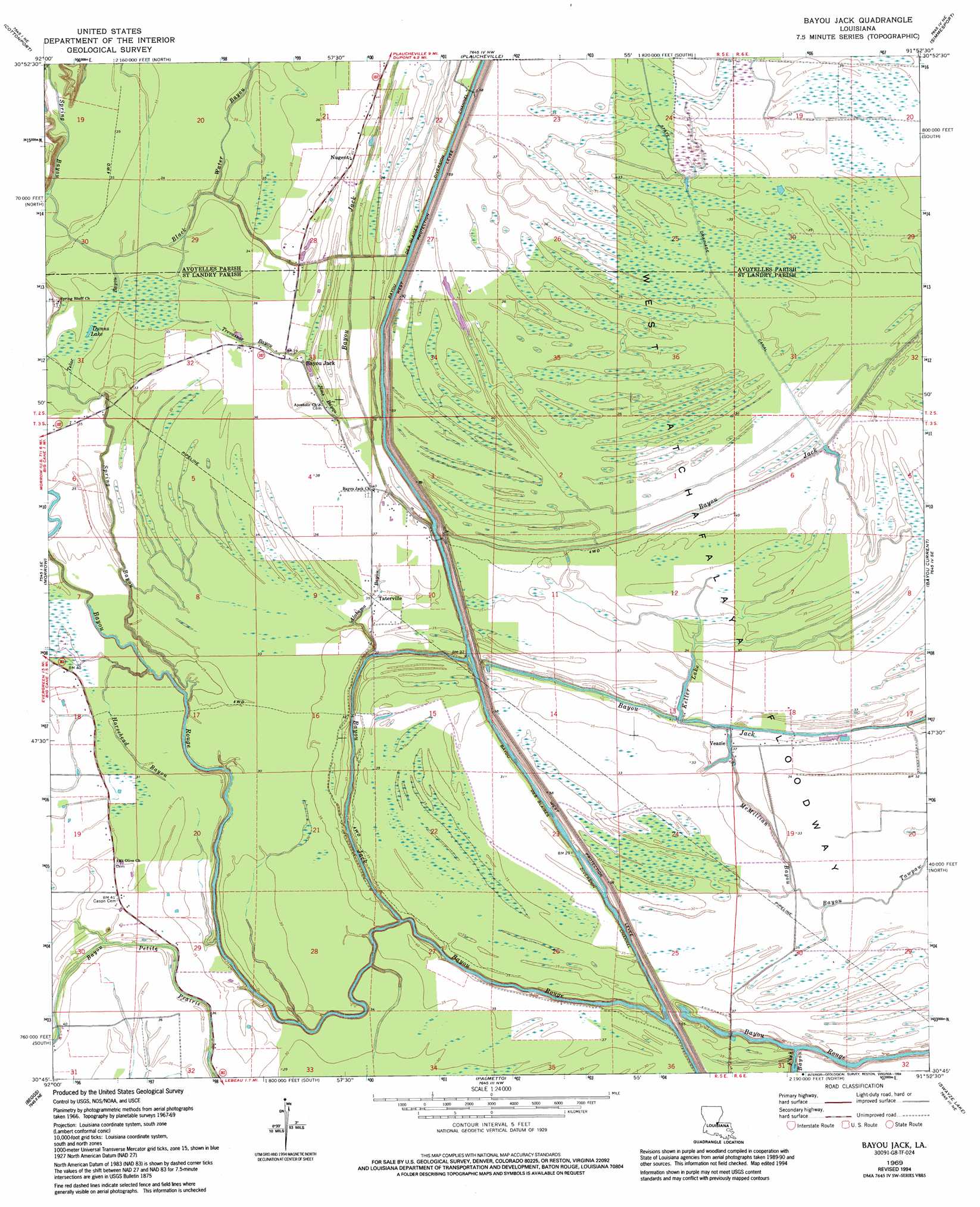
Bayou Jack Topo Map Louisiana
To zoom in, hover over the map of Bayou Jack
USGS Topo Quad 30091g8 - 1:24,000 scale
| Topo Map Name: | Bayou Jack |
| USGS Topo Quad ID: | 30091g8 |
| Print Size: | ca. 21 1/4" wide x 27" high |
| Southeast Coordinates: | 30.75° N latitude / 91.875° W longitude |
| Map Center Coordinates: | 30.8125° N latitude / 91.9375° W longitude |
| U.S. State: | LA |
| Filename: | o30091g8.jpg |
| Download Map JPG Image: | Bayou Jack topo map 1:24,000 scale |
| Map Type: | Topographic |
| Topo Series: | 7.5´ |
| Map Scale: | 1:24,000 |
| Source of Map Images: | United States Geological Survey (USGS) |
| Alternate Map Versions: |
Bayou Jack LA 1969, updated 1971 Download PDF Buy paper map Bayou Jack LA 1969, updated 1979 Download PDF Buy paper map Bayou Jack LA 1969, updated 1994 Download PDF Buy paper map Bayou Jack LA 2012 Download PDF Buy paper map Bayou Jack LA 2015 Download PDF Buy paper map |
1:24,000 Topo Quads surrounding Bayou Jack
Belle D'Eau |
Marksville South |
Moreauville |
Big Bend |
Turnbull Island |
Bunkie |
Cottonport |
Plaucheville |
Simmesport |
Innis |
Whiteville |
Morrow |
Bayou Jack |
Bayou Current |
Batchelor |
Tate Cove |
Beggs |
Palmetto |
Swayze Lake |
Melville |
Lawtell |
Opelousas |
Port Barre |
Krotz Springs |
Lottie |
> Back to 30091e1 at 1:100,000 scale
> Back to 30090a1 at 1:250,000 scale
> Back to U.S. Topo Maps home
Bayou Jack topo map: Gazetteer
Bayou Jack: Canals
Bayou Des Glaises Diversion Channel elevation 10m 32′Bayou Jack: Lakes
Dunns Lake elevation 7m 22′Indian Lake elevation 11m 36′
Keller Lake elevation 7m 22′
Wards Lake elevation 8m 26′
Bayou Jack: Oilfields
Montcrief Gas Field elevation 10m 32′North Bayou Jack Oil Field elevation 10m 32′
Bayou Jack: Populated Places
Bayou Jack elevation 12m 39′Nugent elevation 12m 39′
Taterville elevation 10m 32′
Veazie elevation 12m 39′
Bayou Jack: Streams
Alabama Bayou elevation 6m 19′Bayou Jack elevation 7m 22′
Bayou Tawpaw elevation 9m 29′
Black Water Bayou elevation 9m 29′
Fish Bayou elevation 5m 16′
Horsehead Bayou elevation 5m 16′
Jims Bayou elevation 11m 36′
McMillian Bayou elevation 9m 29′
Spring Bayou elevation 9m 29′
Telac Bayou elevation 8m 26′
Trevassar Bayou elevation 9m 29′
Bayou Jack digital topo map on disk
Buy this Bayou Jack topo map showing relief, roads, GPS coordinates and other geographical features, as a high-resolution digital map file on DVD: