Wilson Topo Map Louisiana
To zoom in, hover over the map of Wilson
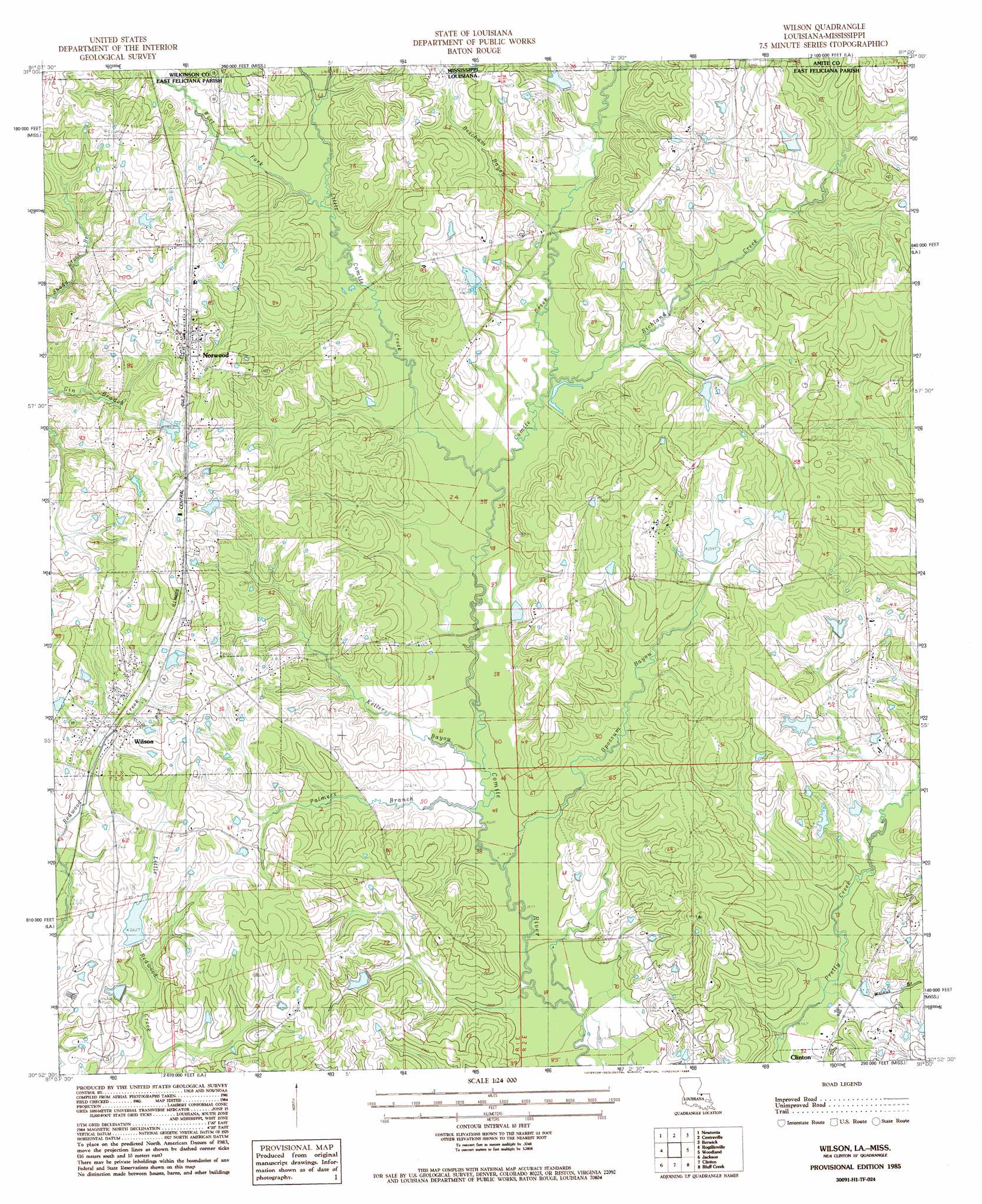
USGS Topo Quad 30091h1 - 1:24,000 scale
| Topo Map Name: | Wilson |
| USGS Topo Quad ID: | 30091h1 |
| Print Size: | ca. 21 1/4" wide x 27" high |
| Southeast Coordinates: | 30.875° N latitude / 91° W longitude |
| Map Center Coordinates: | 30.9375° N latitude / 91.0625° W longitude |
| U.S. States: | LA, MS |
| Filename: | o30091h1.jpg |
| Download Map JPG Image: | Wilson topo map 1:24,000 scale |
| Map Type: | Topographic |
| Topo Series: | 7.5´ |
| Map Scale: | 1:24,000 |
| Source of Map Images: | United States Geological Survey (USGS) |
| Alternate Map Versions: |
Wilson LA 1985, updated 1985 Download PDF Buy paper map Wilson LA 2012 Download PDF Buy paper map Wilson LA 2015 Download PDF Buy paper map |
1:24,000 Topo Quads surrounding Wilson
Laneheart |
Wilkinson |
Gloster |
Bewelcome |
Liberty |
Woodville |
Newtonia |
Centreville |
Berwick |
Street |
Laurel Hill |
Rogillioville |
Wilson |
Woodland |
Chipola |
Elm Park |
Jackson |
Clinton |
Bluff Creek |
Hatchersville |
Port Hudson |
Zachary |
Fred |
Pride |
Pine Grove |
> Back to 30091e1 at 1:100,000 scale
> Back to 30090a1 at 1:250,000 scale
> Back to U.S. Topo Maps home
Wilson topo map: Gazetteer
Wilson: Airports
McCutcheon Field elevation 63m 206′Wilson: Dams
Beechgrove Lake Dam elevation 77m 252′Haynes Lake Dam elevation 82m 269′
Hollywood Lake Dam elevation 91m 298′
Redwood Lake Dam elevation 74m 242′
Richland Lake Dam elevation 80m 262′
Wilson: Populated Places
Norwood elevation 95m 311′Wilson elevation 78m 255′
Wilson: Post Offices
Wilson Post Office elevation 79m 259′Wilson: Streams
Beecham Bayou elevation 71m 232′Beecham Bayou elevation 71m 232′
Comite Creek elevation 59m 193′
Comite Creek elevation 59m 193′
Dixon Branch elevation 57m 187′
Kellers Bayou elevation 61m 200′
Little Comite Creek elevation 65m 213′
Little Comite Creek elevation 66m 216′
Opossum Bayou elevation 60m 196′
Palmers Branch elevation 61m 200′
Richland Creek elevation 68m 223′
Sharps Creek elevation 76m 249′
Walnut Branch elevation 58m 190′
West Fork Little Comite Creek elevation 75m 246′
West Fork Little Comite Creek elevation 70m 229′
Wilson digital topo map on disk
Buy this Wilson topo map showing relief, roads, GPS coordinates and other geographical features, as a high-resolution digital map file on DVD: