Laurel Hill Topo Map Louisiana
To zoom in, hover over the map of Laurel Hill
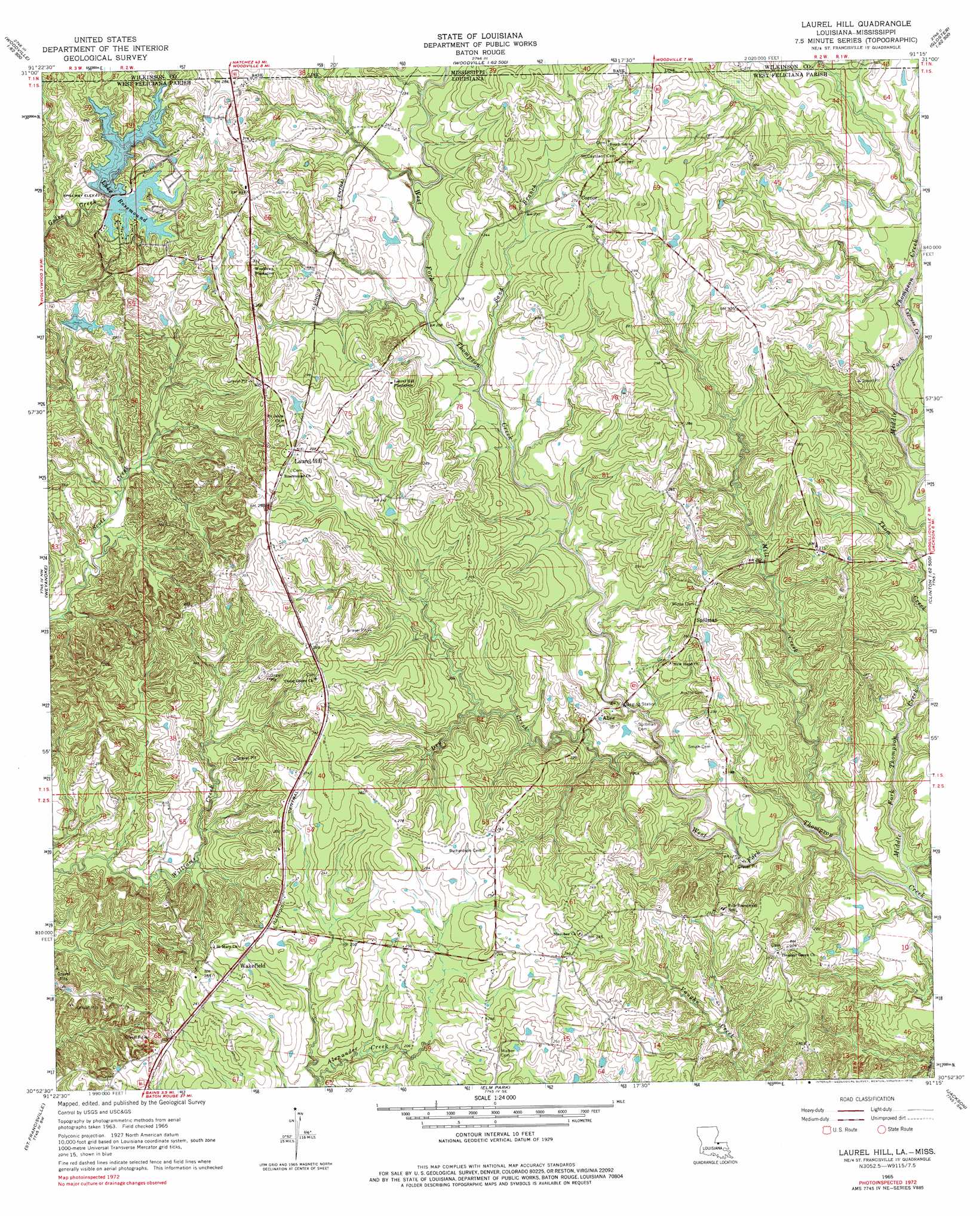
USGS Topo Quad 30091h3 - 1:24,000 scale
| Topo Map Name: | Laurel Hill |
| USGS Topo Quad ID: | 30091h3 |
| Print Size: | ca. 21 1/4" wide x 27" high |
| Southeast Coordinates: | 30.875° N latitude / 91.25° W longitude |
| Map Center Coordinates: | 30.9375° N latitude / 91.3125° W longitude |
| U.S. States: | LA, MS |
| Filename: | o30091h3.jpg |
| Download Map JPG Image: | Laurel Hill topo map 1:24,000 scale |
| Map Type: | Topographic |
| Topo Series: | 7.5´ |
| Map Scale: | 1:24,000 |
| Source of Map Images: | United States Geological Survey (USGS) |
| Alternate Map Versions: |
Laurel Hill LA 1965, updated 1966 Download PDF Buy paper map Laurel Hill LA 1965, updated 1976 Download PDF Buy paper map Laurel Hill LA 2012 Download PDF Buy paper map Laurel Hill LA 2015 Download PDF Buy paper map |
1:24,000 Topo Quads surrounding Laurel Hill
Lake Mary |
Lessley |
Laneheart |
Wilkinson |
Gloster |
Fort Adams |
Pinckneyville |
Woodville |
Newtonia |
Centreville |
Tunica |
Weyanoke |
Laurel Hill |
Rogillioville |
Wilson |
Lacour |
Saint Francisville |
Elm Park |
Jackson |
Clinton |
Morganza |
New Roads |
Port Hudson |
Zachary |
Fred |
> Back to 30091e1 at 1:100,000 scale
> Back to 30090a1 at 1:250,000 scale
> Back to U.S. Topo Maps home
Laurel Hill topo map: Gazetteer
Laurel Hill: Dams
Beechgrove Dam elevation 66m 216′Lake Rosemound Dam elevation 67m 219′
Lemon Lake Dam elevation 73m 239′
Sinclair Lake Dam elevation 65m 213′
Laurel Hill: Oilfields
Lake Rosemound Gas Field elevation 87m 285′Laurel Hill: Populated Places
Alice elevation 61m 200′Converse (historical) elevation 76m 249′
Laurel Hill elevation 93m 305′
McGehee (historical) elevation 76m 249′
Spillman elevation 78m 255′
Wakefield elevation 75m 246′
Laurel Hill: Post Offices
Wakefield Post Office elevation 83m 272′Laurel Hill: Reservoirs
Lake Rosemound elevation 71m 232′Laurel Hill: Streams
Cypress Creek elevation 52m 170′Dry Creek elevation 48m 157′
Middle Fork Thompson Creek elevation 33m 108′
Mill Creek elevation 37m 121′
Sand Branch elevation 58m 190′
Waterhole Branch elevation 36m 118′
Laurel Hill digital topo map on disk
Buy this Laurel Hill topo map showing relief, roads, GPS coordinates and other geographical features, as a high-resolution digital map file on DVD: