Gueydan Topo Map Louisiana
To zoom in, hover over the map of Gueydan
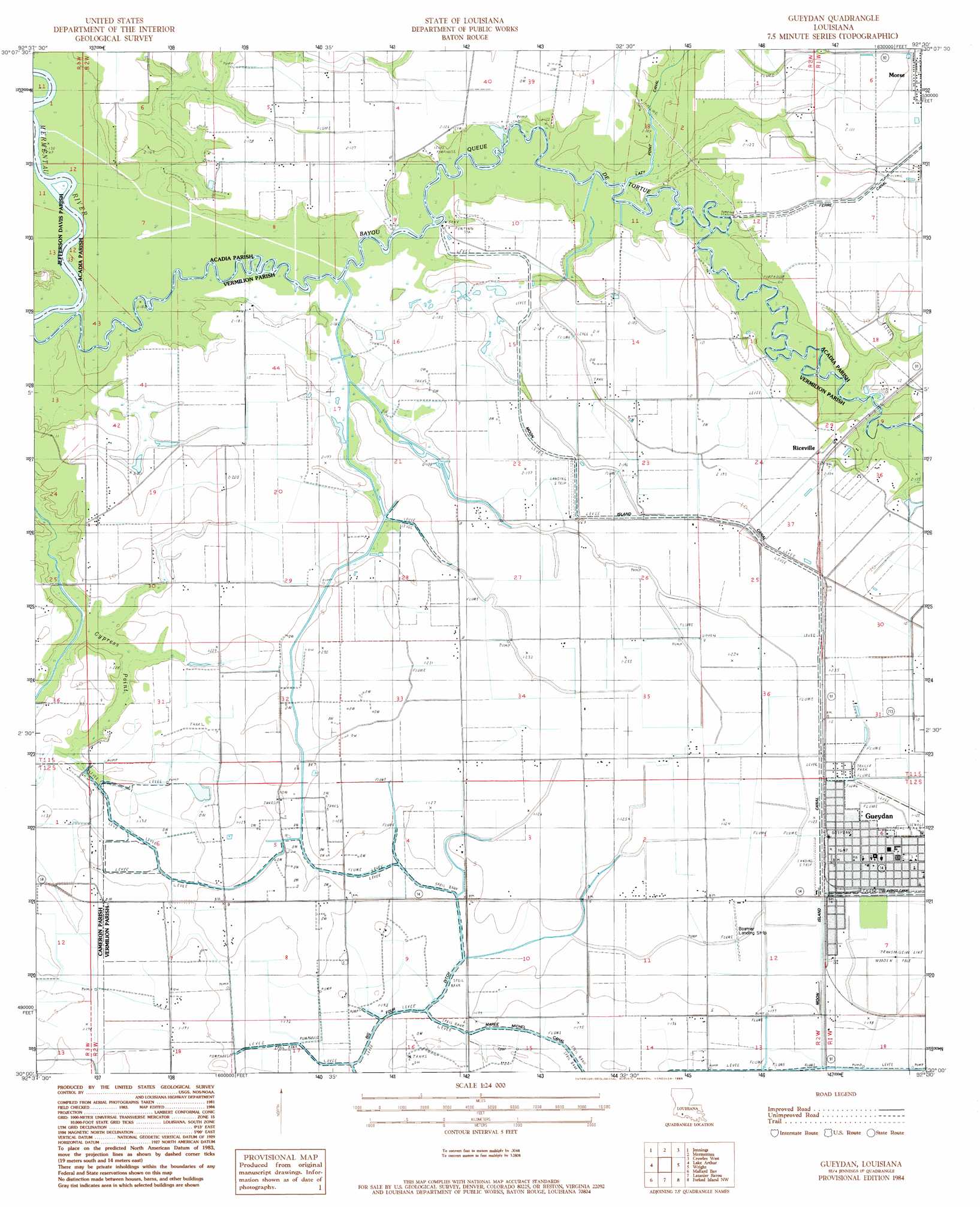
USGS Topo Quad 30092a5 - 1:24,000 scale
| Topo Map Name: | Gueydan |
| USGS Topo Quad ID: | 30092a5 |
| Print Size: | ca. 21 1/4" wide x 27" high |
| Southeast Coordinates: | 30° N latitude / 92.5° W longitude |
| Map Center Coordinates: | 30.0625° N latitude / 92.5625° W longitude |
| U.S. State: | LA |
| Filename: | o30092a5.jpg |
| Download Map JPG Image: | Gueydan topo map 1:24,000 scale |
| Map Type: | Topographic |
| Topo Series: | 7.5´ |
| Map Scale: | 1:24,000 |
| Source of Map Images: | United States Geological Survey (USGS) |
| Alternate Map Versions: |
Gueydan LA 1984, updated 1985 Download PDF Buy paper map Gueydan LA 1984, updated 1985 Download PDF Buy paper map Gueydan LA 2012 Download PDF Buy paper map Gueydan LA 2015 Download PDF Buy paper map |
1:24,000 Topo Quads surrounding Gueydan
Welsh North |
Hathaway |
Evangeline |
Iota |
Branch |
Welsh South |
Jennings |
Mermentau |
Crowley West |
Crowley East |
Thornwell |
Lake Arthur |
Gueydan |
Wright |
Kaplan North |
Latania Lake |
Mallard Bay |
Latanier Bayou |
Forked Island Nw |
Kaplan South |
Catfish Lake |
Collicon Lake |
Lake Le Bleu |
Jacks Point Island |
Forked Island |
> Back to 30092a1 at 1:100,000 scale
> Back to 30092a1 at 1:250,000 scale
> Back to U.S. Topo Maps home
Gueydan topo map: Gazetteer
Gueydan: Airports
Boatner Landing Strip elevation 1m 3′Gueydan: Bridges
Riceville Bridge elevation 2m 6′Gueydan: Canals
Lazy Point Canal elevation 1m 3′Moon Island Canal elevation 2m 6′
Gueydan: Oilfields
Riceville Gas Field elevation 2m 6′South Riceville Gas Field elevation 2m 6′
West Gueydan Oil and Gas Field elevation 2m 6′
Gueydan: Populated Places
Gueydan elevation 2m 6′Riceville elevation 3m 9′
Gueydan: Post Offices
Gueydan Post Office elevation 2m 6′Gueydan: Swamps
Cypress Point elevation 2m 6′Gueydan digital topo map on disk
Buy this Gueydan topo map showing relief, roads, GPS coordinates and other geographical features, as a high-resolution digital map file on DVD: